Rutsker
Located in Bornholm Kommune, Capital Region Coordinates: 55°12′29″ N 14°44′30″ E
- Elevation
- 113 m
- above sea level
- Local time
- UTC+01:00
- Europe/Copenhagen · UTC+01:00
About Rutsker
Rutsker is a village. Location: Bornholm Kommune, Capital Region. Elevation: 113 m.
Rutsker is a small settlement in Rutsker Parish on the Danish island of Bornholm. It is situated in the north western part of the island, 3 km northeast of Hasle. The populated area lies immediately south of Ruth's Church. As of 2009, Rutsker has a population of 64, nine less than in 2004.
Read more on Wikipedia Text: Wikipedia contributors · CC BY-SA 4.0 · shortened
In comparison
- Nearest larger town: Hasle, 3 km SW
- 6 sights and natural places within 10 km Svartingedal, Egeshøj
Nearby attractions & nature
Everything nearby-
Svartingedal Natural site, Bornholm Kommune2.2 km S
-
Egeshøj Mountain, Bornholm Kommune2.7 km NE
-
Finnedalen Natural site, Bornholm Kommune5.1 km N
-
Stjernehøj Mountain, Bornholm Kommune5.9 km E
-
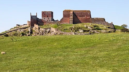 Hammershus Historic site, Bornholm Kommune7.1 km N
-
Kløven Natural site, Bornholm Kommune7 km E
Sources & licences
Data last updated: · 2 independent sources