Auning
Located in Norddjurs Kommune, Central Jutland Coordinates: 56°25′51″ N 10°22′41″ E
- Population
- 3,383
- 3.4K
- Elevation
- 11 m
- above sea level
- Local time
- UTC+01:00
- Europe/Copenhagen · UTC+01:00
About Auning
Auning is a village. Location: Norddjurs Kommune, Central Jutland. Population: 3,383. Elevation: 11 m.
Auning is a minor town on the main road between Randers and Grenå, with a population of 3,383 (1 January 2026). It is located in Region Midtjylland and in Norddjurs Municipality. It used to be one of the two major towns in the abolished Sønderhald Municipality, the other being Assentoft which now belongs to Randers Municipality.
Read more on Wikipedia Text: Wikipedia contributors · CC BY-SA 4.0 · shortened
In comparison
- No. 3 of 7 places in Norddjurs Kommune by population
- Nearest larger town: Lystrup, 9 km NE
- 2 sights and natural places within 10 km Helligbjerg, Tothøj
Climate of Auning
Best months for sightseeing: June–August.
| Month | Jan | Feb | Mar | Apr | May | Jun | Jul | Aug | Sep | Oct | Nov | Dec |
|---|---|---|---|---|---|---|---|---|---|---|---|---|
| Average high (°C) | 3° | 4° | 6° | 10° | 16° | 19° | 21° | 21° | 16° | 12° | 7° | 5° |
| Average low (°C) | -2° | -3° | -1° | 2° | 6° | 10° | 12° | 11° | 9° | 5° | 2° | -1° |
| Precipitation (mm) | 52 | 36 | 42 | 36 | 46 | 60 | 60 | 66 | 71 | 68 | 65 | 57 |
Monthly averages for 1970–2000 at about 18 km resolution, adjusted for elevation. Highlighted months are mild and relatively dry. Source: WorldClim 2.1 (CC BY 4.0).
Airports nearest to Auning
- Aarhus Airport (AAR) Aarhus 21 km
- Midtjyllands Airport / Air Base Karup (KRP) Karup 80 km
- Aalborg Airport (AAL) Aalborg 81 km
Straight-line distance; airports with scheduled flights only. Source: OurAirports (public domain).
Nearby attractions & nature
Everything nearby-
Helligbjerg Mountain, Norddjurs Kommune3 km W
-
Tothøj Mountain, Syddjurs Kommune5.6 km SW
-
Bavnehøj Mountain, Norddjurs Kommune14 km NE
-
Trehøje Mountain, Syddjurs Kommune14 km S
-
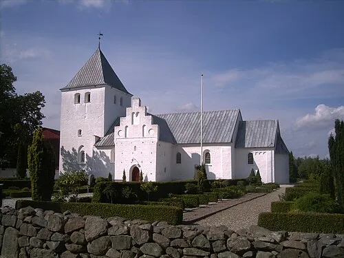 Estruplund Kirke Attraction, Norddjurs Kommune14 km N
-
Møgelbjerg Mountain, Syddjurs Kommune23 km SE
Sources & licences
Data last updated: · 2 independent sources