Hemmet
Located in Ringkøbing-Skjern Kommune, Central Jutland Coordinates: 55°51′01″ N 8°22′32″ E
- Population
- 285
- 285
- Elevation
- 8 m
- above sea level
- Local time
- UTC+01:00
- Europe/Copenhagen · UTC+01:00
- Airports
- EBJ Esbjerg Airport38 km
- BLL Billund Airport51 km
About Hemmet
Hemmet is a village. Location: Ringkøbing-Skjern Kommune, Central Jutland. Population: 285. Elevation: 8 m.
Hemmet is a village and parish in the former Egvad Municipality (Danish: Egvad kommune), which since 1 January 2007 has been part of the Ringkøbing-Skjern Municipality, Midtjylland, near the west coast of Jutland in Denmark. Hemmet has a village population of 285 (1 January 2026) and a parish population of 518 (1 January 2026). The word "Hemmet" derives from prior Danish, meaning "The home". Hemmet is located 11 km northeast of Nørre Nebel, 12 km southwest of Tarm and 15 km southwest of Skjern.
Source: Wikipedia · CC BY-SA 4.0
Climate of Hemmet
Best months for sightseeingBest months for sightseeing: June–August.
This month · November
A wet month
Day 8° · Night 4° · Rain 101 mm
- Hottest month
- August (day 21°)
- Coldest month
- January (night 0°)
- Wettest month
- November (101 mm)
- Driest month
- April (40 mm)
Bars: average monthly low and high temperature. Below: precipitation. Monthly averages for 1970–2000 at about 18 km resolution, adjusted for elevation. Highlighted months are mild and relatively dry. Source: WorldClim 2.1 (CC BY 4.0).
Show values as a table
| Month | Jan | Feb | Mar | Apr | May | Jun | Jul | Aug | Sep | Oct | Nov | Dec |
|---|---|---|---|---|---|---|---|---|---|---|---|---|
| Average high (°C) | 3° | 4° | 6° | 11° | 16° | 18° | 20° | 21° | 17° | 13° | 8° | 4° |
| Average low (°C) | 0° | 0° | 2° | 5° | 9° | 12° | 15° | 14° | 12° | 8° | 4° | 1° |
| Precipitation (mm) | 67 | 44 | 54 | 40 | 47 | 56 | 64 | 74 | 93 | 100 | 101 | 83 |
How to get to Hemmet
The nearest airport is Esbjerg Airport (EBJ), 38 km to the south as the crow flies. For international flights: Billund Airport (BLL) (51 km). The nearest large city is Aarhus, 119 km to the east.
Airports
- Esbjerg Airport (EBJ) Esbjerg 38 kmsouth
- Billund Airport (BLL) Billund 51 kmeast
- Midtjyllands Airport / Air Base Karup (KRP) Karup 67 kmnortheast
Nearby large cities
- Aarhus Population: 285.3K 119 kmeast
- Odense Population: 180.9K 137 kmeast
- Aalborg Population: 142.9K 164 kmnortheast
- Kiel Population: 252.7K 204 kmsoutheast
- Bremerhaven Population: 118.6K 256 kmsouth
Straight-line distances; road distances are longer. Airport data: OurAirports.
Day trips from Hemmet
Within 100 km: 12 historic and cultural sites, 115 natural sites, 18 lakes, rivers and coasts.
0–25 km12 places
- Høje Sande Island 6 kmN
- Stilbjerg Mountain 22 kmS
- Bavnshøj Mountain 13 kmE
- Klægbanke Island 17 kmN
25–60 km43 places
- Fanø Island 49 kmS
- Mølhøj Mountain 39 kmS
- Femhøje Mountain 39 kmS
- Fasterhøj Mountain 34 kmS
60–100 km90 places
- Røjle Banke Mountain 98 kmE
- Königshafen Lake 90 kmS
- Ellenbogenberg Mountain 90 kmS
- Sörensknoll Mountain 89 kmS
Straight-line distances.
Nearby attractions & nature
Everything nearby-
Høje Sande Island, Ringkøbing-Skjern Kommune6 km N
-
Fuglepold Island, Ringkøbing-Skjern Kommune10 km NW
-
Bavnshøje Mountain, Ringkøbing-Skjern Kommune16 km N
-
Brunbjerg Mountain, Ringkøbing-Skjern Kommune19 km N
-
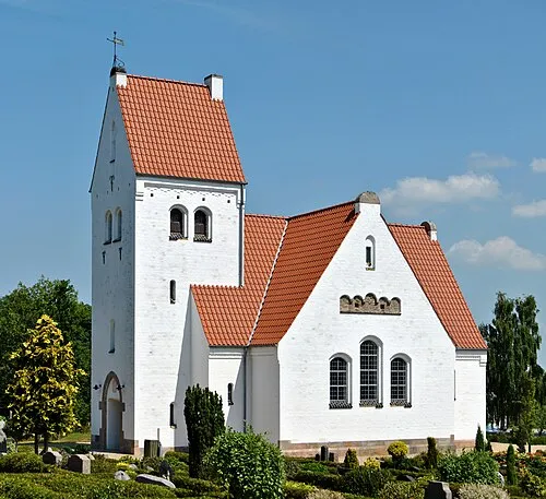 Lønne Kirke Attraction, Varde Kommune11 km SW
-
Troldbjerg Mountain, Ringkøbing-Skjern Kommune23 km NW
Sources & licences
Data last updated: · 2 independent sources