Vedersø
Located in Ringkøbing-Skjern Kommune, Central Jutland Coordinates: 56°14′05″ N 8°11′53″ E
- Elevation
- 4 m
- above sea level
- Local time
- UTC+01:00
- Europe/Copenhagen · UTC+01:00
- Airports
- KRP Midtjyllands Airport / Air Base Karup57 km
- BLL Billund Airport81 km
About Vedersø
Vedersø is a village. Location: Ringkøbing-Skjern Kommune, Central Jutland. Elevation: 4 m.
Vedersø is a small village, with a population of only 201 (1 January 2026), in Ringkøbing-Skjern Municipality, Central Denmark Region in Denmark. It is situated between Ringkøbing Fjord and Nissum Fjord in Western Jutland. Vedersø Church, from around the year 1150, is located in the village. The poet and priest Kaj Munk was priest in Vedersø from 1924, until he was arrested and assassinated by Gestapo in 1944.
Source: Wikipedia · CC BY-SA 4.0
Climate of Vedersø
Best months for sightseeingBest months for sightseeing: June–August.
This month · November
A wet month
Day 8° · Night 4° · Rain 102 mm
- Hottest month
- August (day 20°)
- Coldest month
- February (night -1°)
- Wettest month
- November (102 mm)
- Driest month
- April (40 mm)
Bars: average monthly low and high temperature. Below: precipitation. Monthly averages for 1970–2000 at about 18 km resolution, adjusted for elevation. Highlighted months are mild and relatively dry. Source: WorldClim 2.1 (CC BY 4.0).
Show values as a table
| Month | Jan | Feb | Mar | Apr | May | Jun | Jul | Aug | Sep | Oct | Nov | Dec |
|---|---|---|---|---|---|---|---|---|---|---|---|---|
| Average high (°C) | 3° | 3° | 6° | 10° | 15° | 18° | 20° | 20° | 17° | 12° | 8° | 5° |
| Average low (°C) | -1° | -1° | 1° | 4° | 8° | 12° | 14° | 14° | 11° | 8° | 4° | 1° |
| Precipitation (mm) | 67 | 42 | 51 | 40 | 47 | 53 | 62 | 75 | 94 | 99 | 102 | 82 |
How to get to Vedersø
The nearest airport is Midtjyllands Airport / Air Base Karup (KRP), 57 km to the east as the crow flies. For international flights: Billund Airport (BLL) (81 km). The nearest large city is Aarhus, 125 km to the east.
Airports
- Midtjyllands Airport / Air Base Karup (KRP) Karup 57 kmeast
- Billund Airport (BLL) Billund 81 kmsoutheast
- Esbjerg Airport (EBJ) Esbjerg 82 kmsouth
Nearby large cities
- Aarhus Population: 285.3K 125 kmeast
- Aalborg Population: 142.9K 139 kmnortheast
- Odense Population: 180.9K 166 kmsoutheast
- Kristiansand Population: 117.2K 213 kmnorth
- Kiel Population: 252.7K 246 kmsoutheast
Straight-line distances; road distances are longer. Airport data: OurAirports.
Day trips from Vedersø
Within 100 km: 7 historic and cultural sites, 89 natural sites, 15 lakes, rivers and coasts.
0–25 km9 places
- Fjandø Island 12 kmN
- Bletholm Island 18 kmN
- Dæmonsbjerg Mountain 24 kmS
- Skralbjerg Natural site 13 kmN
25–60 km36 places
- Høje Sande Island 38 kmS
- Yllebjerg Mountain 39 kmE
- Tingdal Høj Mountain 60 kmNE
- Solskov Bjerg Mountain 41 kmE
60–100 km66 places
- Fanø Island 92 kmS
- Urhøje Mountain 82 kmNE
- Tørrehøj Mountain 63 kmNE
- Stilbjerg Mountain 66 kmS
Straight-line distances.
Nearby attractions & nature
Everything nearby-
Stadilø Island, Ringkøbing-Skjern Kommune7.8 km S
-
Næsø Natural site, Ringkøbing-Skjern Kommune8.8 km S
-
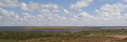 Fjandø Island, Holstebro Kommune12 km N
-
Sternehøj Mountain, Holstebro Kommune11 km E
-
Trenatbjerg Mountain, Ringkøbing-Skjern Kommune19 km S
-
Skralbjerg Natural site, Holstebro Kommune13 km N
Sources & licences
Data last updated: · 2 independent sources