Police Custody Camp Frøslev
Located in Aabenraa Kommune, Region South Denmark Coordinates: 54°49′17″ N 9°20′32″ E
- Local time
- UTC+01:00
- Europe/Copenhagen · UTC+01:00
- Elevation
- 42 m
- above sea level
- Airports
- SGD Sønderborg Airport33 km
- GWT Westerland Sylt Airport65 km
About Police Custody Camp Frøslev
Police Custody Camp Frøslev is a historic site. Location: Aabenraa Kommune, Region South Denmark.
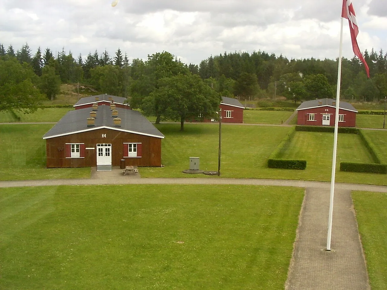
Frøslev Camp (Danish: Frøslevlejren, German: Polizeigefangenenlager Fröslee) was an internment camp in German-occupied Denmark during World War II. In order to avoid deportation of Danes to German concentration camps, Danish authorities suggested, in January 1944, that an internment camp be created in Denmark. The German occupation authorities consented, and the camp was erected near the village of Frøslev in the south-west of Denmark, close to the German border.
Source: Wikipedia · CC BY-SA 4.0
At a glance
- Area
- 13 ha
Source: Wikidata
Photos of Police Custody Camp Frøslev
-

Nationalmuseet - National Museum of Denmark from Denmark · CC BY-SA 2.0 -

Pimvantend · CC BY-SA 4.0 -

Pimvantend · CC BY-SA 4.0


Climate of Police Custody Camp Frøslev
Best months for sightseeingBest months for sightseeing: June–August.
This month · November
A cold month
Day 7° · Night 3° · Rain 93 mm
- Hottest month
- August (day 21°)
- Coldest month
- January (night -1°)
- Wettest month
- November (93 mm)
- Driest month
- April (48 mm)
Bars: average monthly low and high temperature. Below: precipitation. Monthly averages for 1970–2000 at about 18 km resolution, adjusted for elevation. Highlighted months are mild and relatively dry. Source: WorldClim 2.1 (CC BY 4.0).
Show values as a table
| Month | Jan | Feb | Mar | Apr | May | Jun | Jul | Aug | Sep | Oct | Nov | Dec |
|---|---|---|---|---|---|---|---|---|---|---|---|---|
| Average high (°C) | 3° | 3° | 6° | 11° | 16° | 19° | 21° | 21° | 17° | 12° | 7° | 5° |
| Average low (°C) | -1° | -1° | 0° | 2° | 7° | 10° | 12° | 12° | 9° | 6° | 3° | 0° |
| Precipitation (mm) | 74 | 49 | 64 | 48 | 52 | 73 | 82 | 76 | 90 | 91 | 93 | 83 |
How to get to Police Custody Camp Frøslev
The nearest airport is Sønderborg Airport (SGD), 33 km to the northeast as the crow flies. The nearest large city is Kiel, 76 km to the southeast.
Airports
- Sønderborg Airport (SGD) Sønderborg 33 kmnortheast
- Westerland Sylt Airport (GWT) Sylt 65 kmwest
- Esbjerg Airport (EBJ) Esbjerg 93 kmnorthwest
Nearby large cities
- Kiel Population: 252.7K 76 kmsoutheast
- Odense Population: 180.9K 92 kmnortheast
- Lübeck Population: 212.2K 137 kmsoutheast
- Bremerhaven Population: 118.6K 150 kmsouth
- Aarhus Population: 285.3K 158 kmnorth
Straight-line distances; road distances are longer. Airport data: OurAirports.
Day trips from Police Custody Camp Frøslev
Within 100 km: 134 historic and cultural sites, 760 natural sites, 559 lakes, rivers and coasts.
0–25 km112 places
- Solitüde Beach 9 kmE
- Winderatter See Lake 20 kmSE
- Treßsee Lake 16 kmSE
- Südensee Lake 24 kmSE
25–60 km427 places
- Als Island 41 kmNE
- Nordstrand Natural site 47 kmSW
- Oxbek River 31 kmSE
- Strand von Habernis Beach 28 kmE
60–100 km914 places
- Tåsinge Island 83 kmE
- Aeroe Island 64 kmE
- Fanø Island 89 kmNW
- Rindby Strand Beach 91 kmNW
Straight-line distances.
Nearby attractions & nature
Everything nearby-
Niehuussee Lake, Harrislee2.2 km E
-
Stiftungsland Schäferhaus-Nord Natural site, Harrislee3.4 km S
-
Jägerslust Historic site, Flensburg6.6 km S
-
Forst Flensburg Natural site, Harrislee4.4 km E
-
Amtsgericht Flensburg Attraction, Flensburg7.2 km SE
-
Marienhölzung Natural site, Schleswig-Holstein4.9 km SE
-
Stagehøj Mountain, Aabenraa Kommune8.3 km NE
-
Falkenberg Mountain, Flensburg5.6 km SE
Nearest towns and villages


Sources & licences
Data last updated: · 2 independent sources