Elbo Dal
Located in Fredericia Kommune, Region South Denmark Coordinates: 55°34′31″ N 9°38′30″ E
- Elevation
- 4 m
- above sea level
- Local time
- UTC+01:00
- Europe/Copenhagen · UTC+01:00
- Airports
- BLL Billund Airport36 km
- ODE Odense Hans Christian Andersen Airport45 km
About Elbo Dal
Elbo Dal is a natural site. Location: Fredericia Kommune, Region South Denmark. The best months to visit are June–August. The nearest airport is Billund Airport (36 km). Nearby sights include Hathøj and Røjle Banke.
Climate of Elbo Dal
Best months for sightseeingBest months for sightseeing: June–August.
This month · November
A cold month
Day 8° · Night 2° · Rain 79 mm
- Hottest month
- August (day 20°)
- Coldest month
- February (night -3°)
- Wettest month
- November (79 mm)
- Driest month
- February (39 mm)
Bars: average monthly low and high temperature. Below: precipitation. Monthly averages for 1970–2000 at about 18 km resolution, adjusted for elevation. Highlighted months are mild and relatively dry. Source: WorldClim 2.1 (CC BY 4.0).
Show values as a table
| Month | Jan | Feb | Mar | Apr | May | Jun | Jul | Aug | Sep | Oct | Nov | Dec |
|---|---|---|---|---|---|---|---|---|---|---|---|---|
| Average high (°C) | 4° | 4° | 6° | 10° | 15° | 18° | 20° | 20° | 17° | 12° | 8° | 5° |
| Average low (°C) | -3° | -3° | -1° | 3° | 7° | 10° | 12° | 12° | 9° | 6° | 2° | 0° |
| Precipitation (mm) | 56 | 39 | 46 | 41 | 49 | 56 | 66 | 66 | 72 | 78 | 79 | 66 |
How to get to Elbo Dal
The nearest airport is Billund Airport (BLL), 36 km to the northwest as the crow flies. The nearest large city is Odense, 51 km to the southeast.
Airports
- Billund Airport (BLL) Billund 36 kmnorthwest
- Odense Hans Christian Andersen Airport (ODE) Odense 45 kmeast
- Sønderborg Airport (SGD) Sønderborg 69 kmsouth
Nearby large cities
- Odense Population: 180.9K 51 kmsoutheast
- Aarhus Population: 285.3K 74 kmnortheast
- Kiel Population: 252.7K 143 kmsouth
- Aalborg Population: 142.9K 165 kmnorth
- Copenhagen Population: 1.2M 185 kmeast
Straight-line distances; road distances are longer. Airport data: OurAirports.
Day trips from Elbo Dal
Within 100 km: 30 historic and cultural sites, 226 natural sites, 112 lakes, rivers and coasts.
0–25 km12 places
- Svinø Natural site 16 kmSE
- Thyras Høj Mountain 23 kmNW
- Stenhøj Mountain 18 kmNE
- Hathøj Mountain 11 kmN
25–60 km72 places
- Rævshalen Beach 45 kmS
- Flovt Strand Beach 40 kmS
- Flyvesandet Beach 42 kmE
- Vorsø Kalv Island 39 kmNE
60–100 km284 places
- Als Island 68 kmS
- Tåsinge Island 88 kmSE
- Aeroe Island 89 kmSE
- Fanø Island 80 kmW
Straight-line distances.
Nearest towns and villages
-
Taulov Village, Fredericia Kommune3.7 km SW
-
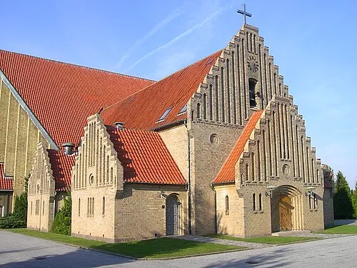 Fredericia City, Fredericia Kommune7.1 km E
-
Snoghøj Village, Fredericia Kommune7.7 km SE
-
Børkop Village, Vejle Kommune7.4 km N
-
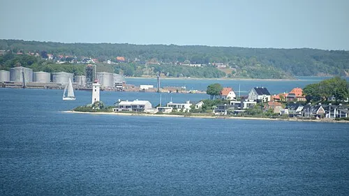 Strib Town, Middelfart Kommune8.8 km SE
-
Middelfart City, Middelfart Kommune9.5 km SE
Nearby attractions & nature
Everything nearby-
Hathøj Mountain, Vejle Kommune11 km N
-
Røjle Banke Mountain, Middelfart Kommune13 km E
-
Svinø Natural site, Middelfart Kommune16 km SE
-
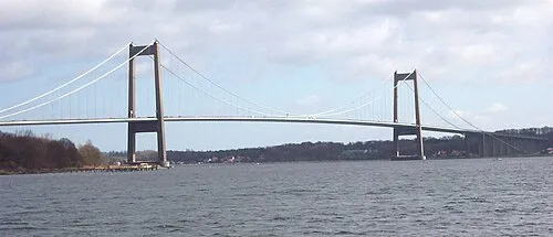 Little Belt Bridge Landmark, Region South Denmark9.2 km SE
-
Bavnbjerg Mountain, Vejle Kommune22 km N
-
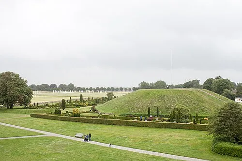 Thyras Høj Mountain, Vejle Kommune23 km NW
-
Grejs Dal Natural site, Vejle Kommune21 km N
-
Brohøj Mountain, Hedensted Kommune24 km N
Sources & licences
Data last updated: · 2 independent sources