Brenderup
Located in Middelfart Kommune, Region South Denmark Coordinates: 55°29′03″ N 9°58′45″ E
- Population
- 1,366
- 1.4K
- Elevation
- 16 m
- above sea level
- Local time
- UTC+01:00
- Europe/Copenhagen · UTC+01:00
About Brenderup
Brenderup is a village. Location: Middelfart Kommune, Region South Denmark. Population: 1,366. Elevation: 16 m.
Brenderup is a town, with a population of 1,481 (1 January 2026), situated on the island of Funen in Middelfart Municipality, Region of Southern Denmark in Denmark. Brenderup is located 14 km southwest of Bogense, 31 km northwest of Odense and 16 km east of Middelfart. Brenderup Church is located to the south in the old part of the town.
Read more on Wikipedia Text: Wikipedia contributors · CC BY-SA 4.0 · shortened
In comparison
- No. 6 of 8 places in Middelfart Kommune by population
- Nearest larger town: Ejby, 7 km SW
Climate of Brenderup
Best months for sightseeing: June–August.
| Month | Jan | Feb | Mar | Apr | May | Jun | Jul | Aug | Sep | Oct | Nov | Dec |
|---|---|---|---|---|---|---|---|---|---|---|---|---|
| Average high (°C) | 4° | 4° | 6° | 10° | 15° | 18° | 20° | 20° | 17° | 12° | 8° | 5° |
| Average low (°C) | -2° | -3° | -1° | 3° | 8° | 11° | 13° | 12° | 10° | 6° | 3° | 0° |
| Precipitation (mm) | 52 | 35 | 42 | 37 | 45 | 53 | 61 | 62 | 61 | 66 | 67 | 58 |
Monthly averages for 1970–2000 at about 18 km resolution, adjusted for elevation. Highlighted months are mild and relatively dry. Source: WorldClim 2.1 (CC BY 4.0).
Airports nearest to Brenderup
- Odense Hans Christian Andersen Airport (ODE) Odense 22 km
- Sønderborg Airport (SGD) Sønderborg 59 km
- Billund Airport (BLL) Billund 59 km
Straight-line distance; airports with scheduled flights only. Source: OurAirports (public domain).
Nearby attractions & nature
Everything nearby-
Fluebjerg Mountain, Middelfart Kommune8.3 km SW
-
Røjle Banke Mountain, Middelfart Kommune11 km NW
-
Svinø Natural site, Middelfart Kommune12 km W
-
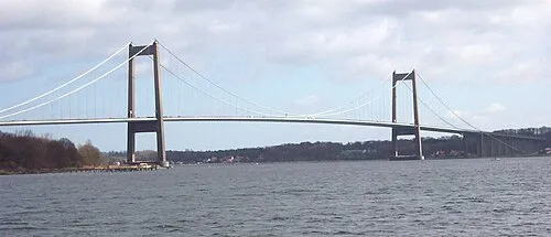 Little Belt Bridge Landmark, Region South Denmark15 km W
-
Ejlinge Island, Nordfyns Kommune19 km NE
-
Dræet Island, Nordfyns Kommune18 km NE
Sources & licences
Data last updated: · 2 independent sources