Nørre Nebel
Located in Varde Kommune, Region South Denmark Coordinates: 55°46′47″ N 8°17′43″ E
- Population
- 1,348
- 1.3K
- Elevation
- 6 m
- above sea level
- Local time
- UTC+01:00
- Europe/Copenhagen · UTC+01:00
About Nørre Nebel
Nørre Nebel is a village. Location: Varde Kommune, Region South Denmark. Population: 1,348. Elevation: 6 m.
Nørre Nebel is a town in southwest Jutland, Denmark, with a population of 1,348 (1 January 2026). The town is influenced by tourism, and most of the inhabitants are working with handicrafts, trade or services. Nørre Nebel is located about 23 kilometres (14 mi) from Varde and Tarm. The town is served by Nørre Nebel railway station, the northern terminus of the Varde–Nørre Nebel railway line.
Read more on Wikipedia Text: Wikipedia contributors · CC BY-SA 4.0 · shortened
In comparison
- No. 5 of 9 places in Varde Kommune by population
- Nearest larger town: Oksbøl, 17 km S
Climate of Nørre Nebel
Best months for sightseeing: June–August.
| Month | Jan | Feb | Mar | Apr | May | Jun | Jul | Aug | Sep | Oct | Nov | Dec |
|---|---|---|---|---|---|---|---|---|---|---|---|---|
| Average high (°C) | 3° | 4° | 6° | 10° | 15° | 18° | 20° | 20° | 17° | 13° | 8° | 5° |
| Average low (°C) | 0° | 0° | 1° | 4° | 9° | 12° | 14° | 14° | 11° | 8° | 4° | 1° |
| Precipitation (mm) | 66 | 44 | 54 | 38 | 44 | 54 | 61 | 71 | 94 | 101 | 99 | 82 |
Monthly averages for 1970–2000 at about 18 km resolution, adjusted for elevation. Highlighted months are mild and relatively dry. Source: WorldClim 2.1 (CC BY 4.0).
Airports nearest to Nørre Nebel
- Esbjerg Airport (EBJ) Esbjerg 33 km
- Billund Airport (BLL) Billund 54 km
- Midtjyllands Airport / Air Base Karup (KRP) Karup 77 km
Straight-line distance; airports with scheduled flights only. Source: OurAirports (public domain).
Nearby attractions & nature
Everything nearby-
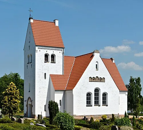 Lønne Kirke Attraction, Varde Kommune3.7 km W
-
Kærhøj Mountain, Varde Kommune13 km SE
-
Stilbjerg Mountain, Varde Kommune18 km SE
-
Bavnshøj Mountain, Varde Kommune17 km E
-
Fuglepold Island, Ringkøbing-Skjern Kommune14 km N
-
Høje Sande Island, Ringkøbing-Skjern Kommune15 km N
Sources & licences
Data last updated: · 2 independent sources