Vipperød
Located in Holbæk Kommune, Region Zealand Coordinates: 55°40′04″ N 11°44′23″ E
- Population
- 2,345
- 2.3K
- Elevation
- 32 m
- above sea level
- Local time
- UTC+01:00
- Europe/Copenhagen · UTC+01:00
About Vipperød
Vipperød is a village. Location: Holbæk Kommune, Region Zealand. Population: 2,345. Elevation: 32 m.
Vipperød is a railway town located 4 km south of Holbæk on the northwestern part of the island of Zealand in Holbæk Municipality, Region Zealand in Denmark. It has a population of 2,803 (1 January 2026). Vipperød is located at the Danish national road 21 and is served by Vipperød railway station located on the railway line between Roskilde and Holbæk.
Read more on Wikipedia Text: Wikipedia contributors · CC BY-SA 4.0 · shortened
In comparison
- No. 6 of 12 places in Holbæk Kommune by population
- Nearest larger town: Holbæk, 6 km N
- 8 sights and natural places within 10 km Munkholm, Mørkemose Bjerg
Climate of Vipperød
Best months for sightseeing: June–August.
| Month | Jan | Feb | Mar | Apr | May | Jun | Jul | Aug | Sep | Oct | Nov | Dec |
|---|---|---|---|---|---|---|---|---|---|---|---|---|
| Average high (°C) | 2° | 2° | 5° | 10° | 15° | 19° | 21° | 20° | 16° | 11° | 7° | 3° |
| Average low (°C) | -1° | -2° | 0° | 4° | 8° | 12° | 14° | 14° | 11° | 7° | 3° | 0° |
| Precipitation (mm) | 46 | 29 | 38 | 37 | 42 | 52 | 66 | 61 | 57 | 55 | 60 | 56 |
Monthly averages for 1970–2000 at about 18 km resolution, adjusted for elevation. Highlighted months are mild and relatively dry. Source: WorldClim 2.1 (CC BY 4.0).
Airports nearest to Vipperød
- Copenhagen Roskilde Airport (RKE) Roskilde 26 km
- Copenhagen Kastrup Airport (CPH) Copenhagen 58 km
- Odense Hans Christian Andersen Airport (ODE) Odense 92 km
Straight-line distance; airports with scheduled flights only. Source: OurAirports (public domain).
Nearby attractions & nature
Everything nearby-
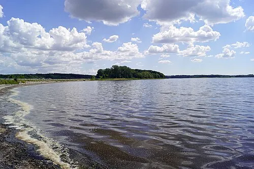 Munkholm Island, Holbæk Kommune4.2 km E
-
Mørkemose Bjerg Mountain, Holbæk Kommune5.1 km SW
-
Kirsebærholm Natural site, Holbæk Kommune7.3 km N
-
Rønnen Island, Holbæk Kommune7.2 km N
-
Bavnehøj Mountain, Holbæk Kommune9.6 km NW
-
Lindholm Island, Holbæk Kommune9.4 km NE
Sources & licences
Data last updated: · 2 independent sources