- Population
- 16,211
- 16.2K
- Elevation
- 3 m
- above sea level
- Local time
- UTC+01:00
- Europe/Copenhagen · UTC+01:00
- Airports
- ODE Odense Hans Christian Andersen Airport53 km
- RKE Copenhagen Roskilde Airport67 km
About Kalundborg
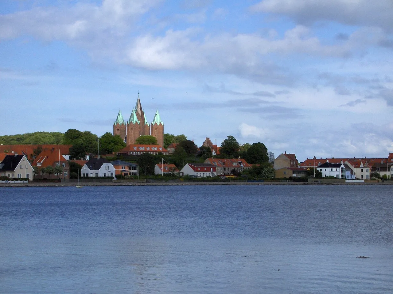
Kalundborg is a city. Location: Kalundborg Kommune, Region Zealand. Population: 16,211. Elevation: 3 m.
Kalundborg (Danish: [kʰælɔnˈpɒˀ]) is a Danish city with a population of 16,466 (1 January 2026), the main town of the municipality of the same name and the site of its municipal council. It is situated on the northwestern coast of the largest Danish island, Zealand (or Sjælland in Danish), on the opposite, eastern side of which lies the capital Copenhagen, 110 km (68 mi) away. Kalundborg is famous as the location of a large broadcasting facility, the Kalundborg Transmitter.
Source: Wikipedia · CC BY-SA 4.0
Photos of Kalundborg
-

Toxophilus · CC BY-SA 4.0 -

Jens Cederskjold · CC BY 3.0 -

Toxophilus · CC BY-SA 4.0 -

Alwaabsalon · CC BY-SA 4.0 -

Jens Cederskjold · CC BY 3.0


Travel notes for Kalundborg
From Wikivoyage
Kalundborg is a city in Zealand, Denmark. You might come here for the medieval city remains, for the spectacular nature of Røsnæs, or because Kalundborg could be on your way from Copenhagen via Samsø to Aarhus.
Understand+
Kalundborg is on western Zealand inside Kalundborg Fjord between the two peninsulas Røsnæs and Asnæs. The town has around 17,000 inhabitants.
History:
Kalundborg was established in 1170 by Esbern Snare who built the West Castle (only ruins remain) just west of the medieval High Town. During the 13th century, the five-spired Church of Our Lady as well as the medieval High Town were established. The town was important during the next couple of centuries as significant part of the Danish central administration was moved to here. During the 16th and 17th centuries, the downtown was established at the location of the present day major shopping and commercial street, Kordilgade.
Get in+
By train:
Kalundborg is the terminal station on the Western Zealand train line. The train from Copenhagen leaves approximately once an hour, is 1 hr 30 min to 1 hr 50 min and costs kr 120.
By boat:
There are ferries from
Aarhus (4-6 times each day, fewer on Sa in low season; Travel time 2hr 40min; Adults kr 175, children 4-15 kr 88; Booking +45 7010 1418 [1]) and from
Samsø (2-4 times each day; Travel time 1 hr 50 min; Adult kr 84, children 4-15 kr 42; Booking +45 7010 1744 [2] )
By plane:
The nearest airport is in Copenhagen (CPH IATA).
Source: Wikivoyage · CC BY-SA 4.0 · abridged
Climate of Kalundborg
Best months for sightseeingBest months for sightseeing: June–August.
This month · November
A cold month
Day 7° · Night 4° · Rain 53 mm
- Hottest month
- August (day 21°)
- Coldest month
- February (night -1°)
- Wettest month
- September (56 mm)
- Driest month
- February (27 mm)
Bars: average monthly low and high temperature. Below: precipitation. Monthly averages for 1970–2000 at about 18 km resolution, adjusted for elevation. Highlighted months are mild and relatively dry. Source: WorldClim 2.1 (CC BY 4.0).
Show values as a table
| Month | Jan | Feb | Mar | Apr | May | Jun | Jul | Aug | Sep | Oct | Nov | Dec |
|---|---|---|---|---|---|---|---|---|---|---|---|---|
| Average high (°C) | 3° | 2° | 5° | 10° | 15° | 19° | 21° | 21° | 17° | 12° | 7° | 4° |
| Average low (°C) | -1° | -1° | 1° | 4° | 8° | 12° | 14° | 14° | 11° | 8° | 4° | 1° |
| Precipitation (mm) | 42 | 27 | 35 | 31 | 41 | 49 | 55 | 54 | 56 | 53 | 53 | 48 |
How to get to Kalundborg
The nearest airport is Odense Hans Christian Andersen Airport (ODE), 53 km to the southwest as the crow flies. The nearest large city is Odense, 54 km to the southwest.
Airports
- Odense Hans Christian Andersen Airport (ODE) Odense 53 kmsouthwest
- Copenhagen Roskilde Airport (RKE) Roskilde 67 kmeast
- Aarhus Airport (AAR) Aarhus 75 kmnorthwest
Nearby large cities
- Odense Population: 180.9K 54 kmsouthwest
- Aarhus Population: 285.3K 76 kmnorthwest
- Copenhagen Population: 1.2M 93 kmeast
- Helsingborg Population: 104.2K 109 kmnortheast
- Malmö Population: 362.1K 121 kmeast
Straight-line distances; road distances are longer. Airport data: OurAirports.
Day trips from Kalundborg
Within 100 km: 26 historic and cultural sites, 158 natural sites, 105 lakes, rivers and coasts.
0–25 km21 places
- Trolddal Natural site 18 kmNE
- Store Vrøj Beach 9 kmNE
- Dalbystrand Beach 18 kmS
- Gisseløre Sand Beach 2 kmW
25–60 km98 places
- Sjælland Island 46 kmSE
- Næsbystrand Beach 32 kmS
- Bildsøstrand Beach 26 kmS
- Flyvesandet Beach 50 kmW
60–100 km170 places
- Amager Island 96 kmE
- Tåsinge Island 82 kmS
- Ballehage Beach 73 kmNW
- Fisketorvet Havnebad Beach 93 kmE
Straight-line distances.
Nearby attractions & nature
Everything nearby-
Møllebakken Mountain, Kalundborg Kommune0.4 km NE
-
Gisseløre Sand Beach, Kalundborg Kommune1.5 km W
-
Småhøje Mountain, Kalundborg Kommune3.4 km NW
-
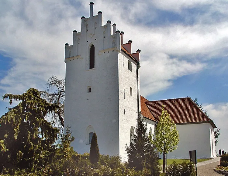 Årby Kirke Attraction, Kalundborg Kommune4.7 km SE
-
Bøgebjerg Mountain, Kalundborg Kommune5.6 km E
-
Store Vrøj Beach, Kalundborg Kommune8.9 km NE
-
Urhøj Mountain, Kalundborg Kommune12 km SE
-
Bjerge Nordstrand Beach, Kalundborg Kommune11 km SE
Sources & licences
Data last updated: · 2 independent sources