Bottenvikens Nationalpark
Located in Lapland Region, Finland Coordinates: 65°38′59″ N 24°21′04″ E
- Local time
- UTC+02:00
- Europe/Helsinki · UTC+02:00
- Airports
- KEM Kemi-Tornio Airport18 km
- OUL Oulu Airport93 km
About Bottenvikens Nationalpark
Bottenvikens Nationalpark is a natural site. Location: Lapland Region, Finland.
Bothnian Bay National Park (Finnish: Perämeren kansallispuisto, Swedish: Bottenvikens nationalpark) is a national park in Lapland, Finland. The park which was established in 1991, covers 157 square kilometres (61 sq mi) of which 2.5 square kilometres (0.97 sq mi) is on land. It is maintained by Metsähallitus. The islands in the area have been formed by post-glacial rebound, and the scenery is still in a constant state of change. There are also numerous traditional fishing bases.
Source: Wikipedia · CC BY-SA 4.0
Climate of Bottenvikens Nationalpark
Best months for sightseeingBest months for sightseeing: June–August.
This month · November
A cold month
Day -1° · Night -8° · Rain 54 mm
- Hottest month
- July (day 20°)
- Coldest month
- January (night -15°)
- Wettest month
- August (65 mm)
- Driest month
- April (29 mm)
Bars: average monthly low and high temperature. Below: precipitation. Monthly averages for 1970–2000 at about 18 km resolution, adjusted for elevation. Highlighted months are mild and relatively dry. Source: WorldClim 2.1 (CC BY 4.0).
Show values as a table
| Month | Jan | Feb | Mar | Apr | May | Jun | Jul | Aug | Sep | Oct | Nov | Dec |
|---|---|---|---|---|---|---|---|---|---|---|---|---|
| Average high (°C) | -7° | -6° | -1° | 4° | 11° | 17° | 20° | 17° | 11° | 5° | -1° | -5° |
| Average low (°C) | -15° | -15° | -10° | -5° | 1° | 8° | 11° | 9° | 4° | -1° | -8° | -13° |
| Precipitation (mm) | 42 | 34 | 34 | 29 | 34 | 43 | 60 | 65 | 60 | 62 | 54 | 43 |
How to get to Bottenvikens Nationalpark
The nearest airport is Kemi-Tornio Airport (KEM), 18 km to the northeast as the crow flies. For international flights: Oulu Airport (OUL) (93 km). The nearest large city is Umeå, 281 km to the southwest.
Airports
- Kemi-Tornio Airport (KEM) Kemi / Tornio 18 kmnortheast
- Oulu Airport (OUL) Oulu / Oulunsalo 93 kmsoutheast
- Luleå Airport (LLA) Luleå 103 kmwest
Nearby large cities
- Umeå Population: 130.2K 281 kmsouthwest
Straight-line distances; road distances are longer. Airport data: OurAirports.
Day trips from Bottenvikens Nationalpark
Within 100 km: 21 natural sites, 95 lakes, rivers and coasts.
0–25 km11 places
- Pihlaja Island 14 kmNW
- Nälkäkari Island 11 kmW
- Lilla Hamnskär Island 14 kmNW
- Selkä-Sarvi Island 8 kmSW
25–60 km32 places
- Granholmen Island 56 kmW
- Långören Island 51 kmW
- Lägenön Island 53 kmW
- Lutskärsgrundet Natural site 51 kmW
60–100 km73 places
- Kahvankari Island 81 kmSE
- Oulujoki River 87 kmSE
- Mittre Fjärdsgrundet Island 76 kmW
- Svartholmen Island 69 kmW
Straight-line distances.
Nearest towns and villages
-
Kemi Town, Kemi14 km NE
-
Kemi Municipality, Kemi-Tornio15 km NE
-
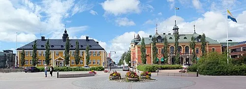 Haparanda City, Haparanda Municipality23 km NW
-
Keminmaa Town, Keminmaa19 km NE
-
Lautiosaari Neighbourhood, Keminmaa20 km NE
-
Nedertorneå-Haparanda Municipality, Haparanda Municipality22 km NW
Nearby attractions & nature
Everything nearby-
Selkä-Sarvi Island, Kemi8.4 km SW
-
Joutukrunni Island, Norrbotten County11 km W
-
Nälkäkari Island, Norrbotten County11 km W
-
Pirkkiö Island, Lapland Region20 km N
-
Pihlaja Island, Norrbotten County14 km NW
-
Hyyppää Island, Norrbotten County15 km NW
-
Lilla Hamnskär Island, Norrbotten County14 km NW
-
Hamppuleiviskä Island, Norrbotten County17 km NW
Sources & licences
Data last updated: · 2 independent sources