
- Elevation
- 1,227 m
- above sea level
- Local time
- UTC+02:00
- Europe/Helsinki · UTC+02:00
- Airports
- SOJ Sørkjosen Airport58 km
- TOS Tromsø Airport105 km
About Ritničohkka
Ritničohkka is a mountain. Location: Enontekiö, Tunturi-Lappi. Elevation: 1,227 m.
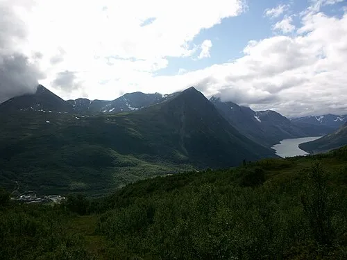
Ridnitšohkka (Northern Sami: Ritničohkka) is the second-highest point in Finland, though it is the highest mountain with its peak within Finland. The eastern face is steep while the western side is mild. While somewhat popular destination among off-piste skiers, the remoteness (50 km or 31 mi from the nearest settlement) of this mountain makes it very isolated.
Source: Wikipedia · CC BY-SA 4.0
Photos of Ritničohkka
-

Ari Mure · CC BY-SA 3.0 -

Ari Mure · CC BY-SA 3.0 -

Halti Ari Mure · CC BY-SA 3.0


Climate of Ritničohkka
This month · November
A cold month
Day -7° · Night -15° · Rain 43 mm
- Hottest month
- July (day 12°)
- Coldest month
- January (night -19°)
- Wettest month
- July (86 mm)
- Driest month
- April (33 mm)
Bars: average monthly low and high temperature. Below: precipitation. Monthly averages for 1970–2000 at about 18 km resolution, adjusted for elevation. Highlighted months are mild and relatively dry. Source: WorldClim 2.1 (CC BY 4.0).
Show values as a table
| Month | Jan | Feb | Mar | Apr | May | Jun | Jul | Aug | Sep | Oct | Nov | Dec |
|---|---|---|---|---|---|---|---|---|---|---|---|---|
| Average high (°C) | -10° | -10° | -8° | -4° | 1° | 8° | 12° | 10° | 4° | -3° | -7° | -9° |
| Average low (°C) | -19° | -19° | -16° | -12° | -5° | 0° | 4° | 2° | -2° | -7° | -15° | -18° |
| Precipitation (mm) | 43 | 35 | 37 | 33 | 36 | 58 | 86 | 70 | 54 | 55 | 43 | 44 |
How to get to Ritničohkka
The nearest airport is Sørkjosen Airport (SOJ), 58 km to the north as the crow flies. For international flights: Tromsø Airport (TOS) (105 km).
Airports
- Sørkjosen Airport (SOJ) Sørkjosen 58 kmnorth
- Tromsø Airport (TOS) Tromsø 105 kmnorthwest
- Alta Airport (ALF) Alta 110 kmnortheast
Straight-line distances; road distances are longer. Airport data: OurAirports.
Day trips from Ritničohkka
Within 100 km: 45 natural sites, 4 lakes, rivers and coasts.
0–25 km3 places
- Govddošgáisi Mountain 9 kmSW
- Haltiatunturi Mountain 4 kmNW
- Halti Mountain 4 kmNW
25–60 km28 places
- Kilpisjärvi Lake 37 kmSW
- Saana Mountain 34 kmSW
- Kaarinasvaara Mountain 47 kmSW
- Njaŋggot Mountain 50 kmSW
60–100 km18 places
- Árjjatoaivi Mountain 69 kmS
- Kelottijärvi Lake 89 kmS
- Könkämäeno River 97 kmSE
- Lätäseno River 97 kmSE
Straight-line distances.
Nearest towns and villages
-
 Birtavarre Village, Kåfjord31 km NW
-
 Kilpisjärvi Village, Enontekiö35 km SW
-
 Lyngseidet City, Lyngen55 km NW
-
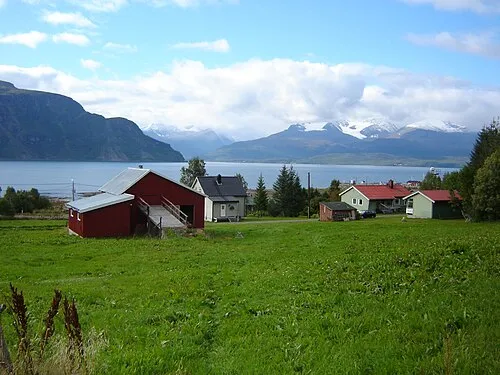 Olderdalen City, Kåfjord48 km NW
-
 Sørkjosen Village, Nordreisa58 km N
-
 Furuflaten Village, Lyngen50 km W
Nearby attractions & nature
Everything nearby-
Halti Mountain, Finland4 km NW
-
Haltiatunturi Mountain, Enontekiö4.1 km NW
-
 Govddošgáisi Mountain, Enontekiö9.2 km SW
More nature in Finland
-
 Saana Mountain, Enontekiö34 km SW
-
 Ounastunturi Mountain, Enontekiö150 km SE
Sources & licences
Data last updated: · 2 independent sources