Forêt de Vaucluse
Located in Jura, Bourgogne-Franche-Comté Coordinates: 46°27′05″ N 5°40′59″ E
- Elevation
- 539 m
- above sea level
- Local time
- UTC+01:00
- Europe/Paris · UTC+01:00
- Airports
- GVA Geneva International Airport40 km
- NCY Annecy Meythet airport66 km
About Forêt de Vaucluse
Forêt de Vaucluse is a natural site. Location: Jura, Bourgogne-Franche-Comté. The best months to visit are June–August. The nearest airport is Geneva International Airport (40 km). Nearby sights include Bois du Mont and Lac de Vouglans.
Climate of Forêt de Vaucluse
Best months for sightseeingBest months for sightseeing: June–August.
This month · November
A wet month
Day 8° · Night 2° · Rain 115 mm
- Hottest month
- July (day 24°)
- Coldest month
- January (night -2°)
- Wettest month
- November (115 mm)
- Driest month
- March (85 mm)
Bars: average monthly low and high temperature. Below: precipitation. Monthly averages for 1970–2000 at about 18 km resolution, adjusted for elevation. Highlighted months are mild and relatively dry. Source: WorldClim 2.1 (CC BY 4.0).
Show values as a table
| Month | Jan | Feb | Mar | Apr | May | Jun | Jul | Aug | Sep | Oct | Nov | Dec |
|---|---|---|---|---|---|---|---|---|---|---|---|---|
| Average high (°C) | 4° | 6° | 10° | 13° | 18° | 21° | 24° | 23° | 19° | 14° | 8° | 5° |
| Average low (°C) | -2° | -1° | 1° | 4° | 8° | 11° | 13° | 13° | 10° | 7° | 2° | 0° |
| Precipitation (mm) | 101 | 98 | 85 | 94 | 109 | 110 | 90 | 85 | 113 | 113 | 115 | 110 |
How to get to Forêt de Vaucluse
The nearest airport is Geneva International Airport (GVA), 40 km to the southeast as the crow flies. The nearest large city is Geneva, 45 km to the southeast.
Airports
- Geneva International Airport (GVA) Geneva 40 kmsoutheast
- Annecy Meythet airport (NCY) Annecy 66 kmsoutheast
- Dole Tavaux Airport (DLE) Dole 68 kmnorth
Nearby large cities
- Geneva Population: 201.7K 45 kmsoutheast
- Lausanne Population: 139.1K 73 kmeast
- Besançon Population: 128.4K 92 kmnorth
- Villeurbanne Population: 131.4K 98 kmsouthwest
- Lyon Population: 520.8K 101 kmsouthwest
Straight-line distances; road distances are longer. Airport data: OurAirports.
Nearest towns and villages
-
Maisod Village, Arrondissement of Saint-Claude2.9 km N
-
Charchilla Village, Arrondissement of Saint-Claude2.8 km NE
-
Onoz Village, Arrondissement of Lons-le-Saunier2.4 km W
-
Charchilla Village, Charchilla2.7 km NE
-
Moirans-en-Montagne Village, Arrondissement of Saint-Claude3.9 km SE
-
Onoz Village, Onoz2.4 km W
Nearby attractions & nature
Everything nearby-
Bois du Mont Natural site, Jura4.5 km NW
-
Lac de Vouglans Lake, Bourgogne-Franche-Comté3.8 km N
-
Bois de Bugna Natural site, Jura7.1 km SW
-
Lac d'Antre Lake, Jura6.6 km SE
-
Bois de Lionge Natural site, Jura7.9 km SW
-
Bois de Malmont Natural site, Jura9.6 km W
-
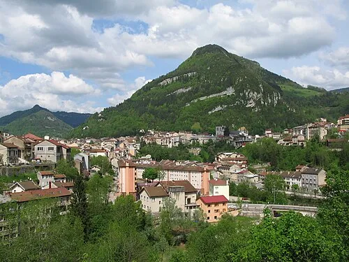 Mont Bayard Mountain, Saint-Claude16 km SE
-
Mont Chavet Mountain, Mérona12 km N
More nature in France
-
Forêt de la Joux Natural site, Jura11 km NE
-
Forêt d'Avignon Natural site, Jura13 km E
-
Côte des Baumes Mountain, Rothonay15 km NW
-
Forêt de la Crochère Natural site, Jura15 km NE
-
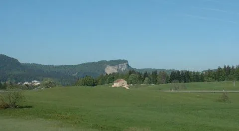 Mont Fier Mountain, Prémanon24 km E
-
Forêt de Prénovel Natural site, Jura15 km NE
Sources & licences
Data last updated: