- Elevation
- 948 m
- above sea level
- Local time
- UTC+01:00
- Europe/Paris · UTC+01:00
- Airports
- CLY Calvi Sainte Catherine Airport19 km
- AJA Ajaccio Napoléon Bonaparte airport50 km
About Capo Rosso
Capo Rosso is a mountain. Location: Galéria, Calvi. Elevation: 948 m. The best months to visit are July–August. The nearest airport is Calvi Sainte Catherine Airport (19 km). Nearby sights include Capu Manganellu and Forêt Territoriale du Fango.
Climate of Capo Rosso
Best months for sightseeingBest months for sightseeing: July–August.
This month · November
A wet month
Day 11° · Night 5° · Rain 116 mm
- Hottest month
- July (day 23°)
- Coldest month
- February (night 1°)
- Wettest month
- October (116 mm)
- Driest month
- July (13 mm)
Bars: average monthly low and high temperature. Below: precipitation. Monthly averages for 1970–2000 at about 18 km resolution, adjusted for elevation. Highlighted months are mild and relatively dry. Source: WorldClim 2.1 (CC BY 4.0).
Show values as a table
| Month | Jan | Feb | Mar | Apr | May | Jun | Jul | Aug | Sep | Oct | Nov | Dec |
|---|---|---|---|---|---|---|---|---|---|---|---|---|
| Average high (°C) | 7° | 7° | 9° | 11° | 16° | 20° | 23° | 23° | 20° | 16° | 11° | 8° |
| Average low (°C) | 1° | 1° | 2° | 4° | 8° | 11° | 14° | 15° | 12° | 9° | 5° | 2° |
| Precipitation (mm) | 86 | 77 | 74 | 72 | 48 | 35 | 13 | 27 | 71 | 116 | 116 | 96 |
How to get to Capo Rosso
The nearest airport is Calvi Sainte Catherine Airport (CLY), 19 km to the north as the crow flies. For international flights: Bastia-Poretta International airport (BIA) (66 km). The nearest large city is Nice, 190 km to the northwest.
Airports
- Calvi Sainte Catherine Airport (CLY) Calvi 19 kmnorth
- Ajaccio Napoléon Bonaparte airport (AJA) Ajaccio 50 kmsouth
- Bastia-Poretta International airport (BIA) Bastia 66 kmeast
Nearby large cities
- Nice Population: 342.7K 190 kmnorthwest
- Toulon Population: 168.7K 244 kmwest
- Marseille Population: 877.2K 292 kmwest
- Aix-en-Provence Population: 146.8K 297 kmnorthwest
- Nîmes Population: 148.2K 391 kmnorthwest
Straight-line distances; road distances are longer. Airport data: OurAirports.
Day trips from Capo Rosso
Within 100 km: 132 historic and cultural sites, 552 natural sites, 291 lakes, rivers and coasts.
0–25 km176 places
- Plage Bussaglia Beach 10 kmS
- Île de Gargali Island 15 kmW
- Étang de Crovani Lake 12 kmN
- Capu di Bagliu Mountain 24 kmS
25–60 km440 places
- Corsica Island 38 kmSE
- Plage du Ruppione Beach 60 kmS
- Plage d'Albitreccia Beach 57 kmS
- Plage Saint-François Beach 50 kmS
60–100 km359 places
- Banda Bianca Beach 68 kmNE
- Plage de Cupabia Beach 70 kmS
- Plage de Capu Laurosu Beach 79 kmS
- Plage de Purraja Beach 78 kmS
Straight-line distances.
Nearest towns and villages
Nearby attractions & nature
Everything nearby-
Capu Manganellu Mountain, Galéria2 km S
-
Forêt Territoriale du Fango Natural site, Corsica1.9 km SE
-
Forêt de Tetti Natural site, Upper Corsica2 km NW
-
Punta di u Tartavellu Mountain, Galéria3.6 km W
-
Punta Salisei Mountain, Partinello4 km SW
-
Capu a Ghiallichiccia Mountain, Manso4.1 km SE
-
Punta a e Forbice Mountain, Manso4.2 km SE
-
Forêt de Perticatu Natural site, Upper Corsica4.4 km SE
More nature in France
-
Capu Tondu Mountain, Galéria5.9 km NW
-
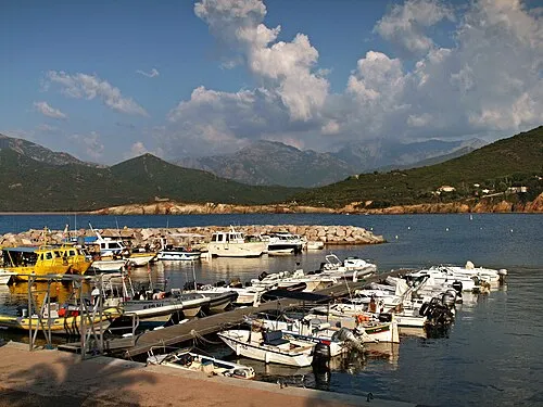 Capo di Vegno Mountain, Galéria10 km NE
-
Punta Muvrareccia Mountain, Galéria9.4 km NW
-
Monte Martinu Mountain, Galéria9.5 km N
-
Capu Licchia Mountain, Galéria9.9 km W
-
Punta â Scala Mountain, Galéria8.1 km NE
Sources & licences
Data last updated: · 2 independent sources