- Population
- 185,231
- 185.2K
- Elevation
- 716 m
- above sea level
- Local time
- UTC+01:00
- Europe/Paris · UTC+01:00
- Places inside
- 211
- listed under Upper Corsica
- Airports
- BIA Bastia-Poretta International airport30 km
- CLY Calvi Sainte Catherine Airport33 km
About Upper Corsica
Upper Corsica is a district. Location: Corsica, France. Population: 185,231.
Haute-Corse (French: [ot kɔʁs] ; Corsican: Corsica suprana [ˈkorsiɡa zuˈprana], Cismonte [tʃiˈzmɔnte] or Alta Corsica; English: Upper Corsica) is a department of France, consisting of the northern part of the island of Corsica. The corresponding departmental territorial collectivity merged with that of Corse-du-Sud on 1 January 2018, forming the single territorial collectivity of Corsica, with territorial elections coinciding with the dissolution of the separate councils.
Source: Wikipedia · CC BY-SA 4.0
Places bordering Upper Corsica
- South Corsica
Population of Upper Corsica over time
| 2015 | 174,553 | |
|---|---|---|
| 2016 | 174,993 | |
| 2017 | 177,689 | |
| 2018 | 180,701 | |
| 2019 | 181,933 | |
| 2020 | 182,887 | |
| 2021 | 184,655 | |
| 2022 | 185,231 | |
| 2023 | 187,180 |
Censuses and official estimates; source: Wikidata.
Climate of Upper Corsica
Best months for sightseeingBest months for sightseeing: June–September.
This month · November
A wet month
Day 13° · Night 7° · Rain 110 mm
- Hottest month
- July (day 26°)
- Coldest month
- February (night 3°)
- Wettest month
- October (111 mm)
- Driest month
- July (15 mm)
Bars: average monthly low and high temperature. Below: precipitation. Monthly averages for 1970–2000 at about 18 km resolution, adjusted for elevation. Highlighted months are mild and relatively dry. Source: WorldClim 2.1 (CC BY 4.0).
Show values as a table
| Month | Jan | Feb | Mar | Apr | May | Jun | Jul | Aug | Sep | Oct | Nov | Dec |
|---|---|---|---|---|---|---|---|---|---|---|---|---|
| Average high (°C) | 9° | 9° | 11° | 13° | 18° | 22° | 26° | 26° | 22° | 18° | 13° | 10° |
| Average low (°C) | 3° | 3° | 4° | 6° | 10° | 13° | 17° | 17° | 14° | 11° | 7° | 4° |
| Precipitation (mm) | 85 | 80 | 72 | 68 | 50 | 37 | 15 | 28 | 71 | 111 | 110 | 97 |
Other places to visit in this season: June July August September
How to get to Upper Corsica
The nearest airport is Bastia-Poretta International airport (BIA), 30 km to the northeast as the crow flies. The nearest large city is Nice, 211 km to the northwest.
Airports
- Bastia-Poretta International airport (BIA) Bastia 30 kmnortheast
- Calvi Sainte Catherine Airport (CLY) Calvi 33 kmnorthwest
- Ajaccio Napoléon Bonaparte airport (AJA) Ajaccio 62 kmsouthwest
Nearby large cities
- Nice Population: 342.7K 211 kmnorthwest
- Toulon Population: 168.7K 276 kmwest
- Marseille Population: 877.2K 324 kmwest
- Aix-en-Provence Population: 146.8K 327 kmnorthwest
Straight-line distances; road distances are longer. Airport data: OurAirports.
Places in Upper Corsica
211 placesCities & villages1
- Tintorajo · Village
Lakes, rivers & coasts30
- Ruisseau de San Clemente · River
- Ruisseau de Saninco · River
- Ruisseau de San Pancrazio · River
- Ruisseau de San Petru · River
- Ruisseau de Santa Maria · River
- Ruisseau de Sbiri · River
- Ruisseau de Sisco · River
- Ruisseau de Taola · River
- Ruisseau de Tenzonio · River
- Ruisseau de Terrivola · River
- Ruisseau de Tovo · River
- Ruisseau de Vacile · River
- Ruisseau de Vadarbico · River
- Ruisseau de Vadi · River
- Ruisseau de Vadone · River
- Ruisseau de Vadule · River
- Ruisseau de Valdu Castagnu · River
- Ruisseau de Varagno · River
- Ruisseau de Verjello · River
- Ruisseau de Zingajo · River
- Ruisseau Gavignaninco · River
- Salinelle · River
- Tagnone · River
- Travo · River
- U Fiume Seccu · River
- U Guadu Grande · River
- U Viru · River
- Vaccareccia · River
- Vaghio · River
- Vecchio · River
Nature and heritage in Upper Corsica
Nearby attractions & nature
Everything nearby-
Ponte Castirla Landmark, Corsica4.3 km SW
-
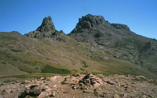
Aiguilles de Popolasca Mountain, Corsica5.1 km W
-
San Michele Attraction, Corsica5.2 km S
-
Gorges de l'Asco Natural site, Corsica8.3 km NW
-
Monte Cecu Mountain, Corsica9.5 km S
-
San Pantaleo Attraction, Corsica9.4 km E
Sources & licences
Data last updated: · 2 independent sources