- Population
- 582
- 582
- Elevation
- 277 m
- above sea level
- Local time
- UTC+01:00
- Europe/Paris · UTC+01:00
- Places inside
- 1
- listed under Weyer
- Airports
- SCN Saarbrücken Airport40 km
- SXB Strasbourg Airport49 km
About Weyer
Weyer is a village. Location: Arrondissement of Saverne, Bas-Rhin. Population: 582. Elevation: 277 m. The best months to visit are June–August. The nearest airport is Saarbrücken Airport (40 km). Nearby sights include Brueschbach and Musée Lalique.
Climate of Weyer
Best months for sightseeingBest months for sightseeing: June–August.
This month · November
A cold month
Day 8° · Night 2° · Rain 77 mm
- Hottest month
- July (day 24°)
- Coldest month
- January (night -2°)
- Wettest month
- December (85 mm)
- Driest month
- April (55 mm)
Bars: average monthly low and high temperature. Below: precipitation. Monthly averages for 1970–2000 at about 18 km resolution, adjusted for elevation. Highlighted months are mild and relatively dry. Source: WorldClim 2.1 (CC BY 4.0).
Show values as a table
| Month | Jan | Feb | Mar | Apr | May | Jun | Jul | Aug | Sep | Oct | Nov | Dec |
|---|---|---|---|---|---|---|---|---|---|---|---|---|
| Average high (°C) | 4° | 5° | 10° | 13° | 18° | 21° | 24° | 23° | 19° | 14° | 8° | 5° |
| Average low (°C) | -2° | -1° | 1° | 4° | 8° | 11° | 13° | 12° | 9° | 6° | 2° | 0° |
| Precipitation (mm) | 65 | 62 | 59 | 55 | 74 | 75 | 68 | 58 | 65 | 74 | 77 | 85 |
How to get to Weyer
The nearest airport is Saarbrücken Airport (SCN), 40 km to the north as the crow flies. For international flights: Strasbourg Airport (SXB) (49 km). The nearest large city is Saarbrücken, 43 km to the north.
Airports
- Saarbrücken Airport (SCN) Saarbrücken 40 kmnorth
- Strasbourg Airport (SXB) Strasbourg 49 kmsoutheast
- Metz-Nancy-Lorraine Airport (ETZ) Goin 68 kmwest
Nearby large cities
- Saarbrücken Population: 183K 43 kmnorth
- Strasbourg Population: 274.8K 53 kmsoutheast
- Nancy Population: 105.1K 74 kmwest
- Metz Population: 123.9K 78 kmnorthwest
- Karlsruhe Population: 283.8K 93 kmeast
Straight-line distances; road distances are longer. Airport data: OurAirports.
Day trips from Weyer
Within 100 km: 417 historic and cultural sites, 2,413 natural sites, 469 lakes, rivers and coasts.
0–25 km85 places
- Étang du Stock Lake 20 kmSW
- Grand Étang de Mittersheim Lake 17 kmW
- Schlossberg Mountain 21 kmSE
- le Spitzeck Mountain 23 kmNE
25–60 km868 places
- Zündelsberg Mountain 49 kmNE
- Zöllerberg Mountain 54 kmNE
- Strietberg Mountain 59 kmN
- Stenndinger Mountain 53 kmNW
60–100 km2,346 places
- Unditz River 69 kmSE
- Rench River 63 kmE
- Mummelsee Lake 82 kmE
- Huzenbacher See Lake 93 kmE
Straight-line distances.
Places in Weyer
1 placeBar: population relative to the most populous place in this list.
Nearby attractions & nature
Everything nearby-
Brueschbach River, Bas-Rhin6.1 km W
-
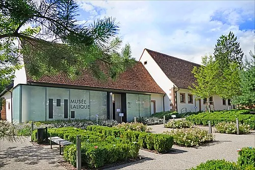 Musée Lalique Museum, Grand Est17 km NE
-
Isch River, Bas-Rhin7.6 km W
-
Forêt Domaniale de la Petite-Pierre Sud Natural site, Bas-Rhin10 km SE
-
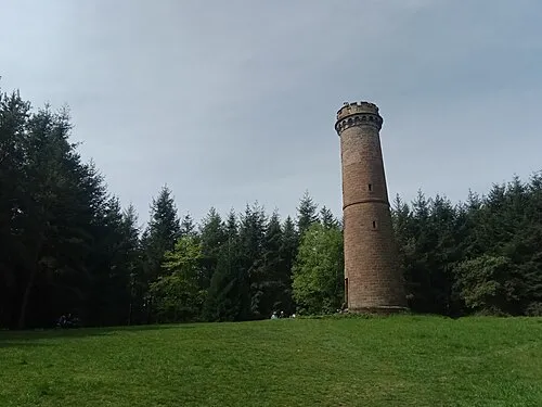 Brotschberg Mountain, Haegen20 km SE
-
Château de Lützelstein Historic site, Grand Est11 km E
Sources & licences
Data last updated: