- Local time
- UTC+01:00
- Europe/Paris · UTC+01:00
- Elevation
- 900 m
- above sea level
- Airports
- BSL EuroAirport Basel–Mulhouse–Freiburg40 km
- SXB Strasbourg Airport83 km
About Mémorial du Vieil Armand
Mémorial du Vieil Armand is a landmark. Location: Grand Est, France. The best months to visit are July–August. The nearest airport is EuroAirport Basel–Mulhouse–Freiburg (40 km). Nearby sights include Hartmannswillerkopf and Le Molkenrain.
Climate of Mémorial du Vieil Armand
Best months for sightseeingBest months for sightseeing: July–August.
This month · November
A wet month
Day 5° · Night 0° · Rain 117 mm
- Hottest month
- July (day 19°)
- Coldest month
- January (night -4°)
- Wettest month
- December (128 mm)
- Driest month
- April (91 mm)
Bars: average monthly low and high temperature. Below: precipitation. Monthly averages for 1970–2000 at about 18 km resolution, adjusted for elevation. Highlighted months are mild and relatively dry. Source: WorldClim 2.1 (CC BY 4.0).
Show values as a table
| Month | Jan | Feb | Mar | Apr | May | Jun | Jul | Aug | Sep | Oct | Nov | Dec |
|---|---|---|---|---|---|---|---|---|---|---|---|---|
| Average high (°C) | 2° | 2° | 6° | 9° | 14° | 17° | 19° | 19° | 16° | 11° | 5° | 3° |
| Average low (°C) | -4° | -4° | -1° | 1° | 5° | 8° | 11° | 11° | 8° | 4° | 0° | -2° |
| Precipitation (mm) | 107 | 103 | 92 | 91 | 113 | 114 | 104 | 92 | 96 | 107 | 117 | 128 |
How to get to Mémorial du Vieil Armand
The nearest airport is EuroAirport Basel–Mulhouse–Freiburg (BSL), 40 km to the southeast as the crow flies. The nearest large city is Mulhouse, 18 km to the southeast.
Airports
- EuroAirport Basel–Mulhouse–Freiburg (BSL) Bâle / Mulhouse 40 kmsoutheast
- Strasbourg Airport (SXB) Strasbourg 83 kmnortheast
- Bern Airport (BRN) Bern 108 kmsouth
Nearby large cities
- Mulhouse Population: 111.4K 18 kmsoutheast
- Basel Population: 177.6K 46 kmsoutheast
- Freiburg im Breisgau Population: 237.5K 55 kmeast
- Strasbourg Population: 274.8K 92 kmnortheast
- Bern Population: 121.6K 104 kmsouth
Straight-line distances; road distances are longer. Airport data: OurAirports.
Nearby attractions & nature
Everything nearby-
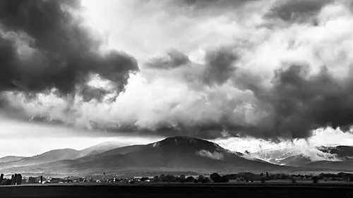 Hartmannswillerkopf Mountain, Wattwiller0.9 km E
-
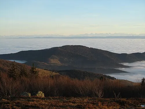 Le Molkenrain Mountain, Wattwiller1.6 km W
-
Château du Herrenfluh Historic site, Wattwiller1.8 km S
-
Château du Hirtzenstein Historic site, Wattwiller2 km SE
-
Riesenkopf Mountain, Willer-sur-Thur1.7 km W
-
Château de Freundstein Historic site, Grand Est2.3 km NW
-
Wolfskopf Mountain, Uffholtz2.8 km S
-
Notre-Dame de Thierenbach Attraction, Grand Est3.9 km NE
Nearest towns and villages
-
Wattwiller Village, Arrondissement de Thann-Guebwiller3.3 km SE
-
Arrondissement de Thann-Guebwiller Municipality, Haut-Rhin5.8 km SW
-
Wattwiller Village, Wattwiller3.2 km SE
-
Steinbach Village, Arrondissement de Thann-Guebwiller4.2 km S
More sights in Grand Est
-
Chateau d'Ollwiller Historic site, Wuenheim3.9 km E
-
Château du Weckenthal Historic site, Berrwiller5.2 km SE
-
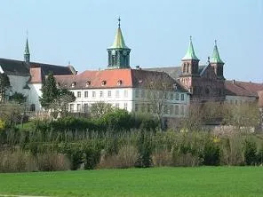 Abbaye Notre-Dame d'Oelenberg Attraction, Reiningue13 km S
-
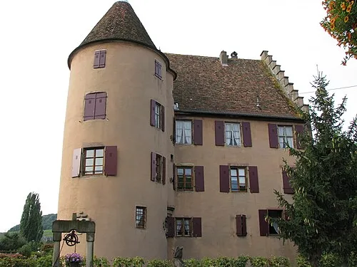 Château Wagenbourg Historic site, Grand Est13 km NE
-
Château d'Engelbourg Historic site, Grand Est6.1 km SW
-
Collégiale Saint-Thiébaut Attraction, Grand Est6.4 km SW
Sources & licences
Data last updated: