- Population
- 2,998
- 3K
- Elevation
- 44 m
- above sea level
- Local time
- UTC+01:00
- Europe/Paris · UTC+01:00
- Places inside
- 5
- listed under Mérignies
- Airports
- LIL Lille Airport7 km
- OST Ostend-Bruges International Airport79 km
About Mérignies
Mérignies is a village. Location: Arrondissement of Lille, North. Population: 2,998. Elevation: 44 m. The best months to visit are June–August. The nearest airport is Lille Airport (7 km). Nearby sights include Bois de Phalempin and Bois de l'Offlarde.
Climate of Mérignies
Best months for sightseeingBest months for sightseeing: June–August.
This month · November
A cold month
Day 10° · Night 4° · Rain 73 mm
- Hottest month
- August (day 23°)
- Coldest month
- February (night 1°)
- Wettest month
- November (73 mm)
- Driest month
- February (42 mm)
Bars: average monthly low and high temperature. Below: precipitation. Monthly averages for 1970–2000 at about 18 km resolution, adjusted for elevation. Highlighted months are mild and relatively dry. Source: WorldClim 2.1 (CC BY 4.0).
Show values as a table
| Month | Jan | Feb | Mar | Apr | May | Jun | Jul | Aug | Sep | Oct | Nov | Dec |
|---|---|---|---|---|---|---|---|---|---|---|---|---|
| Average high (°C) | 6° | 7° | 10° | 13° | 18° | 20° | 23° | 23° | 19° | 15° | 10° | 7° |
| Average low (°C) | 1° | 1° | 3° | 5° | 8° | 11° | 13° | 13° | 11° | 7° | 4° | 2° |
| Precipitation (mm) | 57 | 42 | 57 | 48 | 63 | 67 | 62 | 53 | 64 | 65 | 73 | 65 |
How to get to Mérignies
The nearest airport is Lille Airport (LIL), 7 km to the north as the crow flies. The nearest large city is Lille, 15 km to the north.
Airports
- Lille Airport (LIL) Lesquin 7 kmnorth
- Ostend-Bruges International Airport (OST) Oostende 79 kmnorth
- Brussels South Charleroi Airport (CRL) Charleroi 96 kmeast
Nearby large cities
- Lille Population: 238.7K 15 kmnorth
- Ghent Population: 265.1K 74 kmnortheast
- Bruges Population: 118.5K 79 kmnorth
- Amiens Population: 143.1K 89 kmsouthwest
- Anderlecht Population: 160.6K 93 kmnortheast
Straight-line distances; road distances are longer. Airport data: OurAirports.
Day trips from Mérignies
Within 100 km: 194 historic and cultural sites, 365 natural sites, 668 lakes, rivers and coasts.
0–25 km78 places
- Mont de la Justice Mountain 22 kmE
- Bois de Rongy Natural site 18 kmE
- Bois des Moines Natural site 18 kmE
- Bois de Logneroeul Natural site 18 kmE
25–60 km362 places
- Blankaart Lake 56 kmN
- Lac des Herbieres Lake 49 kmE
- Les marais d'HArchies Lake 41 kmE
- Rode Berg Mountain 40 kmNW
60–100 km787 places
- Knokke-Strand Beach 95 kmN
- Klein Strand Oostende Beach 82 kmN
- Het Eiland Island 99 kmNE
- Étang de Séloignes Lake 100 kmSE
Straight-line distances.
Places in Mérignies
5 placesBar: population relative to the most populous place in this list.
Cities & villages4
- La Rosière · Village
- La Verderie · Village
- Molpas · Village
- Nouveau Jeu · Village
Nearby attractions & nature
Everything nearby-
Bois de Phalempin Natural site, North4.2 km W
-
Bois de l'Offlarde Natural site, North6.1 km SW
-
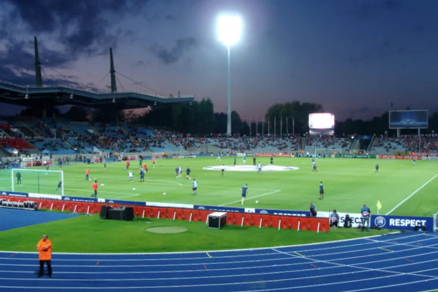 Stadium Lille Metropole Landmark, Villeneuve d'Ascq14 km N
-
Camphin-en-Carembault Radio Tower Landmark, Camphin-en-Carembault8.1 km W
-
Camphin-en-Carembault Radio Mast Landmark, Camphin-en-Carembault8.3 km W
-
Bois de Flines Natural site, North8.6 km SE
Sources & licences
Data last updated: