Arrondissement of Abbeville
Located in Somme, Hauts-de-France Coordinates: 50°09′50″ N 1°45′47″ E
- Population
- 121,655
- 121.7K
- Elevation
- 50 m
- above sea level
- Local time
- UTC+01:00
- Europe/Paris · UTC+01:00
- Places inside
- 163
- listed under Arrondissement of Abbeville
- Airports
- BVA Beauvais-Tillé airport83 km
- LIL Lille Airport105 km
About Arrondissement of Abbeville
Arrondissement of Abbeville is a municipality. Location: Somme, Hauts-de-France. Population: 121,655. Elevation: 50 m. The best months to visit are June–August. The nearest airport is Beauvais-Tillé airport (83 km). Nearby sights include Dien and River Somme.
Climate of Arrondissement of Abbeville
Best months for sightseeingBest months for sightseeing: June–August.
This month · November
A cold month
Day 10° · Night 5° · Rain 81 mm
- Hottest month
- August (day 22°)
- Coldest month
- February (night 2°)
- Wettest month
- November (81 mm)
- Driest month
- February (49 mm)
Bars: average monthly low and high temperature. Below: precipitation. Monthly averages for 1970–2000 at about 18 km resolution, adjusted for elevation. Highlighted months are mild and relatively dry. Source: WorldClim 2.1 (CC BY 4.0).
Show values as a table
| Month | Jan | Feb | Mar | Apr | May | Jun | Jul | Aug | Sep | Oct | Nov | Dec |
|---|---|---|---|---|---|---|---|---|---|---|---|---|
| Average high (°C) | 6° | 7° | 10° | 13° | 17° | 19° | 21° | 22° | 19° | 15° | 10° | 7° |
| Average low (°C) | 2° | 2° | 3° | 5° | 8° | 11° | 13° | 13° | 11° | 8° | 5° | 3° |
| Precipitation (mm) | 61 | 49 | 53 | 51 | 56 | 63 | 51 | 55 | 72 | 75 | 81 | 75 |
How to get to Arrondissement of Abbeville
The nearest airport is Beauvais-Tillé airport (BVA), 83 km to the south as the crow flies. The nearest large city is Amiens, 48 km to the southeast.
Airports
- Beauvais-Tillé airport (BVA) Beauvais 83 kmsouth
- Lille Airport (LIL) Lesquin 105 kmnortheast
- Ostend-Bruges International Airport (OST) Oostende 139 kmnortheast
Nearby large cities
- Amiens Population: 143.1K 48 kmsoutheast
- Rouen Population: 116.3K 93 kmsouthwest
- Lille Population: 238.7K 106 kmnortheast
- Eastbourne Population: 101.7K 125 kmnorthwest
- Cergy-Pontoise Population: 183.4K 127 kmsouth
Straight-line distances; road distances are longer. Airport data: OurAirports.
Day trips from Arrondissement of Abbeville
Within 100 km: 132 historic and cultural sites, 116 natural sites, 98 lakes, rivers and coasts.
0–25 km27 places
- Plage de Fort-Mahon Beach 24 kmNW
- Bois de Vron Natural site 15 kmN
- Baie de Somme Natural site 14 kmNW
- Bois de Saint-Saulve Natural site 15 kmNE
25–60 km89 places
- Plage Saint-Gabriel Beach 47 kmN
- Plage d'Equihen Beach 56 kmN
- Plage d'Écault Beach 57 kmN
- Bois de Watron Natural site 48 kmE
60–100 km230 places
- Rode Berg Mountain 98 kmNE
- Winterbeek River 100 kmNE
- Warnave River 97 kmNE
- Warandebeek River 98 kmNE
Straight-line distances.
Arrondissement of Abbeville and similar cities
Side by side with cities of similar size in the same country: population, elevation and climate.
| Measure | Arrondissement of Abbeville | Metz | Orléans | Rouen |
|---|---|---|---|---|
| Population | 121.7K | 123.9K | 116.3K | 116.3K |
| Elevation | 50 m | 182 m | 115 m | 21 m |
| Summer day (hottest month) | 22° | 25° | 25° | 23° |
| Winter night (coldest month) | 2° | -1° | 1° | 2° |
| Annual rainfall | 742 mm | 776 mm | 641 mm | 724 mm |
| Best months | Jun–Aug | May–Sep | Jun–Sep | Jun–Aug |
| Distance | — | 339 km | 252 km | 93 km |
Climate values are 1970–2000 monthly averages; straight-line distance.
Places in Arrondissement of Abbeville
163 places- 1 Abbeville 23.2K
- 2 Friville-Escarbotin 4.6K
- 3 Rue 3.1K
- 4 Mers-les-Bains 2.8K
- 5 Gamaches 2.6K
- 6 Feuquières-en-Vimeu 2.6K
- 7 Saint-Valery-sur-Somme 2.6K
- 8 Cayeux-sur-Mer 2.5K
- 9 Fressenneville 2.2K
- 10 Le Crotoy 2K
- 11 Longpré-les-Corps-Saints 1.7K
- 12 Ault 1.5K
- 13 Pont-Remy 1.5K
- 14 Crécy-en-Ponthieu 1.5K
- 15 Quend 1.4K
- 16 Hallencourt 1.3K
- 17 Nouvion 1.3K
- 18 Woincourt 1.3K
- 19 Saint-Quentin-la-Motte-Croix-au-Bailly 1.3K
- 20 Dargnies 1.3K
- 21 Chépy 1.3K
- 22 Saint-Riquier 1.2K
- 23 Fort-Mahon-Plage 1.2K
- 24 Pendé 1.1K
- 25 Sailly-Flibeaucourt 1K
- 26 Beauchamps 999
- 27 Béthencourt-sur-Mer 971
- 28 Ailly-le-Haut-Clocher 951
- 29 Bouttencourt 938
- 30 Drucat 917
- 31 Condé-Folie 916
- 32 Lanchères 909
- 33 Aigneville 881
- 34 Saint-Blimont 878
- 35 Arrest 862
- 36 Bouvaincourt-sur-Bresle 852
- 37 Nibas 852
- 38 Vauchelles-les-Quesnoy 847
- 39 Vron 839
- 40 Tours-en-Vimeu 835
- 41 Woignarue 835
- 42 Mareuil-Caubert 820
- 43 Huppy 805
- 44 Allery 797
- 45 Friaucourt 772
- 46 Cambron 733
- 47 Noyelles-sur-Mer 727
- 48 Moyenneville 715
- 49 Bourseville 696
- 50 Huchenneville 669
- 51 Valines 636
- 52 Oust-Marest 629
- 53 Long 624
- 54 Ponthoile 618
- 55 Caours 603
- 56 Hautvillers-Ouville 584
- 57 Quesnoy-le-Montant 574
- 58 Embreville 562
- 59 Miannay 560
- 60 Tully 559
Bar: population relative to the most populous place in this list.
Nearby attractions & nature
Everything nearby-
Dien River, Somme5.8 km NW
-
River Somme River, Somme8.4 km W
-
Forêt Domaniale de Crécy Natural site, Somme9.7 km NE
-
Bois du Rondel Natural site, Somme9.6 km NE
-
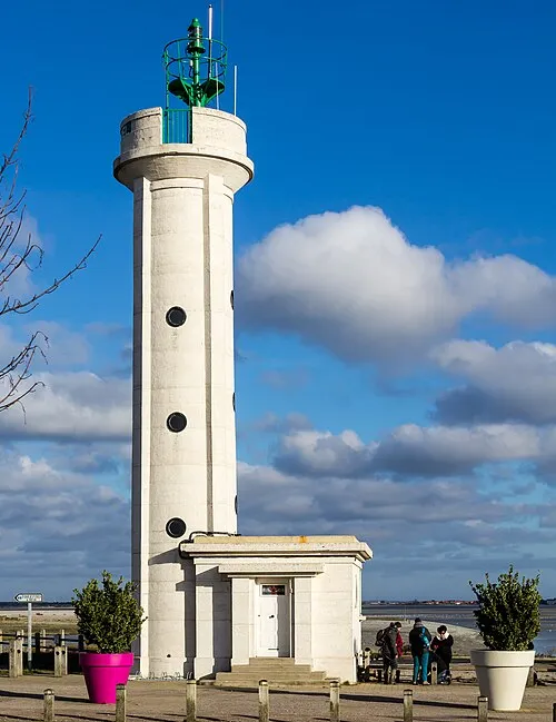 Phare du Hourdel Landmark, Hauts-de-France15 km W
-
Bois du Périot Natural site, Somme15 km N
-
Bois de Saint-Saulve Natural site, Somme15 km NE
-
Bois de Vron Natural site, Somme15 km N
Other cities and towns in Somme
-
Abbeville Town, Abbeville8.3 km SE
-
Arrondissement of Amiens Municipality, Somme39 km SE
-
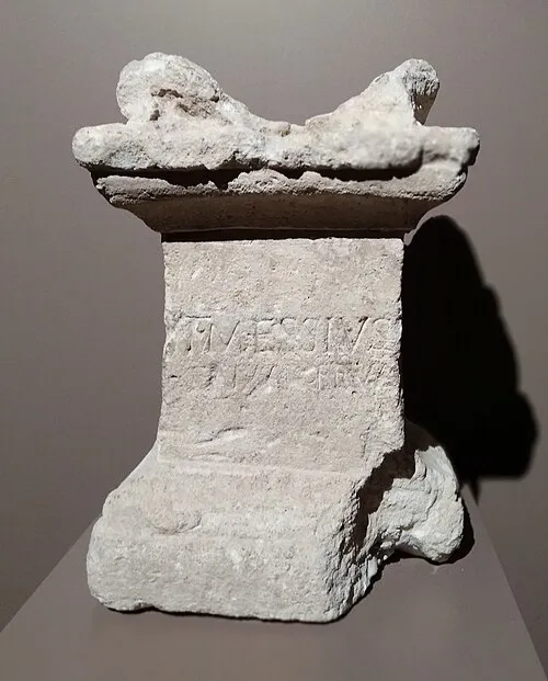 Amiens City, Amiens48 km SE
-
Arrondissement of Péronne Municipality, Somme80 km E
-
Arrondissement of Montdidier Municipality, Somme78 km SE
-
Doullens Town, Doullens41 km E
Sources & licences
Data last updated: