- Population
- 62
- 62
- Elevation
- 155 m
- above sea level
- Local time
- UTC+01:00
- Europe/Paris · UTC+01:00
- Places inside
- 1
- listed under Ginchy
- Airports
- LIL Lille Airport63 km
- BVA Beauvais-Tillé airport82 km
About Ginchy
Ginchy is a village. Location: Arrondissement of Péronne, Somme. Population: 62. Elevation: 155 m. The best months to visit are July–August. The nearest airport is Lille Airport (63 km). Nearby sights include Bois Delville and Bois de Saint-Pierre-Vaast.
Climate of Ginchy
Best months for sightseeingBest months for sightseeing: July–August.
This month · November
A cold month
Day 9° · Night 3° · Rain 67 mm
- Hottest month
- August (day 22°)
- Coldest month
- February (night 0°)
- Wettest month
- November (67 mm)
- Driest month
- February (46 mm)
Bars: average monthly low and high temperature. Below: precipitation. Monthly averages for 1970–2000 at about 18 km resolution, adjusted for elevation. Highlighted months are mild and relatively dry. Source: WorldClim 2.1 (CC BY 4.0).
Show values as a table
| Month | Jan | Feb | Mar | Apr | May | Jun | Jul | Aug | Sep | Oct | Nov | Dec |
|---|---|---|---|---|---|---|---|---|---|---|---|---|
| Average high (°C) | 5° | 6° | 9° | 12° | 17° | 19° | 22° | 22° | 19° | 14° | 9° | 6° |
| Average low (°C) | 0° | 0° | 2° | 4° | 8° | 10° | 12° | 12° | 10° | 7° | 3° | 2° |
| Precipitation (mm) | 57 | 46 | 54 | 49 | 60 | 65 | 58 | 52 | 61 | 64 | 67 | 66 |
How to get to Ginchy
The nearest airport is Lille Airport (LIL), 63 km to the north as the crow flies. The nearest large city is Amiens, 41 km to the west.
Airports
- Lille Airport (LIL) Lesquin 63 kmnorth
- Beauvais-Tillé airport (BVA) Beauvais 82 kmsouthwest
- Charles de Gaulle International Airport (CDG) Paris (Roissy-en-France, Val-d'Oise) 115 kmsouth
Nearby large cities
- Amiens Population: 143.1K 41 kmwest
- Lille Population: 238.7K 70 kmnorth
- Reims Population: 196.6K 121 kmsoutheast
- Cergy-Pontoise Population: 183.4K 122 kmsouthwest
- Charleroi Population: 200.1K 123 kmeast
Straight-line distances; road distances are longer. Airport data: OurAirports.
Day trips from Ginchy
Within 100 km: 194 historic and cultural sites, 230 natural sites, 239 lakes, rivers and coasts.
0–25 km10 places
- Bois des Vaux Natural site 9 kmE
- Bois de Saint-Pierre-Vaast Natural site 7 kmE
- Bois d'Havrincourt Natural site 18 kmE
- Bois Delville Natural site 2 kmNW
25–60 km105 places
- Sensée River 34 kmNE
- Bois de Watron Natural site 34 kmNW
- Bois de Wailly Natural site 58 kmSW
- Forêt de Vignacourt Natural site 50 kmW
60–100 km548 places
- Plage de Fort-Mahon Beach 98 kmW
- Étang de la Forge Gérard Lake 98 kmE
- Lac des Herbieres Lake 84 kmNE
- Les marais d'HArchies Lake 78 kmNE
Straight-line distances.
Places in Ginchy
1 placeBar: population relative to the most populous place in this list.
Nearby attractions & nature
Everything nearby-
Bois Delville Natural site, Somme1.6 km NW
-
Bois de Saint-Pierre-Vaast Natural site, Somme7.2 km E
-
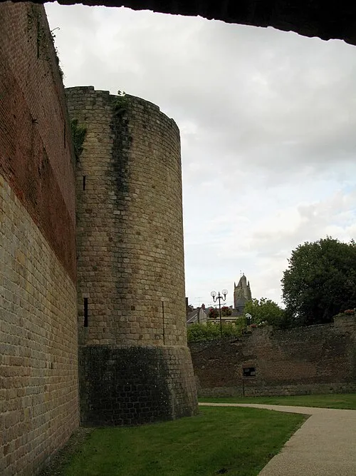 Museum of the Great War Museum, Péronne13 km SE
-
Bois des Vaux Natural site, Somme9.3 km E
-
Abbaye Notre-Dame de la Brelle Attraction, Biaches13 km SE
-
Cologne River, Somme13 km SE
Sources & licences
Data last updated: