Plateau de Capcir
Located in Pyrénées-Orientales, Occitanie Coordinates: 42°36′08″ N 2°07′00″ E
- Elevation
- 1,481 m
- above sea level
- Local time
- UTC+01:00
- Europe/Paris · UTC+01:00
About Plateau de Capcir
Plateau de Capcir is a natural site. Location: Pyrénées-Orientales, Occitanie.
In comparison
- 35 sights and natural places within 10 km Capcir, Pica Bastard
Climate of Plateau de Capcir
Best months for sightseeing: July–August.
| Month | Jan | Feb | Mar | Apr | May | Jun | Jul | Aug | Sep | Oct | Nov | Dec |
|---|---|---|---|---|---|---|---|---|---|---|---|---|
| Average high (°C) | 3° | 4° | 6° | 8° | 13° | 18° | 22° | 22° | 18° | 13° | 7° | 5° |
| Average low (°C) | -3° | -3° | -2° | 0° | 4° | 7° | 10° | 11° | 8° | 4° | 0° | -2° |
| Precipitation (mm) | 112 | 98 | 92 | 95 | 123 | 98 | 63 | 81 | 88 | 134 | 132 | 115 |
Monthly averages for 1970–2000 at about 18 km resolution, adjusted for elevation. Highlighted months are mild and relatively dry. Source: WorldClim 2.1 (CC BY 4.0).
Airports nearest to Plateau de Capcir
- Perpignan-Rivesaltes (Llabanère) Airport (PGF) Perpignan/Rivesaltes 64 km
- Pirineus - la Seu d'Urgel Airport (LEU) La Seu d'Urgell Pyrenees and Andorra 65 km
- Carcassonne Salvaza Airport (CCF) Carcassonne 70 km
Straight-line distance; airports with scheduled flights only. Source: OurAirports (public domain).
Nearest towns and villages
-
Formiguères Village, Arrondissement of Prades1.8 km NW
-
Matemale Village, Arrondissement of Prades1.7 km S
-
Formiguères Village, Formiguères1.8 km NW
-
Matemale Village, Matemale1.7 km S
-
Réal Village, Arrondissement of Prades3.4 km NE
-
Les Angles Village, Arrondissement of Prades4.3 km SW
Nearby attractions & nature
Everything nearby-
Capcir Natural site, Pyrénées-Orientales0.3 km S
-
Pica Bastard Mountain, Matemale2.8 km SE
-
Puig dels Agrellons Mountain, Formiguères2.8 km NE
-
Puig de l'Orri Mountain, Formiguères3.1 km NE
-
Roc de les Comes Mountain, Caudiès-de-Conflent3.7 km SE
-
Puig de la Socarrada Mountain, Ayguatébia-Talau4.2 km SE
-
Puig de l'Esquena d'Ase Mountain, Réal4.3 km NE
-
el Dormidor Mountain, Matemale4.8 km S
More nature in France
-
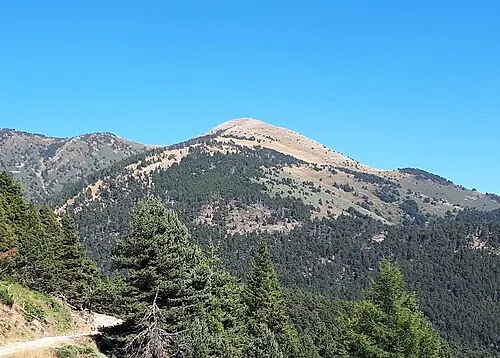 Puig de la Pelada Mountain, Olette6.8 km E
-
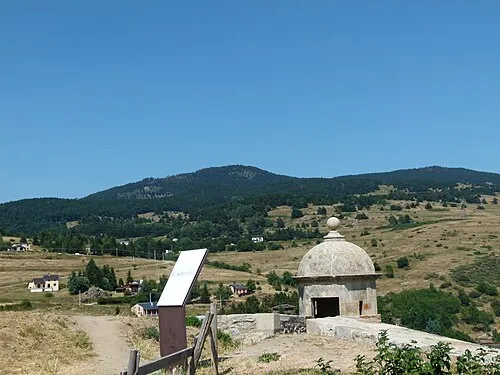 Puig de la Tossa Mountain, Ayguatébia-Talau8.4 km S
-
Roc dels Clots del Gorg Mountain, Olette7.7 km NE
-
Roc de les Perxes Blanques Mountain, Formiguères5 km W
-
Pic de Casteillou Mountain, Matemale5.3 km S
-
Roc Cosconer Mountain, Sansa5.6 km NE
Sources & licences
Data last updated: