Arrondissement of Muret
Located in Upper Garonne, Occitanie Coordinates: 43°21′51″ N 1°12′20″ E
- Population
- 235,273
- 235.3K
- Elevation
- 213 m
- above sea level
- Local time
- UTC+01:00
- Europe/Paris · UTC+01:00
- Places inside
- 126
- listed under Arrondissement of Muret
- Airports
- TLS Toulouse-Blagnac Airport32 km
- DCM Castres Mazamet Airport90 km
About Arrondissement of Muret
Arrondissement of Muret is a municipality. Location: Upper Garonne, Occitanie. Population: 235,273. Elevation: 213 m. The best months to visit are June–September. The nearest airport is Toulouse-Blagnac Airport (32 km). Nearby sights include Rieutort and Ruisseau de Lardou.
Climate of Arrondissement of Muret
Best months for sightseeingBest months for sightseeing: June–September.
This month · November
Outside the best season
Day 13° · Night 4° · Rain 62 mm
- Hottest month
- July (day 26°)
- Coldest month
- January (night 1°)
- Wettest month
- May (87 mm)
- Driest month
- July (49 mm)
Bars: average monthly low and high temperature. Below: precipitation. Monthly averages for 1970–2000 at about 18 km resolution, adjusted for elevation. Highlighted months are mild and relatively dry. Source: WorldClim 2.1 (CC BY 4.0).
Show values as a table
| Month | Jan | Feb | Mar | Apr | May | Jun | Jul | Aug | Sep | Oct | Nov | Dec |
|---|---|---|---|---|---|---|---|---|---|---|---|---|
| Average high (°C) | 9° | 11° | 14° | 16° | 20° | 23° | 26° | 26° | 24° | 19° | 13° | 10° |
| Average low (°C) | 1° | 2° | 4° | 6° | 9° | 13° | 15° | 15° | 12° | 8° | 4° | 2° |
| Precipitation (mm) | 65 | 63 | 66 | 82 | 87 | 70 | 49 | 57 | 58 | 65 | 62 | 61 |
Other places to visit in this season: June July August September
How to get to Arrondissement of Muret
The nearest airport is Toulouse-Blagnac Airport (TLS), 32 km to the northeast as the crow flies. The nearest large city is Toulouse, 33 km to the northeast.
Airports
- Toulouse-Blagnac Airport (TLS) Toulouse/Blagnac 32 kmnortheast
- Castres Mazamet Airport (DCM) Castres 90 kmeast
- Carcassonne Salvaza Airport (CCF) Carcassonne 91 kmeast
Nearby large cities
- Toulouse Population: 511.7K 33 kmnortheast
- Perpignan Population: 110.7K 156 kmsoutheast
- Lleida Population: 140.8K 200 kmsouth
- Girona Population: 100.3K 203 kmsoutheast
- Terrassa Population: 218.5K 211 kmsouth
Straight-line distances; road distances are longer. Airport data: OurAirports.
Day trips from Arrondissement of Muret
Within 100 km: 171 historic and cultural sites, 1,001 natural sites, 272 lakes, rivers and coasts.
0–25 km27 places
- Forêt de Rieumes Natural site 10 kmW
- Forêt de la Ramette Natural site 25 kmNE
- Volp River 19 kmSW
- Ruisseau de Saudrune River 16 kmN
25–60 km281 places
- Base de loisirs de Bouconne Natural site 34 kmN
- Forêt de Montaigut Natural site 34 kmN
- Pic de Sérau Mountain 56 kmS
- Montagnes du Plantaurel Mountain 44 kmSE
60–100 km1,136 places
- Artigue River 64 kmS
- Estany de Travessani Lake 88 kmS
- Estany de Sant Maurici Lake 88 kmS
- Lago Saburó Lake 94 kmS
Straight-line distances.
Arrondissement of Muret and similar cities
Side by side with cities of similar size in the same country: population, elevation and climate.
| Measure | Arrondissement of Muret | Lille | Paris 15 Vaugirard | Rennes |
|---|---|---|---|---|
| Population | 235.3K | 238.7K | 229.7K | 227.8K |
| Elevation | 213 m | 20 m | 47 m | 39 m |
| Summer day (hottest month) | 26° | 23° | 25° | 24° |
| Winter night (coldest month) | 1° | 1° | 2° | 3° |
| Annual rainfall | 785 mm | 716 mm | 632 mm | 738 mm |
| Best months | Jun–Sep | Jun–Aug | May–Sep | Jun–Sep |
| Distance | — | 820 km | 615 km | 573 km |
Climate values are 1970–2000 monthly averages; straight-line distance.
Places in Arrondissement of Muret
126 places- 61 Montbrun-Bocage 592
- 62 Montaut 578
- 63 Saint-Thomas 568
- 64 Salles-sur-Garonne 563
- 65 Lagrâce-Dieu 551
- 66 Saint-Julien-sur-Garonne 549
- 67 Puydaniel 493
- 68 Mauressac 492
- 69 Auragne 480
- 70 Beaufort 475
- 71 Marignac-Lasclares 470
- 72 Cambernard 465
- 73 Le Plan 454
- 74 Bois-de-la-Pierre 425
- 75 Gensac-sur-Garonne 421
- 76 Couladère 415
- 77 Pouy-de-Touges 406
- 78 Latrape 365
- 79 Sabonnères 332
- 80 Bragayrac 324
- 81 Saint-Michel 316
- 82 Empeaux 314
- 83 Plagnole 306
- 84 Castagnac 292
- 85 Labruyère-Dorsa 277
- 86 Esperce 253
- 87 Lacaugne 252
- 88 Lautignac 248
- 89 Saint-Christaud 247
- 90 Francon 236
- 91 Sana 236
- 92 Lussan-Adeilhac 226
- 93 Castelnau-Picampeau 216
- 94 Lahage 215
- 95 Savères 213
- 96 Forgues 208
- 97 Auribail 207
- 98 Mauran 201
- 99 Marignac-Laspeyres 194
- 100 Montberaud 192
- 101 Goutevernisse 185
- 102 Montgazin 164
- 103 Le Pin-Murelet 163
- 104 Saint-Araille 151
- 105 Massabrac 132
- 106 Marliac 129
- 107 Montégut-Bourjac 129
- 108 Montoussin 126
- 109 Casties-Labrande 118
- 110 Sénarens 118
- 111 Montgras 104
- 112 Sajas 104
- 113 Plagne 95
- 114 Montclar-de-Comminges 90
- 115 Bax 88
- 116 Monès 87
- 117 Gouzens 81
- 118 Latour 80
- 119 Lescuns 75
- 120 Montastruc-Savès 75
Bar: population relative to the most populous place in this list.
Nearby attractions & nature
Everything nearby-
Rieutort River, Upper Garonne6.9 km SW
-
Ruisseau de Lardou River, Upper Garonne7.7 km N
-
Arize River, Upper Garonne8.6 km S
-
Ruisseau de Sarrat River, Upper Garonne8.8 km W
-
Forêt de Rieumes Natural site, Upper Garonne10 km W
-
Lamesan River, Upper Garonne12 km SW
-
Louge River, Upper Garonne15 km NE
-
Ruisseau de Saudrune River, Upper Garonne16 km N
Other cities and towns in Upper Garonne
-
Arrondissement of Toulouse Municipality, Upper Garonne37 km NE
-
Muret Town, Muret14 km NE
-
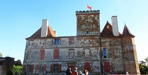 La Salvetat-Saint-Gilles Town, La Salvetat-Saint-Gilles24 km N
-
Seysses Town, Seysses17 km NE
-
Saint-Lys Town, Saint-Lys17 km N
-
Arrondissement of Saint-Gaudens Municipality, Upper Garonne48 km SW
Sources & licences
Data last updated: