Arrondissement of Saint-Gaudens
Located in Upper Garonne, Occitanie Coordinates: 43°05′25″ N 0°44′52″ E
- Population
- 77,429
- 77.4K
- Elevation
- 424 m
- above sea level
- Local time
- UTC+01:00
- Europe/Paris · UTC+01:00
- Places inside
- 236
- listed under Arrondissement of Saint-Gaudens
- Airports
- LDE Tarbes-Lourdes-Pyrénées Airport62 km
- TLS Toulouse-Blagnac Airport78 km
About Arrondissement of Saint-Gaudens
Arrondissement of Saint-Gaudens is a municipality. Location: Upper Garonne, Occitanie. Population: 77,429. Elevation: 424 m. The best months to visit are June–September. The nearest airport is Tarbes-Lourdes-Pyrénées Airport (62 km). Nearby sights include Ruisseau de Job and Ger.
Climate of Arrondissement of Saint-Gaudens
Best months for sightseeingBest months for sightseeing: June–September.
This month · November
Outside the best season
Day 13° · Night 4° · Rain 93 mm
- Hottest month
- August (day 26°)
- Coldest month
- January (night 1°)
- Wettest month
- May (113 mm)
- Driest month
- July (65 mm)
Bars: average monthly low and high temperature. Below: precipitation. Monthly averages for 1970–2000 at about 18 km resolution, adjusted for elevation. Highlighted months are mild and relatively dry. Source: WorldClim 2.1 (CC BY 4.0).
Show values as a table
| Month | Jan | Feb | Mar | Apr | May | Jun | Jul | Aug | Sep | Oct | Nov | Dec |
|---|---|---|---|---|---|---|---|---|---|---|---|---|
| Average high (°C) | 10° | 11° | 13° | 15° | 19° | 22° | 25° | 26° | 23° | 18° | 13° | 11° |
| Average low (°C) | 1° | 2° | 3° | 5° | 9° | 12° | 14° | 14° | 12° | 8° | 4° | 2° |
| Precipitation (mm) | 88 | 84 | 89 | 102 | 113 | 96 | 65 | 77 | 79 | 90 | 93 | 86 |
Other places to visit in this season: June July August September
How to get to Arrondissement of Saint-Gaudens
The nearest airport is Tarbes-Lourdes-Pyrénées Airport (LDE), 62 km to the west as the crow flies. For international flights: Toulouse-Blagnac Airport (TLS) (78 km). The nearest large city is Toulouse, 80 km to the northeast.
Airports
- Tarbes-Lourdes-Pyrénées Airport (LDE) Tarbes/Lourdes/Pyrénées 62 kmwest
- Toulouse-Blagnac Airport (TLS) Toulouse/Blagnac 78 kmnortheast
- Pirineus - la Seu d'Urgel Airport (LEU) La Seu d'Urgell Pyrenees and Andorra 100 kmsoutheast
Nearby large cities
- Toulouse Population: 511.7K 80 kmnortheast
- Lleida Population: 140.8K 164 kmsouth
- Perpignan Population: 110.7K 181 kmeast
- Pamplona Population: 208.2K 197 kmwest
- Terrassa Population: 218.5K 199 kmsoutheast
Straight-line distances; road distances are longer. Airport data: OurAirports.
Day trips from Arrondissement of Saint-Gaudens
Within 100 km: 161 historic and cultural sites, 1,462 natural sites, 267 lakes, rivers and coasts.
0–25 km102 places
- Pic Saillant Mountain 16 kmS
- Pic de Picarre Mountain 24 kmSW
- Pic de l'Aube Mountain 16 kmSE
- Pic de Montbajan Mountain 6 kmS
25–60 km701 places
- Artigue River 48 kmSE
- Estany de Travessani Lake 54 kmS
- Estanh de Rius Lake 50 kmS
- Lago de Ribereta Lake 53 kmS
60–100 km1,087 places
- Base de loisirs de Bouconne Natural site 75 kmNE
- Forêt de Montaigut Natural site 75 kmNE
- Esglesia de Sant Esteve de Ginast Attraction 66 kmS
- Fourmat Mountain 91 kmW
Straight-line distances.
Arrondissement of Saint-Gaudens and similar cities
Side by side with cities of similar size in the same country: population, elevation and climate.
| Measure | Arrondissement of Saint-Gaudens | La Rochelle | Pau | Créteil |
|---|---|---|---|---|
| Population | 77.4K | 76.8K | 82.7K | 84.8K |
| Elevation | 424 m | 13 m | 219 m | 49 m |
| Summer day (hottest month) | 26° | 25° | 25° | 25° |
| Winter night (coldest month) | 1° | 3° | 4° | 2° |
| Annual rainfall | 1,062 mm | 769 mm | 1,304 mm | 632 mm |
| Best months | Jun–Sep | Jun–Sep | Jun–Sep | May–Sep |
| Distance | — | 373 km | 93 km | 648 km |
Climate values are 1970–2000 monthly averages; straight-line distance.
Places in Arrondissement of Saint-Gaudens
236 places- 121 Marsoulas 143
- 122 Saman 143
- 123 Garin 142
- 124 Lilhac 140
- 125 Eup 139
- 126 Terrebasse 139
- 127 Saint-Lary-Boujean 138
- 128 Régades 137
- 129 Lalouret-Laffiteau 134
- 130 Gensac-de-Boulogne 133
- 131 Salles-et-Pratviel 133
- 132 Eoux 131
- 133 Antichan-de-Frontignes 130
- 134 Aspret-Sarrat 130
- 135 Cabanac-Cazaux 128
- 136 Saint-Pé-Delbosc 128
- 137 Moustajon 127
- 138 Lieoux 126
- 139 Burgalays 124
- 140 Lourde 123
- 141 Le Fréchet 120
- 142 Urau 118
- 143 Agassac 115
- 144 Antignac 113
- 145 Malvezie 113
- 146 Belbèze-en-Comminges 111
- 147 Samouillan 110
- 148 Fougaron 109
- 149 Arlos 106
- 150 Bagiry 105
- 151 Nizan-Gesse 105
- 152 Oô 104
- 153 Ore 104
- 154 Montgaillard-de-Salies 102
- 155 Laffite-Toupière 98
- 156 Melles 95
- 157 Cazeaux-de-Larboust 94
- 158 Saint-Aventin 94
- 159 Arbon 93
- 160 Ausseing 91
- 161 Bachas 90
- 162 Cazaril-Tambourès 89
- 163 Sarremezan 89
- 164 Mondilhan 88
- 165 Peyrissas 86
- 166 Coueilles 85
- 167 Montgaillard-sur-Save 85
- 168 Galié 84
- 169 Bouzin 82
- 170 Cazeneuve-Montaut 82
- 171 Mauvezin 82
- 172 Peyrouzet 81
- 173 Lespugue 80
- 174 Payssous 80
- 175 Lespiteau 78
- 176 Escoulis 76
- 177 Cazac 75
- 178 Herran 75
- 179 Frontignan-de-Comminges 74
- 180 Poubeau 73
Bar: population relative to the most populous place in this list.
Nearby attractions & nature
Everything nearby-
Ruisseau de Job River, Upper Garonne2.5 km S
-
Ger River, Upper Garonne6.5 km E
-
Soumès River, Upper Garonne9.8 km E
-
Bois du Thouas Natural site, Upper Garonne12 km SE
-
Forêt du Gars Natural site, Upper Garonne14 km S
-
Forêt de Cagire Natural site, Upper Garonne15 km S
-
Forêt d'Arbas Natural site, Upper Garonne16 km SE
-
Jô River, Upper Garonne14 km E
Other cities and towns in Upper Garonne
-
Saint-Gaudens Town, Saint-Gaudens2.8 km NW
-
Arrondissement of Muret Municipality, Upper Garonne48 km NE
-
Arrondissement of Toulouse Municipality, Upper Garonne85 km NE
-
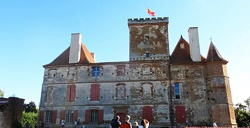 La Salvetat-Saint-Gilles Town, La Salvetat-Saint-Gilles69 km NE
-
Toulouse City, Toulouse80 km NE
-
Muret Town, Muret62 km NE
Sources & licences
Data last updated: