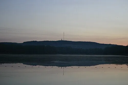
Bois de Chemasson
Located in Sarthe, Pays de la Loire Region Coordinates: 48°20′34″ N 0°06′33″ W
- Elevation
- 231 m
- above sea level
- Local time
- UTC+01:00
- Europe/Paris · UTC+01:00
- Airports
- CFR Caen Carpiquet airport96 km
- DOL Deauville Normandie airport115 km
About Bois de Chemasson
Bois de Chemasson is a natural site. Location: Sarthe, Pays de la Loire Region. The best months to visit are June–August. The nearest airport is Caen Carpiquet airport (96 km). Nearby sights include Merdereau and Vaudelle.
Climate of Bois de Chemasson
Best months for sightseeingBest months for sightseeing: June–August.
This month · November
A cold month
Day 10° · Night 4° · Rain 74 mm
- Hottest month
- August (day 23°)
- Coldest month
- February (night 1°)
- Wettest month
- December (82 mm)
- Driest month
- August (44 mm)
Bars: average monthly low and high temperature. Below: precipitation. Monthly averages for 1970–2000 at about 18 km resolution, adjusted for elevation. Highlighted months are mild and relatively dry. Source: WorldClim 2.1 (CC BY 4.0).
Show values as a table
| Month | Jan | Feb | Mar | Apr | May | Jun | Jul | Aug | Sep | Oct | Nov | Dec |
|---|---|---|---|---|---|---|---|---|---|---|---|---|
| Average high (°C) | 7° | 8° | 11° | 13° | 17° | 20° | 23° | 23° | 20° | 15° | 10° | 7° |
| Average low (°C) | 1° | 1° | 3° | 4° | 8° | 10° | 12° | 12° | 10° | 7° | 4° | 2° |
| Precipitation (mm) | 78 | 69 | 59 | 57 | 66 | 53 | 51 | 44 | 67 | 71 | 74 | 82 |
How to get to Bois de Chemasson
The nearest airport is Caen Carpiquet airport (CFR), 96 km to the north as the crow flies. The nearest large city is Le Mans, 44 km to the southeast.
Airports
- Caen Carpiquet airport (CFR) Caen 96 kmnorth
- Deauville Normandie airport (DOL) Deauville 115 kmnorth
- Tours Val de Loire Airport (TUF) Tours, Indre-et-Loire 119 kmsoutheast
Nearby large cities
- Le Mans Population: 144.5K 44 kmsoutheast
- Caen Population: 110.6K 96 kmnorth
- Angers Population: 168.3K 102 kmsouth
- Rennes Population: 227.8K 119 kmwest
- Tours Population: 141.6K 122 kmsoutheast
Straight-line distances; road distances are longer. Airport data: OurAirports.
Day trips from Bois de Chemasson
Within 100 km: 163 historic and cultural sites, 142 natural sites, 149 lakes, rivers and coasts.
0–25 km29 places
- Mont du Saule Mountain 21 kmW
- Butte Chaumont Mountain 16 kmN
- Bois de Vaux Natural site 11 kmE
- Forêt de Sillé Natural site 14 kmS
25–60 km108 places
- Dive River 37 kmE
- Mont Margantin Mountain 45 kmNW
- Bois des Vallons Natural site 37 kmSW
- Bois de Sapins Natural site 60 kmSE
60–100 km317 places
- Cloche River 70 kmE
- Étang du Val Joyeux Lake 95 kmS
- Étang de Rumien Lake 74 kmE
- Étang de Roches Lake 100 kmSW
Straight-line distances.
Nearest towns and villages
-
Saint-Léonard-des-Bois Village, Arrondissement of Mamers2.6 km NE
-
Saint-Paul-le-Gaultier Village, Arrondissement of Mamers2.4 km S
-
Saint-Léonard-des-Bois Village, Saint-Léonard-des-Bois2.6 km NE
-
Saint-Paul-le-Gaultier Village, Saint-Paul-le-Gaultier2.4 km S
-
Gesvres Village, Arrondissement of Mayenne4 km NW
-
Gesvres Village, Gesvres4 km NW
Nearby attractions & nature
Everything nearby-
Merdereau River, Sarthe4.9 km SE
-
Vaudelle River, Sarthe5.2 km SE
-
Sarthon River, Sarthe5.5 km NE
-
Orthe River, Sarthe8.7 km SE
-
Forêt de Pail Natural site, Mayenne department8.6 km NW
-
 Mont Rochard Mountain, Sainte-Gemmes-le-Robert23 km SW
-
Forêt de Multonne Natural site, Mayenne department11 km N
-
Bois de Vaux Natural site, Sarthe11 km E
Sources & licences
Data last updated: