Vallon de Jallorgues
Located in Alpes-Maritimes, Provence-Alpes-Côte d'Azur Region Coordinates: 44°16′00″ N 6°52′00″ E
- Elevation
- 2,234 m
- above sea level
- Local time
- UTC+01:00
- Europe/Paris · UTC+01:00
- Airports
- CUF Cuneo International Airport68 km
- NCE Nice-Côte d'Azur Airport73 km
About Vallon de Jallorgues
Vallon de Jallorgues is a natural site. Location: Alpes-Maritimes, Provence-Alpes-Côte d'Azur Region. The best months to visit are July–August. The nearest airport is Cuneo International Airport (68 km). Nearby sights include Mont Aunes and Mont Pierre Châtel.
Photos of Vallon de Jallorgues
-
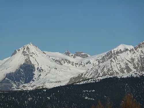
Cime de Pal André Payan-Passeron · CC BY-SA 3.0

Climate of Vallon de Jallorgues
Best months for sightseeingBest months for sightseeing: July–August.
This month · November
A wet month
Day 2° · Night -4° · Rain 117 mm
- Hottest month
- August (day 17°)
- Coldest month
- January (night -8°)
- Wettest month
- October (121 mm)
- Driest month
- July (44 mm)
Bars: average monthly low and high temperature. Below: precipitation. Monthly averages for 1970–2000 at about 18 km resolution, adjusted for elevation. Highlighted months are mild and relatively dry. Source: WorldClim 2.1 (CC BY 4.0).
Show values as a table
| Month | Jan | Feb | Mar | Apr | May | Jun | Jul | Aug | Sep | Oct | Nov | Dec |
|---|---|---|---|---|---|---|---|---|---|---|---|---|
| Average high (°C) | -2° | -1° | 1° | 3° | 8° | 12° | 16° | 17° | 12° | 7° | 2° | -1° |
| Average low (°C) | -8° | -8° | -6° | -4° | 0° | 3° | 7° | 7° | 4° | 0° | -4° | -7° |
| Precipitation (mm) | 105 | 87 | 89 | 99 | 98 | 71 | 44 | 63 | 85 | 121 | 117 | 105 |
How to get to Vallon de Jallorgues
The nearest airport is Cuneo International Airport (CUF), 68 km to the northeast as the crow flies. For international flights: Nice-Côte d'Azur Airport (NCE) (73 km). The nearest large city is Nice, 70 km to the southeast.
Airports
- Cuneo International Airport (CUF) Levaldigi (CN) 68 kmnortheast
- Nice-Côte d'Azur Airport (NCE) Nice, Alpes-Maritimes 73 kmsoutheast
- Turin Airport (TRN) Caselle Torinese (TO) 121 kmnortheast
Nearby large cities
- Nice Population: 342.7K 70 kmsoutheast
- Grenoble Population: 158.6K 136 kmnorthwest
- Aix-en-Provence Population: 146.8K 140 kmsouthwest
- Toulon Population: 168.7K 148 kmsouthwest
- Marseille Population: 877.2K 161 kmsouthwest
Straight-line distances; road distances are longer. Airport data: OurAirports.
Day trips from Vallon de Jallorgues
Within 100 km: 128 historic and cultural sites, 1,217 natural sites, 245 lakes, rivers and coasts.
0–25 km133 places
- Lakes of Vens Lake 8 kmNE
- Lacs de Ténibres Lake 8 kmE
- Lac de la Reculaïa Lake 22 kmN
- Lac de Rabuons Lake 9 kmE
25–60 km605 places
- Clapes River 44 kmW
- Lac Premier Lake 30 kmN
- Lac Vert Lake 36 kmN
- Lac Sainte-Anne Lake 39 kmN
60–100 km852 places
- Siagne River 82 kmS
- Plage du Grand Boucharel Beach 100 kmS
- Plage de la Galiote Beach 98 kmS
- Plage de Saint-Aygulf Beach 96 kmS
Straight-line distances.
Nearest towns and villages
-
Saint-Dalmas-le-Selvage Village, Arrondissement of Nice2 km N
-
Saint-Dalmas-le-Selvage Village, Saint-Dalmas-le-Selvage2 km N
-
Saint-Étienne-de-Tinée Village, Arrondissement of Nice4.8 km E
-
Saint-Étienne-de-Tinée Village, Saint-Étienne-de-Tinée4.8 km E
-
Pont Haut Village, Saint-Dalmas-le-Selvage3.2 km NE
-
Vens Village, Saint-Dalmas-le-Selvage4.6 km NE
Nearby attractions & nature
Everything nearby-
Mont Aunes Mountain, Saint-Dalmas-le-Selvage<0.1 km N
-
Mont Pierre Châtel Mountain, Saint-Dalmas-le-Selvage2.8 km SW
-
Mont Gros Serre de la Braisse Mountain, Saint-Dalmas-le-Selvage4.4 km NW
-
Pointe des Trois Hommes Mountain, Saint-Dalmas-le-Selvage4.6 km SW
-
Pointe Gias Vieux Mountain, Saint-Dalmas-le-Selvage5.3 km W
-
Mont Riounet Mountain, Saint-Étienne-de-Tinée5.7 km S
-
Claï Inférieur Mountain, Saint-Étienne-de-Tinée5.8 km NE
-
Ruisseau l'Ardon River, Alpes-Maritimes4.4 km SE
More nature in France
-
Cime de Pal Mountain, Saint-Étienne-de-Tinée7 km SW
-
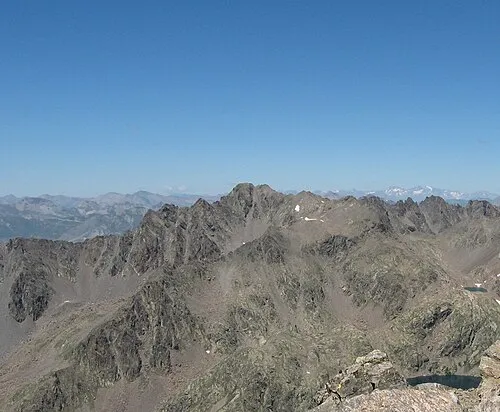 Monte Tenibres Mountain, Saint-Étienne-de-Tinée8.6 km E
-
Claï Supérieur Mountain, Saint-Étienne-de-Tinée6.2 km NE
-
Vallon de Demandols Natural site, Alpes-Maritimes5.7 km S
-
Mont Triboulet Mountain, Saint-Étienne-de-Tinée7 km S
-
Cime de la Bercia Mountain, Saint-Étienne-de-Tinée5.2 km SE
Sources & licences
Data last updated: · 2 independent sources