Le Mardaric
Located in Provence-Alpes-Côte d'Azur Region, France Coordinates: 44°09′27″ N 5°58′57″ E
- Elevation
- 526 m
- above sea level
- Local time
- UTC+01:00
- Europe/Paris · UTC+01:00
- Airports
- AVN Avignon Caumont airport91 km
- MRS Marseille Provence Airport101 km
About Le Mardaric
Le Mardaric is a village. Location: Provence-Alpes-Côte d'Azur Region, France. Elevation: 526 m. The best months to visit are May–June, September. The nearest airport is Avignon Caumont airport (91 km). Nearby sights include Le Grépon and Montagne de la Baume.
Photos of Le Mardaric
-
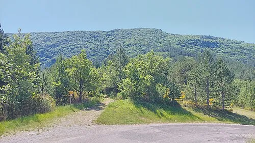
Montagne de la Baume Harald Hetzner · CC0

Climate of Le Mardaric
Best months for sightseeingBest months for sightseeing: May–June, September.
This month · November
Outside the best season
Day 13° · Night 3° · Rain 83 mm
- Hottest month
- July (day 28°)
- Coldest month
- January (night 0°)
- Wettest month
- October (99 mm)
- Driest month
- July (39 mm)
Bars: average monthly low and high temperature. Below: precipitation. Monthly averages for 1970–2000 at about 18 km resolution, adjusted for elevation. Highlighted months are mild and relatively dry. Source: WorldClim 2.1 (CC BY 4.0).
Show values as a table
| Month | Jan | Feb | Mar | Apr | May | Jun | Jul | Aug | Sep | Oct | Nov | Dec |
|---|---|---|---|---|---|---|---|---|---|---|---|---|
| Average high (°C) | 9° | 10° | 13° | 16° | 20° | 24° | 28° | 28° | 24° | 18° | 13° | 9° |
| Average low (°C) | 0° | 1° | 3° | 5° | 9° | 12° | 15° | 15° | 12° | 8° | 3° | 1° |
| Precipitation (mm) | 66 | 55 | 59 | 74 | 73 | 61 | 39 | 63 | 74 | 99 | 83 | 71 |
How to get to Le Mardaric
The nearest airport is Avignon Caumont airport (AVN), 91 km to the west as the crow flies. For international flights: Marseille Provence Airport (MRS) (101 km). The nearest large city is Aix-en-Provence, 82 km to the southwest.
Airports
- Avignon Caumont airport (AVN) Avignon 91 kmwest
- Marseille Provence Airport (MRS) Marignane, Bouches-du-Rhône 101 kmsouthwest
- Nice-Côte d'Azur Airport (NCE) Nice, Alpes-Maritimes 114 kmsoutheast
Nearby large cities
- Aix-en-Provence Population: 146.8K 82 kmsouthwest
- Marseille Population: 877.2K 107 kmsouthwest
- Nice Population: 342.7K 115 kmsoutheast
- Toulon Population: 168.7K 115 kmsouth
- Grenoble Population: 158.6K 115 kmnorth
Straight-line distances; road distances are longer. Airport data: OurAirports.
Day trips from Le Mardaric
Within 100 km: 113 historic and cultural sites, 1,277 natural sites, 256 lakes, rivers and coasts.
0–25 km92 places
- La Roche Percée Mountain 23 kmSE
- Montagne de Lure Mountain 17 kmW
- La Faye Mountain 7 kmN
- Sommet de Jouerre Mountain 16 kmNE
25–60 km446 places
- Clapes River 36 kmNE
- Lac de Castillon Lake 53 kmSE
- Lac d'Allos Lake 58 kmE
- Plan d'eau d'Embrun Lake 58 kmNE
60–100 km1,108 places
- Lac Mort Lake 98 kmN
- Île d'Oiselet Island 94 kmW
- Île de Miémar Island 97 kmW
- Île du Colombier Island 100 kmW
Straight-line distances.
Nearby attractions & nature
Everything nearby-
Le Grépon Mountain, Sourribes3.3 km E
-
Montagne de la Baume Mountain, Entrepierres4.7 km N
-
Torrent le Jabron River, Alpes-de-Haute-Provence2.4 km W
-
Vanson River, Alpes-de-Haute-Provence3 km S
-
Cathédrale Notre-Dame-des-Pommiers de Sisteron Attraction, Sisteron5.3 km NW
-
Rochers de Saint Michel Mountain, Entrepierres6.7 km NE
Sources & licences
Data last updated: