Rhein-Neckar-Kreis
Located in Karlsruhe Region, Baden-Wurttemberg Coordinates: 49°22′12″ N 8°44′06″ E
- Population
- 558,561
- 558.6K
- Elevation
- 390 m
- above sea level
- Local time
- UTC+01:00
- Europe/Berlin · UTC+01:00
- Places inside
- 54
- listed under Rhein-Neckar-Kreis
- Airports
- MHG Mannheim-City Airport20 km
- FRA Frankfurt Main Airport74 km
About Rhein-Neckar-Kreis
Rhein-Neckar-Kreis is a municipality. Location: Karlsruhe Region, Baden-Wurttemberg. Population: 558,561. Elevation: 390 m. The best months to visit are June–August. The nearest airport is Mannheim-City Airport (20 km). Nearby sights include Hochfirst and Großer Wald.
Photos of Rhein-Neckar-Kreis
-
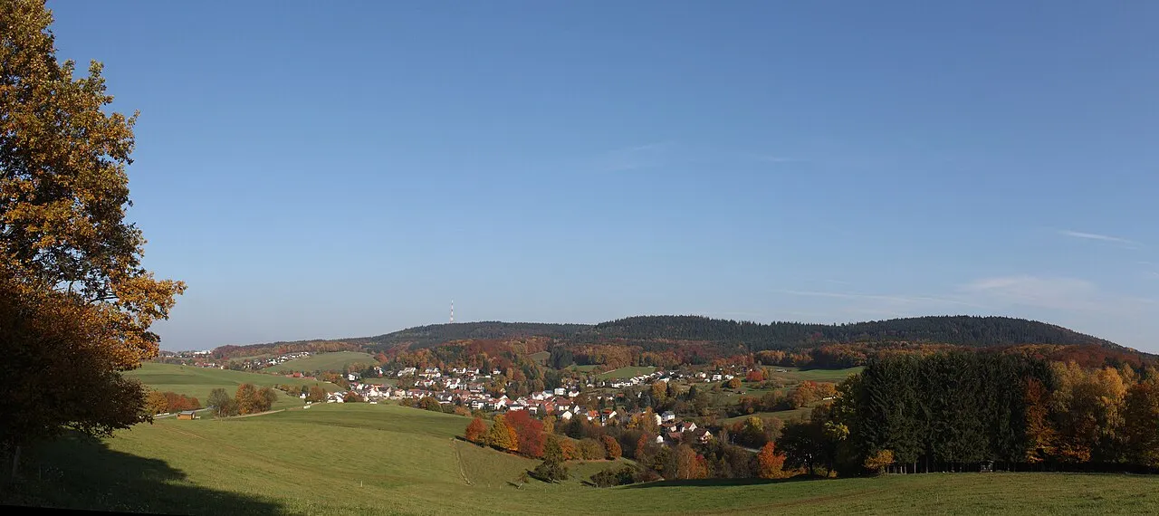
Stiefelhöhe Arne Hückelheim · CC BY-SA 3.0 -
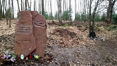
Hohe Nistler Cerroramon · CC BY-SA 3.0 -
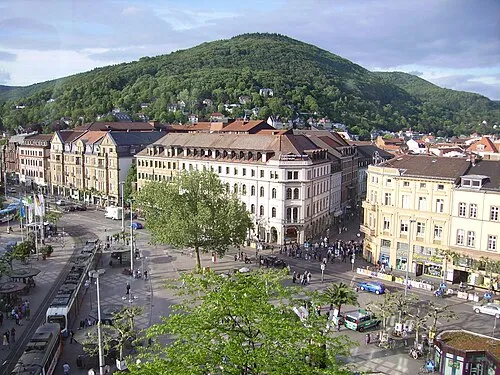
Heiligenberg Immanuel Giel · Public domain -
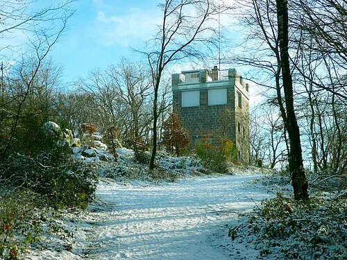
Eichelberg Ramessos · Public domain -
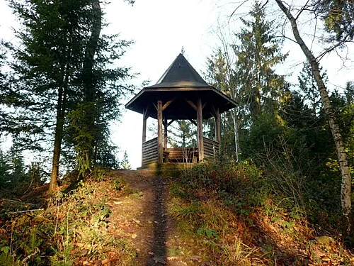
Goldkopf Ramessos · Public domain


Climate of Rhein-Neckar-Kreis
Best months for sightseeingBest months for sightseeing: June–August.
This month · November
A cold month
Day 7° · Night 1° · Rain 87 mm
- Hottest month
- July (day 22°)
- Coldest month
- January (night -2°)
- Wettest month
- December (94 mm)
- Driest month
- April (63 mm)
Bars: average monthly low and high temperature. Below: precipitation. Monthly averages for 1970–2000 at about 18 km resolution, adjusted for elevation. Highlighted months are mild and relatively dry. Source: WorldClim 2.1 (CC BY 4.0).
Show values as a table
| Month | Jan | Feb | Mar | Apr | May | Jun | Jul | Aug | Sep | Oct | Nov | Dec |
|---|---|---|---|---|---|---|---|---|---|---|---|---|
| Average high (°C) | 3° | 4° | 8° | 12° | 18° | 20° | 22° | 22° | 18° | 12° | 7° | 4° |
| Average low (°C) | -2° | -2° | 1° | 4° | 8° | 11° | 13° | 13° | 9° | 6° | 1° | -1° |
| Precipitation (mm) | 78 | 71 | 77 | 63 | 86 | 87 | 89 | 63 | 75 | 83 | 87 | 94 |
How to get to Rhein-Neckar-Kreis
The nearest airport is Mannheim-City Airport (MHG), 20 km to the northwest as the crow flies. For international flights: Frankfurt Main Airport (FRA) (74 km). The nearest large city is Heidelberg, 5 km to the northwest.
Airports
- Mannheim-City Airport (MHG) Mannheim 20 kmnorthwest
- Frankfurt Main Airport (FRA) Frankfurt am Main 74 kmnorth
- Karlsruhe Baden-Baden Airport (FKB) Rheinmünster 81 kmsouthwest
Nearby large cities
- Heidelberg Population: 143.3K 5 kmnorthwest
- Mannheim Population: 308K 24 kmnorthwest
- Ludwigshafen am Rhein Population: 163.2K 24 kmnorthwest
- Heilbronn Population: 120.7K 44 kmsoutheast
- Karlsruhe Population: 283.8K 47 kmsouthwest
Straight-line distances; road distances are longer. Airport data: OurAirports.
Day trips from Rhein-Neckar-Kreis
Within 100 km: 1,128 historic and cultural sites, 3,892 natural sites, 921 lakes, rivers and coasts.
0–25 km477 places
- Elsenz River 5 kmNE
- Insel Flotzgrün Island 23 kmSW
- Neckarinsel Island 6 kmNW
- Otterstadter Altrhein Lake 19 kmW
25–60 km1,611 places
- Modau River 53 kmN
- Friesenheimer Insel Island 26 kmNW
- Große Woog Lake 55 kmN
- Altrhein Kleiner Bodensee Lake 44 kmSW
60–100 km3,853 places
- Hessental Concentration Camp Historic site 81 kmE
- Umpfer River 75 kmE
- Rench River 95 kmSW
- Lauter River 90 kmSE
Straight-line distances.
Rhein-Neckar-Kreis and similar cities
Side by side with cities of similar size in the same country: population, elevation and climate.
| Measure | Rhein-Neckar-Kreis | Dresden | Bremen | Dortmund |
|---|---|---|---|---|
| Population | 558.6K | 564.9K | 546.5K | 588.5K |
| Elevation | 390 m | 116 m | 17 m | 96 m |
| Summer day (hottest month) | 22° | 25° | 22° | 24° |
| Winter night (coldest month) | -2° | -2° | -1° | -1° |
| Annual rainfall | 953 mm | 653 mm | 679 mm | 857 mm |
| Best months | Jun–Aug | May–Sep | Jun–Aug | Jun–Aug |
| Distance | — | 403 km | 412 km | 255 km |
Climate values are 1970–2000 monthly averages; straight-line distance.
Places in Rhein-Neckar-Kreis
54 places- 1 Weinheim 45.9K
- 2 Sinsheim 37K
- 3 Wiesloch 27.7K
- 4 Leimen 26.9K
- 5 Schwetzingen 21.8K
- 6 Hockenheim 21.6K
- 7 Walldorf 16.2K
- 8 Eppelheim 15.7K
- 9 Sandhausen 15.3K
- 10 Schriesheim 15.2K
- 11 Eberbach 14.7K
- 12 Edingen-Neckarhausen 14.6K
- 13 Brühl 14.3K
- 14 St. Leon-Rot 14K
- 15 Neckargemünd 13.3K
- 16 Ketsch 13.1K
- 17 Ladenburg 12.9K
- 18 Dossenheim 12.7K
- 19 Heddesheim 12.3K
- 20 Oftersheim 12.3K
- 21 Hemsbach 11.9K
- 22 Nußloch 11.4K
- 23 Plankstadt 10.6K
- 24 Hirschberg an der Bergstraße 9.6K
- 25 Ilvesheim 9.2K
- 26 Dielheim 9.1K
- 27 Mühlhausen 8.8K
- 28 Rauenberg 8.7K
- 29 Reilingen 8.4K
- 30 Neulußheim 7.2K
- 31 Laudenbach 6.6K
- 32 Altlußheim 6.3K
- 33 Bammental 6.3K
- 34 Waibstadt 5.8K
- 35 Angelbachtal 5.3K
- 36 Meckesheim 5.3K
- 37 Schönau 4.4K
- 38 Neckarbischofsheim 4.2K
- 39 Mauer 4.1K
- 40 Helmstadt-Bargen 3.9K
- 41 Malsch 3.5K
- 42 Wilhelmsfeld 3.3K
- 43 Wiesenbach 3.2K
- 44 Schönbrunn 2.9K
- 45 Eschelbronn 2.7K
- 46 Heiligkreuzsteinach 2.6K
- 47 Gaiberg 2.5K
- 48 Epfenbach 2.4K
- 49 Lobbach 2.4K
- 50 Zuzenhausen 2.3K
- 51 Reichartshausen 2.2K
- 52 Neidenstein 1.8K
- 53 Spechbach 1.8K
- 54 Heddesbach 472
Bar: population relative to the most populous place in this list.
Nearby attractions & nature
Everything nearby-
Hochfirst Mountain, Heidelberg1.2 km W
-
Großer Wald Natural site, Baden-Wurttemberg2.3 km E
-
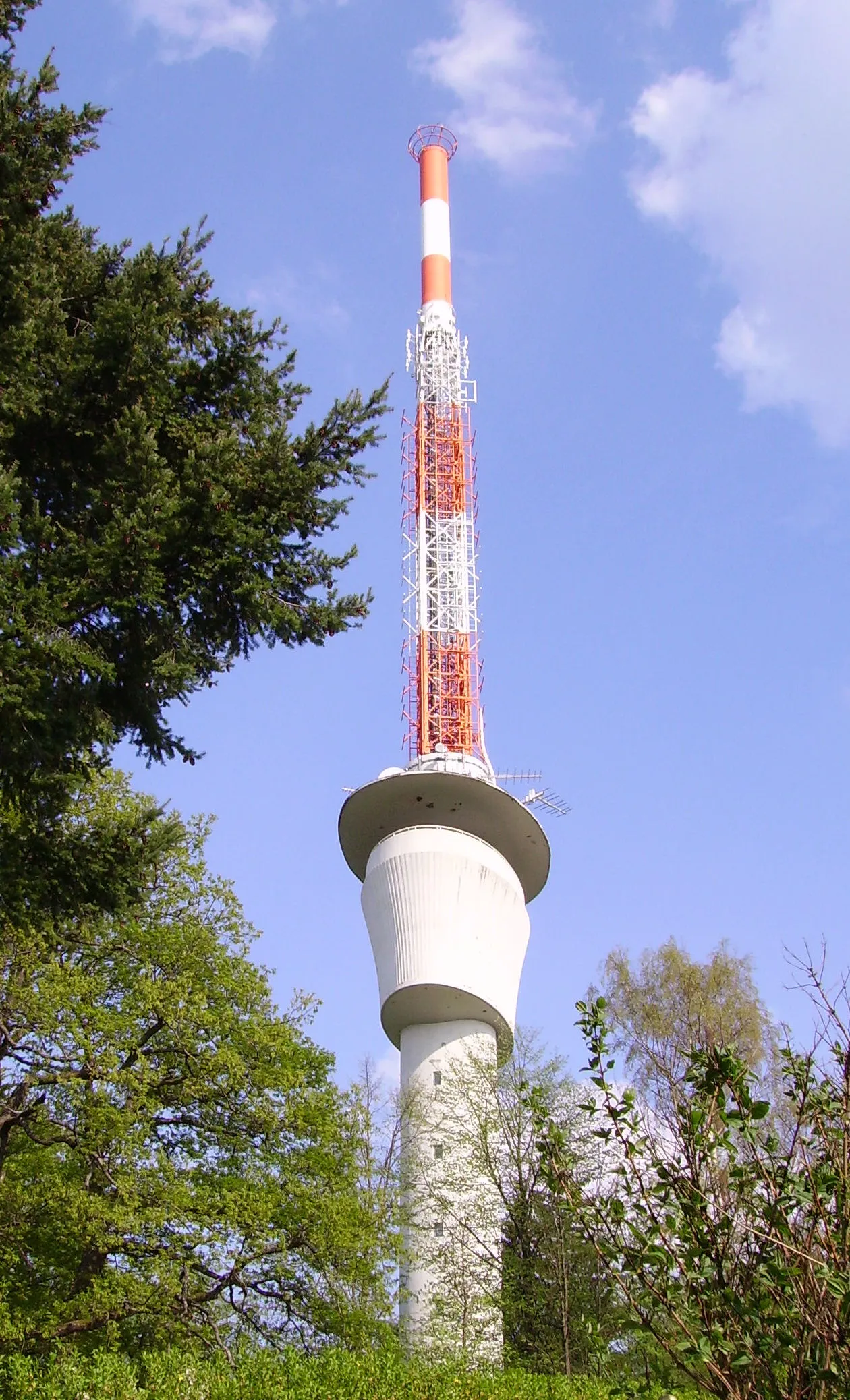 Fernsehturm Heidelberg Landmark, Heidelberg3.8 km N
-
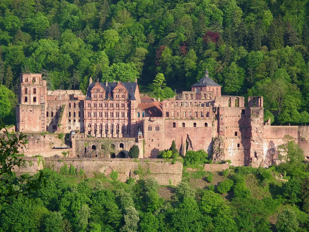 Heidelberg Castle Historic site, Heidelberg4.7 km N
-
Unterer Stadtwald Natural site, Baden-Wurttemberg2.7 km NE
-
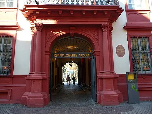 Kurpfälzisches Museum Museum, Heidelberg5.2 km NW
-
Auerhahnenkopf Mountain, Heidelberg4.1 km NE
-
Ameisenbuckel Mountain, Heidelberg3.6 km NW
Sources & licences
Data last updated: