Landkreis Böblingen
Located in Regierungsbezirk Stuttgart, Baden-Wurttemberg Coordinates: 48°41′51″ N 8°58′15″ E
- Population
- 395,167
- 395.2K
- Elevation
- 444 m
- above sea level
- Local time
- UTC+01:00
- Europe/Berlin · UTC+01:00
- Places inside
- 26
- listed under Landkreis Böblingen
- Airports
- STR Stuttgart Airport19 km
- FKB Karlsruhe Baden-Baden Airport66 km
About Landkreis Böblingen
Landkreis Böblingen is a municipality. Location: Regierungsbezirk Stuttgart, Baden-Wurttemberg. Population: 395,167. Elevation: 444 m. The best months to visit are June–August. The nearest airport is Stuttgart Airport (19 km). Nearby sights include Fasanengarten and Eschbach.
Photos of Landkreis Böblingen
-
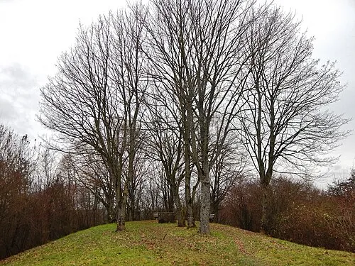
Bernhartshöhe qwesy qwesy · CC BY 3.0 -
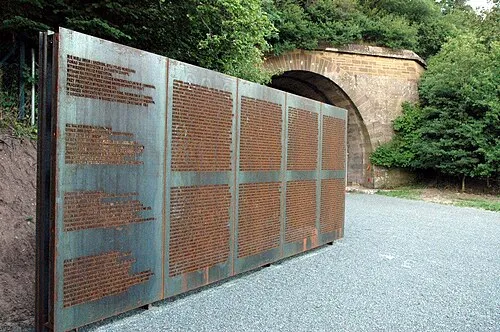
Leonberg Concentration Camp (Reiher) K. Jähne · CC BY-SA 3.0 -
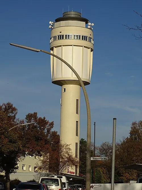
Goldbergturm Giftzwerg 88 · CC BY-SA 4.0


Climate of Landkreis Böblingen
Best months for sightseeingBest months for sightseeing: June–August.
This month · November
A cold month
Day 7° · Night 1° · Rain 67 mm
- Hottest month
- July (day 23°)
- Coldest month
- January (night -3°)
- Wettest month
- June (91 mm)
- Driest month
- January (49 mm)
Bars: average monthly low and high temperature. Below: precipitation. Monthly averages for 1970–2000 at about 18 km resolution, adjusted for elevation. Highlighted months are mild and relatively dry. Source: WorldClim 2.1 (CC BY 4.0).
Show values as a table
| Month | Jan | Feb | Mar | Apr | May | Jun | Jul | Aug | Sep | Oct | Nov | Dec |
|---|---|---|---|---|---|---|---|---|---|---|---|---|
| Average high (°C) | 3° | 4° | 9° | 13° | 18° | 20° | 23° | 23° | 19° | 13° | 7° | 4° |
| Average low (°C) | -3° | -2° | 1° | 3° | 8° | 11° | 13° | 12° | 9° | 5° | 1° | -1° |
| Precipitation (mm) | 49 | 53 | 54 | 59 | 87 | 91 | 73 | 69 | 62 | 60 | 67 | 65 |
How to get to Landkreis Böblingen
The nearest airport is Stuttgart Airport (STR), 19 km to the east as the crow flies. The nearest large city is Stuttgart, 18 km to the northeast.
Airports
- Stuttgart Airport (STR) Stuttgart 19 kmeast
- Karlsruhe Baden-Baden Airport (FKB) Rheinmünster 66 kmwest
- Mannheim-City Airport (MHG) Mannheim 92 kmnorth
Nearby large cities
- Stuttgart Population: 612.7K 18 kmnortheast
- Reutlingen Population: 112.6K 29 kmsoutheast
- Pforzheim Population: 119.3K 29 kmnorthwest
- Heilbronn Population: 120.7K 52 kmnorth
- Karlsruhe Population: 283.8K 54 kmnorthwest
Straight-line distances; road distances are longer. Airport data: OurAirports.
Day trips from Landkreis Böblingen
Within 100 km: 978 historic and cultural sites, 3,755 natural sites, 879 lakes, rivers and coasts.
0–25 km654 places
- Pfaffensee Lake 12 kmNE
- Bärensee Lake 11 kmNE
- Max-Eyth lake Lake 24 kmNE
- Hölzersee Lake 7 kmNE
25–60 km2,039 places
- Lauter River 30 kmE
- Mummelsee Lake 58 kmW
- Huzenbacher See Lake 48 kmW
- Annasee Lake 49 kmNE
60–100 km2,919 places
- Hessental Concentration Camp Historic site 74 kmNE
- Unditz River 87 kmW
- Elsenz River 79 kmN
- Rench River 73 kmW
Straight-line distances.
Landkreis Böblingen and similar cities
Side by side with cities of similar size in the same country: population, elevation and climate.
| Measure | Landkreis Böblingen | Bochum | Wuppertal | Bielefeld |
|---|---|---|---|---|
| Population | 395.2K | 385.7K | 360.8K | 331.9K |
| Elevation | 444 m | 102 m | 150 m | 111 m |
| Summer day (hottest month) | 23° | 23° | 23° | 23° |
| Winter night (coldest month) | -3° | 0° | 0° | -1° |
| Annual rainfall | 789 mm | 1,007 mm | 1,087 mm | 833 mm |
| Best months | Jun–Aug | Jun–Aug | Jun–Aug | Jun–Aug |
| Distance | — | 334 km | 313 km | 372 km |
Climate values are 1970–2000 monthly averages; straight-line distance.
Places in Landkreis Böblingen
26 places- 1 Sindelfingen 61.4K
- 2 Böblingen 51.5K
- 3 Leonberg 49.5K
- 4 Herrenberg 34.2K
- 5 Weil der Stadt 19.4K
- 6 Renningen 18.6K
- 7 Holzgerlingen 14.2K
- 8 Gärtringen 12.9K
- 9 Rutesheim 11.3K
- 10 Schönaich 10.5K
- 11 Weil im Schönbuch 10K
- 12 Magstadt 9.5K
- 13 Aidlingen 9.3K
- 14 Ehningen 9.3K
- 15 Gäufelden 9.2K
- 16 Waldenbuch 8.8K
- 17 Jettingen 8K
- 18 Weissach 7.7K
- 19 Grafenau 6.6K
- 20 Steinenbronn 6.3K
- 21 Bondorf 6.2K
- 22 Nufringen 5.8K
- 23 Altdorf 4.5K
- 24 Mötzingen 3.7K
- 25 Hildrizhausen 3.6K
- 26 Deckenpfronn 3.3K
Bar: population relative to the most populous place in this list.
Nearby attractions & nature
Everything nearby-
Fasanengarten Natural site, Baden-Wurttemberg2.6 km SW
-
Eschbach Natural site, Baden-Wurttemberg3.2 km SW
-
Goldbach River, Baden-Wurttemberg3.4 km E
-
Brand Natural site, Baden-Wurttemberg3.9 km SE
-
Stelzenhau Natural site, Baden-Wurttemberg3.9 km S
-
Spitzholz Natural site, Baden-Wurttemberg4 km NE
-
Eichholz Natural site, Baden-Wurttemberg4.2 km NE
-
Dachsbau Natural site, Baden-Wurttemberg4.3 km W
Sources & licences
Data last updated: