- Elevation
- 673 m
- above sea level
- Local time
- UTC+01:00
- Europe/Berlin · UTC+01:00
- Airports
- STR Stuttgart Airport18 km
- FMM Memmingen Allgau Airport91 km
About Jusiberg
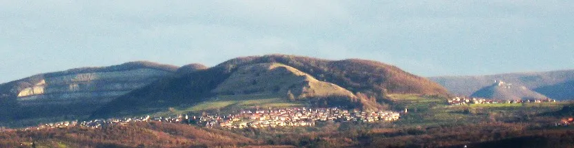
Jusiberg is a mountain. Location: Neuffen, Landkreis Esslingen. Elevation: 673 m.
Jusi is the residual of a volcano, an erosional outlier of the Swabian Alb, Baden-Württemberg, Germany. This category of extinct volcanos is only found within a range of 25 km of Bad Urach. It is the largest of the 355 residuals. Many of them are unrecognizable in the geological relief. Their tuffic pipe could only be identified by seismo-electric methods. These volcanos were active in the time before 17 - 16 million years.
Source: Wikipedia · CC BY-SA 4.0
Photos of Jusiberg
-

Windharp · CC BY-SA 4.0 -

Giftzwerg 88 · CC BY-SA 3.0 -

Giftzwerg 88 · CC BY-SA 3.0 -

CEphoto, Uwe Aranas · CC BY-SA 3.0 -

Windharp · CC BY-SA 4.0


Climate of Jusiberg
Best months for sightseeingBest months for sightseeing: June–August.
This month · November
A cold month
Day 6° · Night -1° · Rain 66 mm
- Hottest month
- July (day 21°)
- Coldest month
- January (night -5°)
- Wettest month
- June (104 mm)
- Driest month
- January (52 mm)
Bars: average monthly low and high temperature. Below: precipitation. Monthly averages for 1970–2000 at about 18 km resolution, adjusted for elevation. Highlighted months are mild and relatively dry. Source: WorldClim 2.1 (CC BY 4.0).
Show values as a table
| Month | Jan | Feb | Mar | Apr | May | Jun | Jul | Aug | Sep | Oct | Nov | Dec |
|---|---|---|---|---|---|---|---|---|---|---|---|---|
| Average high (°C) | 1° | 3° | 7° | 11° | 16° | 19° | 21° | 21° | 17° | 11° | 6° | 2° |
| Average low (°C) | -5° | -4° | -1° | 1° | 6° | 9° | 11° | 11° | 7° | 3° | -1° | -3° |
| Precipitation (mm) | 52 | 53 | 57 | 67 | 89 | 104 | 91 | 80 | 65 | 66 | 66 | 66 |
How to get to Jusiberg
The nearest airport is Stuttgart Airport (STR), 18 km to the northwest as the crow flies. The nearest large city is Reutlingen, 12 km to the southwest.
Airports
- Stuttgart Airport (STR) Stuttgart 18 kmnorthwest
- Memmingen Allgau Airport (FMM) Memmingen 91 kmsoutheast
- Karlsruhe Baden-Baden Airport (FKB) Rheinmünster 96 kmwest
Nearby large cities
- Reutlingen Population: 112.6K 12 kmsouthwest
- Stuttgart Population: 612.7K 28 kmnorthwest
- Ulm Population: 120.5K 51 kmeast
- Pforzheim Population: 119.3K 60 kmnorthwest
- Heilbronn Population: 120.7K 66 kmnorth
Straight-line distances; road distances are longer. Airport data: OurAirports.
Day trips from Jusiberg
Within 100 km: 869 historic and cultural sites, 3,639 natural sites, 859 lakes, rivers and coasts.
0–25 km516 places
- Lauter River 15 kmN
- Ziegelberg Mountain 24 kmS
- Schneiderhau Mountain 6 kmS
- Wackerstein Mountain 16 kmSW
25–60 km1,932 places
- Lauter River 44 kmE
- Pfaffensee Lake 29 kmNW
- Federsee Lake 56 kmSE
- Blinder See Lake 56 kmS
60–100 km2,919 places
- Hessental Concentration Camp Historic site 69 kmNE
- Mainau Island 94 kmS
- Dominikanerinsel Konstanz Island 99 kmS
- Buecher Schüppel Mountain 100 kmSW
Straight-line distances.
Nearest towns and villages
-
Kohlberg Village, Kohlberg1 km N
-
Kohlberg Village, Landkreis Esslingen1.1 km N
-
Dettingen an der Erms Village, Landkreis Reutlingen2.1 km S
-
Neuffen Town, Neuffen2.7 km E
-
Dettingen an der Erms Town, Dettingen an der Erms2.1 km S
-
Kappishäusern Village, Neuffen0.7 km W
Nearby attractions & nature
Everything nearby-
Hörnle Mountain, Dettingen an der Erms1.3 km SE
-
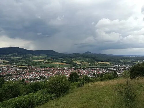 Hofbühl Mountain, Metzingen2.5 km SW
-
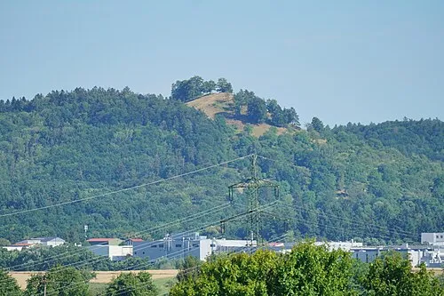 Floriansberg Mountain, Metzingen2.2 km W
-
Weinschnaid Natural site, Baden-Wurttemberg2 km NE
-
Lerchenberg Mountain, Neuffen2.8 km NE
-
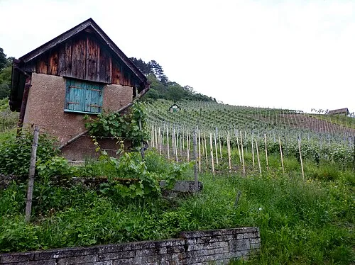 Weinberg Mountain, Metzingen3.4 km SW
-
Hohenneuffen Mountain, Neuffen4 km E
-
Karpfenbühl Mountain, Dettingen an der Erms3.8 km S
Sources & licences
Data last updated: · 2 independent sources