Landkreis Heidenheim
Located in Regierungsbezirk Stuttgart, Baden-Wurttemberg Coordinates: 48°41′03″ N 10°10′12″ E
- Population
- 135,235
- 135.2K
- Elevation
- 599 m
- above sea level
- Local time
- UTC+01:00
- Europe/Berlin · UTC+01:00
- Places inside
- 12
- listed under Landkreis Heidenheim
- Airports
- STR Stuttgart Airport70 km
- FMM Memmingen Allgau Airport78 km
About Landkreis Heidenheim
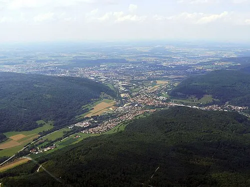
Landkreis Heidenheim is a municipality. Location: Regierungsbezirk Stuttgart, Baden-Wurttemberg. Population: 135,235. Elevation: 599 m. The best months to visit are June–August. The nearest airport is Stuttgart Airport (70 km). Nearby sights include Buchschorren and Heintal.
Climate of Landkreis Heidenheim
Best months for sightseeingBest months for sightseeing: June–August.
This month · November
A cold month
Day 5° · Night 0° · Rain 69 mm
- Hottest month
- July (day 22°)
- Coldest month
- January (night -4°)
- Wettest month
- June (100 mm)
- Driest month
- February (57 mm)
Bars: average monthly low and high temperature. Below: precipitation. Monthly averages for 1970–2000 at about 18 km resolution, adjusted for elevation. Highlighted months are mild and relatively dry. Source: WorldClim 2.1 (CC BY 4.0).
Show values as a table
| Month | Jan | Feb | Mar | Apr | May | Jun | Jul | Aug | Sep | Oct | Nov | Dec |
|---|---|---|---|---|---|---|---|---|---|---|---|---|
| Average high (°C) | 1° | 3° | 7° | 11° | 17° | 20° | 22° | 22° | 18° | 12° | 5° | 2° |
| Average low (°C) | -4° | -4° | -1° | 2° | 7° | 10° | 12° | 11° | 8° | 4° | 0° | -3° |
| Precipitation (mm) | 60 | 57 | 60 | 63 | 86 | 100 | 95 | 80 | 66 | 69 | 69 | 73 |
How to get to Landkreis Heidenheim
The nearest airport is Stuttgart Airport (STR), 70 km to the west as the crow flies. The nearest large city is Ulm, 34 km to the southwest.
Airports
- Stuttgart Airport (STR) Stuttgart 70 kmwest
- Memmingen Allgau Airport (FMM) Memmingen 78 kmsouth
- Nuremberg Airport (NUE) Nuremberg 112 kmnortheast
Nearby large cities
- Ulm Population: 120.5K 34 kmsouthwest
- Augsburg Population: 301.1K 64 kmsoutheast
- Stuttgart Population: 612.7K 74 kmwest
- Reutlingen Population: 112.6K 74 kmwest
- Heilbronn Population: 120.7K 86 kmnorthwest
Straight-line distances; road distances are longer. Airport data: OurAirports.
Day trips from Landkreis Heidenheim
Within 100 km: 1,016 historic and cultural sites, 2,994 natural sites, 686 lakes, rivers and coasts.
0–25 km219 places
- Itzelberger See Lake 6 kmNW
- Zwerenberg Mountain 13 kmN
- Nusshäule Mountain 14 kmW
- Wartberg Mountain 6 kmS
25–60 km1,459 places
- Hessental Concentration Camp Historic site 55 kmNW
- Zusam River 43 kmE
- Lauter River 58 kmW
- Lauter River 36 kmSW
60–100 km3,018 places
- Uzbach River 95 kmN
- Ziegelweiher Lake 96 kmSE
- Zeller See Lake 85 kmSW
- Waldsee Lake 83 kmS
Straight-line distances.
Landkreis Heidenheim and similar cities
Side by side with cities of similar size in the same country: population, elevation and climate.
| Measure | Landkreis Heidenheim | Würzburg | Fürth | Paderborn |
|---|---|---|---|---|
| Population | 135.2K | 133.7K | 132K | 142.2K |
| Elevation | 599 m | 204 m | 302 m | 118 m |
| Summer day (hottest month) | 22° | 24° | 25° | 23° |
| Winter night (coldest month) | -4° | -2° | -3° | -1° |
| Annual rainfall | 878 mm | 659 mm | 718 mm | 934 mm |
| Best months | Jun–Aug | May–Sep | May–Sep | Jun–Aug |
| Distance | — | 124 km | 106 km | 352 km |
Climate values are 1970–2000 monthly averages; straight-line distance.
Places in Landkreis Heidenheim
12 places- 1 Heidenheim an der Brenz 50.6K
- 2 Giengen an der Brenz 20K
- 3 Herbrechtingen 13.2K
- 4 Gerstetten 11.6K
- 5 Steinheim am Albuch 8.9K
- 6 Königsbronn 7K
- 7 Nattheim 6.6K
- 8 Sontheim 5.8K
- 9 Niederstotzingen 4.9K
- 10 Dischingen 4.4K
- 11 Hermaringen 2.3K
Bar: population relative to the most populous place in this list.
Mountains & nature1
- Lindletal · Natural site
Nearby attractions & nature
Everything nearby-
Buchschorren Natural site, Baden-Wurttemberg1.5 km E
-
Heintal Natural site, Baden-Wurttemberg2.2 km SE
-
Osterholz Natural site, Baden-Wurttemberg2.1 km E
-
Sankt Margaret Natural site, Baden-Wurttemberg3.5 km E
-
Itzelberger See Lake, Baden-Wurttemberg6 km NW
-
Stubental Natural site, Baden-Wurttemberg8 km W
-
Dickenhau Natural site, Baden-Wurttemberg8 km N
-
Wollenberg Mountain, Essingen11 km NW
Other cities and towns in Regierungsbezirk Stuttgart
-
Heidenheim Town, Heidenheim an der Brenz1.5 km SW
-
Ostalbkreis Municipality, Regierungsbezirk Stuttgart22 km N
-
 Aalen Town, Aalen18 km N
-
Nattheim Town, Nattheim5.6 km E
-
Herbrechtingen Town, Herbrechtingen7 km S
-
Giengen an der Brenz Town, Giengen an der Brenz8.7 km SE
Sources & licences
Data last updated: