Langenburg
Located in Landkreis Schwäbisch Hall, Regierungsbezirk Stuttgart Coordinates: 49°15′16″ N 9°50′45″ E
- Population
- 1,749
- 1.7K
- Elevation
- 410 m
- above sea level
- Local time
- UTC+01:00
- Europe/Berlin · UTC+01:00
- Places inside
- 11
- listed under Langenburg
- Airports
- STR Stuttgart Airport78 km
- NUE Nuremberg Airport94 km
About Langenburg
Langenburg is a village. Location: Landkreis Schwäbisch Hall, Regierungsbezirk Stuttgart. Population: 1,749. Elevation: 410 m. The best months to visit are June–August. The nearest airport is Stuttgart Airport (78 km). Nearby sights include Lücke and Burg Tierberg.
Photos of Langenburg
-
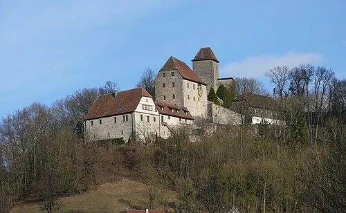
Schloß Tierberg Bernd Haynold · CC BY-SA 3.0 -
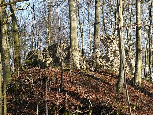
Burg Werdeck Bernd Haynold · CC BY-SA 3.0 -
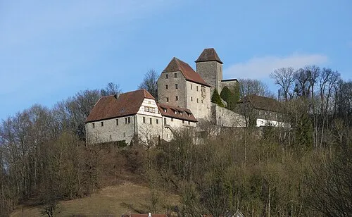
Burg Tierberg Bernd Haynold · CC BY-SA 3.0


Climate of Langenburg
Best months for sightseeingBest months for sightseeing: June–August.
This month · November
A cold month
Day 6° · Night 1° · Rain 73 mm
- Hottest month
- August (day 23°)
- Coldest month
- January (night -3°)
- Wettest month
- June (87 mm)
- Driest month
- April (60 mm)
Bars: average monthly low and high temperature. Below: precipitation. Monthly averages for 1970–2000 at about 18 km resolution, adjusted for elevation. Highlighted months are mild and relatively dry. Source: WorldClim 2.1 (CC BY 4.0).
Show values as a table
| Month | Jan | Feb | Mar | Apr | May | Jun | Jul | Aug | Sep | Oct | Nov | Dec |
|---|---|---|---|---|---|---|---|---|---|---|---|---|
| Average high (°C) | 2° | 4° | 8° | 13° | 18° | 21° | 23° | 23° | 19° | 13° | 6° | 4° |
| Average low (°C) | -3° | -3° | 0° | 3° | 8° | 11° | 13° | 12° | 9° | 5° | 1° | -2° |
| Precipitation (mm) | 72 | 66 | 70 | 60 | 77 | 87 | 77 | 67 | 61 | 75 | 73 | 84 |
How to get to Langenburg
The nearest airport is Stuttgart Airport (STR), 78 km to the southwest as the crow flies. The nearest large city is Heilbronn, 47 km to the west.
Airports
- Stuttgart Airport (STR) Stuttgart 78 kmsouthwest
- Nuremberg Airport (NUE) Nuremberg 94 kmeast
- Mannheim-City Airport (MHG) Mannheim 100 kmwest
Nearby large cities
- Heilbronn Population: 120.7K 47 kmwest
- Würzburg Population: 133.7K 60 kmnorth
- Stuttgart Population: 612.7K 72 kmsouthwest
- Heidelberg Population: 143.3K 86 kmwest
- Fürth Population: 132K 87 kmeast
Straight-line distances; road distances are longer. Airport data: OurAirports.
Day trips from Langenburg
Within 100 km: 1,433 historic and cultural sites, 3,516 natural sites, 846 lakes, rivers and coasts.
0–25 km174 places
- Hessental Concentration Camp Historic site 17 kmS
- Stausee Münster Lake 24 kmNE
- Waldenburger Berge Mountain 22 kmSW
- Taubenhof Mountain 5 kmN
25–60 km1,529 places
- Umpfer River 33 kmN
- Uzbach River 40 kmNE
- Wolfsee Lake 60 kmNE
- Sperbersee Lake 58 kmNE
60–100 km4,092 places
- Elsenz River 78 kmW
- Zusam River 90 kmSE
- Lauter River 72 kmSW
- Lauter River 93 kmS
Straight-line distances.
Places in Langenburg
11 placesBar: population relative to the most populous place in this list.
Cities & villages7
- Atzenrod · Village
- Bächlingen · Village
- Hürden · Village
- Ludwigsruhe · Village
- Nesselbach · Village
- Oberregenbach · Village
- Unterregenbach · Village
Mountains & nature1
- Meisenfeld · Mountain
Heritage & sights2
- Langenburg, Stadtpfarrkirche Hl. Blut · Attraction
- Sendemast Langenburg · Landmark
Nearby attractions & nature
Everything nearby-
Lücke Natural site, Baden-Wurttemberg2 km NE
-
Burg Tierberg Historic site, Winterberg4.3 km W
-
Schloß Tierberg Historic site, Braunsbach4 km W
-
Baierwald Natural site, Baden-Wurttemberg4.2 km E
-
Dachsbühl Natural site, Baden-Wurttemberg4.2 km NE
-
Schloß Morstein Historic site, Gerabronn4.6 km SE
Sources & licences
Data last updated: