- Elevation
- 776 m
- above sea level
- Local time
- UTC+01:00
- Europe/Berlin · UTC+01:00
- Airports
- STR Stuttgart Airport51 km
- FMM Memmingen Allgau Airport88 km
About Falkenberg
Falkenberg is a mountain. Location: Bartholomä, Ostalbkreis. Elevation: 776 m. The best months to visit are June–August. The nearest airport is Stuttgart Airport (51 km). Nearby sights include Zwerenberg and Bargauer Horn.
At a glance
- Topographic prominence
- 20 m
Source: Wikidata
Photos of Falkenberg
-
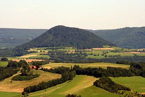
Stuifen Rosenzweig · CC BY-SA 3.0 -
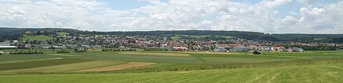
Kolmannswald Kreuzschnabel · CC BY-SA 3.0 -
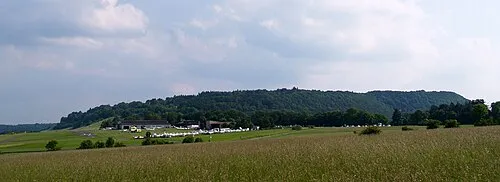
Kaltes Feld User:Kreuzschnabel · CC BY-SA 3.0


Climate of Falkenberg
Best months for sightseeingBest months for sightseeing: June–August.
This month · November
A cold month
Day 5° · Night -1° · Rain 80 mm
- Hottest month
- July (day 21°)
- Coldest month
- January (night -5°)
- Wettest month
- June (112 mm)
- Driest month
- February (67 mm)
Bars: average monthly low and high temperature. Below: precipitation. Monthly averages for 1970–2000 at about 18 km resolution, adjusted for elevation. Highlighted months are mild and relatively dry. Source: WorldClim 2.1 (CC BY 4.0).
Show values as a table
| Month | Jan | Feb | Mar | Apr | May | Jun | Jul | Aug | Sep | Oct | Nov | Dec |
|---|---|---|---|---|---|---|---|---|---|---|---|---|
| Average high (°C) | 1° | 2° | 6° | 10° | 16° | 18° | 21° | 21° | 16° | 11° | 5° | 2° |
| Average low (°C) | -5° | -4° | -2° | 1° | 6° | 9° | 11° | 11° | 7° | 3° | -1° | -3° |
| Precipitation (mm) | 71 | 67 | 70 | 73 | 92 | 112 | 101 | 85 | 73 | 78 | 80 | 82 |
How to get to Falkenberg
The nearest airport is Stuttgart Airport (STR), 51 km to the west as the crow flies. The nearest large city is Ulm, 40 km to the south.
Airports
- Stuttgart Airport (STR) Stuttgart 51 kmwest
- Memmingen Allgau Airport (FMM) Memmingen 88 kmsouth
- Nuremberg Airport (NUE) Nuremberg 119 kmnortheast
Nearby large cities
- Ulm Population: 120.5K 40 kmsouth
- Stuttgart Population: 612.7K 54 kmwest
- Reutlingen Population: 112.6K 59 kmsouthwest
- Heilbronn Population: 120.7K 67 kmnorthwest
- Augsburg Population: 301.1K 84 kmsoutheast
Straight-line distances; road distances are longer. Airport data: OurAirports.
Day trips from Falkenberg
Within 100 km: 978 historic and cultural sites, 3,316 natural sites, 739 lakes, rivers and coasts.
0–25 km319 places
- Leinecksee Lake 19 kmNW
- Reichenbachsee Lake 18 kmNW
- Itzelberger See Lake 17 kmE
- Schießtalsee Lake 10 kmNW
25–60 km1,628 places
- Hessental Concentration Camp Historic site 41 kmN
- Lauter River 40 kmW
- Lauter River 37 kmS
- Pfaffensee Lake 59 kmW
60–100 km3,086 places
- Umpfer River 89 kmN
- Zusam River 62 kmE
- Uzbach River 90 kmN
- Zeller See Lake 86 kmS
Straight-line distances.
Nearest towns and villages
-
Äußerer Kitzinghof Village, Bartholomä1.4 km NE
-
Heubach Village, Ostalbkreis5.1 km N
-
Heubach Town, Heubach5.1 km N
-
 Bettringen Village, Schwäbisch Gmünd6.6 km NW
-
Innerer Kitzinghof Village, Bartholomä2.4 km E
-
Lauterstein Village, Landkreis Göppingen5.2 km SW
Nearby attractions & nature
Everything nearby-
Zwerenberg Mountain, Lauterstein1.1 km SW
-
Bargauer Horn Mountain, Schwäbisch Gmünd1.6 km N
-
Bernhardus Mountain, Lauterstein1.7 km W
-
Nägelberg Mountain, Heubach3.2 km NE
-
Rechberger Buch Natural site, Baden-Wurttemberg2.6 km NE
-
Scheuelberg Mountain, Heubach3.5 km N
-
Kaltes Feld Mountain, Schwäbisch Gmünd4.7 km W
-
Hornberg Mountain, Waldstetten4.3 km W
More nature in Germany
-
Kolmannswald Mountain, Bartholomä4.9 km SE
-
Wirtsberg Mountain, Bartholomä5.4 km E
-
Schopf Mountain, Bartholomä3.5 km E
-
Nameless Point Mountain, Bartholomä6.2 km E
Sources & licences
Data last updated: · 2 independent sources