- Elevation
- 717 m
- above sea level
- Local time
- UTC+01:00
- Europe/Berlin · UTC+01:00
- Airports
- STR Stuttgart Airport62 km
- FMM Memmingen Allgau Airport89 km
About Schmaler Hau
Schmaler Hau is a mountain. Location: Essingen, Ostalbkreis. Elevation: 717 m. The best months to visit are June–August. The nearest airport is Stuttgart Airport (62 km). Nearby sights include Raubenhau and Auerwang.
Photos of Schmaler Hau
-
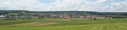
Kolmannswald Kreuzschnabel · CC BY-SA 3.0

Climate of Schmaler Hau
Best months for sightseeingBest months for sightseeing: June–August.
This month · November
A cold month
Day 5° · Night -1° · Rain 74 mm
- Hottest month
- July (day 21°)
- Coldest month
- January (night -5°)
- Wettest month
- June (107 mm)
- Driest month
- February (61 mm)
Bars: average monthly low and high temperature. Below: precipitation. Monthly averages for 1970–2000 at about 18 km resolution, adjusted for elevation. Highlighted months are mild and relatively dry. Source: WorldClim 2.1 (CC BY 4.0).
Show values as a table
| Month | Jan | Feb | Mar | Apr | May | Jun | Jul | Aug | Sep | Oct | Nov | Dec |
|---|---|---|---|---|---|---|---|---|---|---|---|---|
| Average high (°C) | 1° | 2° | 7° | 11° | 16° | 19° | 21° | 21° | 17° | 11° | 5° | 2° |
| Average low (°C) | -5° | -4° | -1° | 2° | 6° | 9° | 11° | 11° | 7° | 4° | -1° | -3° |
| Precipitation (mm) | 65 | 61 | 65 | 69 | 88 | 107 | 98 | 83 | 69 | 73 | 74 | 77 |
How to get to Schmaler Hau
The nearest airport is Stuttgart Airport (STR), 62 km to the west as the crow flies. The nearest large city is Ulm, 42 km to the south.
Airports
- Stuttgart Airport (STR) Stuttgart 62 kmwest
- Memmingen Allgau Airport (FMM) Memmingen 89 kmsouth
- Nuremberg Airport (NUE) Nuremberg 110 kmnortheast
Nearby large cities
- Ulm Population: 120.5K 42 kmsouth
- Stuttgart Population: 612.7K 64 kmwest
- Reutlingen Population: 112.6K 70 kmsouthwest
- Heilbronn Population: 120.7K 73 kmnorthwest
- Augsburg Population: 301.1K 77 kmsoutheast
Straight-line distances; road distances are longer. Airport data: OurAirports.
Day trips from Schmaler Hau
Within 100 km: 1,019 historic and cultural sites, 3,173 natural sites, 709 lakes, rivers and coasts.
0–25 km297 places
- Reichenbachsee Lake 24 kmNW
- Itzelberger See Lake 8 kmSE
- Bucher Stausee Lake 17 kmNE
- Schießtalsee Lake 17 kmW
25–60 km1,371 places
- Hessental Concentration Camp Historic site 42 kmNW
- Zusam River 52 kmE
- Lauter River 50 kmW
- Lauter River 41 kmS
60–100 km3,233 places
- Umpfer River 89 kmN
- Uzbach River 86 kmN
- Zeller See Lake 91 kmS
- Wolfsee Lake 100 kmN
Straight-line distances.
Nearest towns and villages
-
Essingen Town, Essingen4 km N
-
Oberkochen Village, Ostalbkreis4.3 km E
-
Oberkochen Town, Oberkochen4.3 km E
-
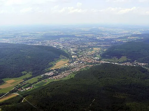 Aalen Town, Aalen7.7 km NE
-
Bartholomä Village, Ostalbkreis5.1 km SW
-
Bartholomä Village, Bartholomä5.1 km SW
Nearby attractions & nature
Everything nearby-
Raubenhau Natural site, Baden-Wurttemberg1.1 km SW
-
Auerwang Natural site, Baden-Wurttemberg1.5 km NW
-
Bilz Natural site, Baden-Wurttemberg1.7 km E
-
Tiefental Natural site, Baden-Wurttemberg2.4 km SE
-
Wollenberg Mountain, Essingen3 km SE
-
Bemmel Mountain, Oberkochen2.5 km E
-
Berghäule Mountain, Oberkochen2.6 km NE
-
Banwang Natural site, Baden-Wurttemberg2.5 km S
Sources & licences
Data last updated: