- Elevation
- 499 m
- above sea level
- Local time
- UTC+01:00
- Europe/Berlin · UTC+01:00
- Airports
- STR Stuttgart Airport79 km
- NUE Nuremberg Airport90 km
About Lippach
Lippach is a village. Location: Westhausen, Ostalbkreis. Elevation: 499 m. The best months to visit are June–August. The nearest airport is Stuttgart Airport (79 km). Nearby sights include Hornsberg and Erbisberg.
Photos of Lippach
-
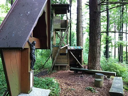
Wöllerstein Bernhard Hampp · CC BY 3.0

Climate of Lippach
Best months for sightseeingBest months for sightseeing: June–August.
This month · November
A cold month
Day 6° · Night 0° · Rain 67 mm
- Hottest month
- July (day 23°)
- Coldest month
- January (night -3°)
- Wettest month
- June (93 mm)
- Driest month
- February (59 mm)
Bars: average monthly low and high temperature. Below: precipitation. Monthly averages for 1970–2000 at about 18 km resolution, adjusted for elevation. Highlighted months are mild and relatively dry. Source: WorldClim 2.1 (CC BY 4.0).
Show values as a table
| Month | Jan | Feb | Mar | Apr | May | Jun | Jul | Aug | Sep | Oct | Nov | Dec |
|---|---|---|---|---|---|---|---|---|---|---|---|---|
| Average high (°C) | 2° | 4° | 8° | 12° | 18° | 20° | 23° | 23° | 18° | 12° | 6° | 3° |
| Average low (°C) | -3° | -3° | 0° | 2° | 7° | 10° | 12° | 12° | 8° | 4° | 0° | -2° |
| Precipitation (mm) | 62 | 59 | 61 | 60 | 78 | 93 | 86 | 73 | 60 | 68 | 67 | 76 |
How to get to Lippach
The nearest airport is Stuttgart Airport (STR), 79 km to the west as the crow flies. The nearest large city is Ulm, 59 km to the south.
Airports
- Stuttgart Airport (STR) Stuttgart 79 kmwest
- Nuremberg Airport (NUE) Nuremberg 90 kmnortheast
- Memmingen Allgau Airport (FMM) Memmingen 101 kmsouth
Nearby large cities
- Ulm Population: 120.5K 59 kmsouth
- Augsburg Population: 301.1K 75 kmsoutheast
- Stuttgart Population: 612.7K 80 kmwest
- Heilbronn Population: 120.7K 80 kmwest
- Fürth Population: 132K 84 kmnortheast
Straight-line distances; road distances are longer. Airport data: OurAirports.
Day trips from Lippach
Within 100 km: 1,244 historic and cultural sites, 3,012 natural sites, 699 lakes, rivers and coasts.
0–25 km250 places
- Itzelberger See Lake 20 kmSW
- Bucher Stausee Lake 8 kmW
- Zwerenberg Mountain 14 kmSW
- Volkmarsberg Mountain 17 kmSW
25–60 km1,236 places
- Hessental Concentration Camp Historic site 42 kmNW
- Zusam River 43 kmSE
- Lauter River 59 kmSW
- Kreutweiher Lake 33 kmNE
60–100 km3,469 places
- Umpfer River 82 kmNW
- Uzbach River 72 kmN
- Lauter River 68 kmW
- Wolfsee Lake 83 kmN
Straight-line distances.
Nearby attractions & nature
Everything nearby-
Hornsberg Mountain, Ellwangen (Jagst)2.3 km W
-
Erbisberg Mountain, Lauchheim2.7 km SE
-
Stettberg Mountain, Lauchheim3.4 km S
-
Zöbinger Forst Natural site, Baden-Wurttemberg3.1 km NE
-
Barnberg Mountain, Lauchheim4.4 km SE
-
Fuchshalde Natural site, Baden-Wurttemberg3.6 km S
Sources & licences
Data last updated: