Landkreis Freyung-Grafenau
Located in Lower Bavaria, Bavaria Coordinates: 48°50′35″ N 13°31′15″ E
- Population
- 78,710
- 78.7K
- Elevation
- 693 m
- above sea level
- Local time
- UTC+01:00
- Europe/Berlin · UTC+01:00
- Places inside
- 27
- listed under Landkreis Freyung-Grafenau
- Airports
- JCL České Budějovice South Bohemian Airport68 km
- LNZ Linz-Hörsching Airport84 km
About Landkreis Freyung-Grafenau
Landkreis Freyung-Grafenau is a municipality. Location: Lower Bavaria, Bavaria. Population: 78,710. Elevation: 693 m. The best months to visit are June–August. The nearest airport is České Budějovice South Bohemian Airport (68 km). Nearby sights include Hacker Holz and Steinberg.
Photos of Landkreis Freyung-Grafenau
-
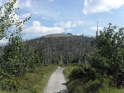
Lusen Takmocsekretovanej! · CC0 -
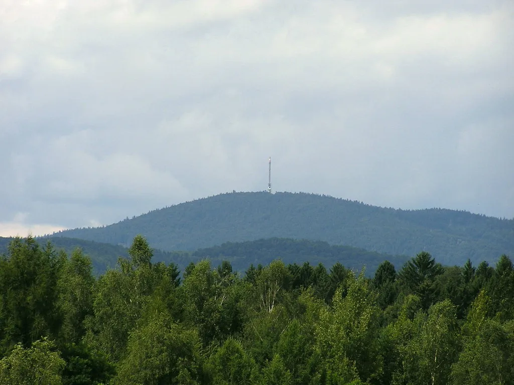
Brotjacklriegel MdE · CC BY-SA 3.0


Climate of Landkreis Freyung-Grafenau
Best months for sightseeingBest months for sightseeing: June–August.
This month · November
A wet month
Day 5° · Night -1° · Rain 105 mm
- Hottest month
- July (day 21°)
- Coldest month
- January (night -4°)
- Wettest month
- July (145 mm)
- Driest month
- April (76 mm)
Bars: average monthly low and high temperature. Below: precipitation. Monthly averages for 1970–2000 at about 18 km resolution, adjusted for elevation. Highlighted months are mild and relatively dry. Source: WorldClim 2.1 (CC BY 4.0).
Show values as a table
| Month | Jan | Feb | Mar | Apr | May | Jun | Jul | Aug | Sep | Oct | Nov | Dec |
|---|---|---|---|---|---|---|---|---|---|---|---|---|
| Average high (°C) | 2° | 3° | 6° | 10° | 16° | 19° | 21° | 21° | 17° | 12° | 5° | 3° |
| Average low (°C) | -4° | -4° | -1° | 2° | 7° | 9° | 11° | 11° | 8° | 4° | -1° | -3° |
| Precipitation (mm) | 121 | 91 | 102 | 76 | 88 | 122 | 145 | 107 | 97 | 90 | 105 | 140 |
How to get to Landkreis Freyung-Grafenau
The nearest airport is České Budějovice South Bohemian Airport (JCL), 68 km to the east as the crow flies. The nearest large city is Linz, 82 km to the southeast.
Airports
- České Budějovice South Bohemian Airport (JCL) České Budějovice 68 kmeast
- Linz-Hörsching Airport (LNZ) Linz 84 kmsoutheast
- Salzburg Airport (SZG) Salzburg 123 kmsouth
Nearby large cities
- Linz Population: 204.8K 82 kmsoutheast
- Regensburg Population: 151.4K 106 kmwest
- Salzburg Population: 157.2K 121 kmsouth
- Prague Population: 1.2M 153 kmnortheast
- Ingolstadt Population: 120.7K 154 kmwest
Straight-line distances; road distances are longer. Airport data: OurAirports.
Day trips from Landkreis Freyung-Grafenau
Within 100 km: 130 historic and cultural sites, 801 natural sites, 326 lakes, rivers and coasts.
0–25 km178 places
- Einsiedelberg Mountain 25 kmSE
- Weißbach River 25 kmSE
- Rachelsee Lake 17 kmNW
- Saldenburger Weiher Lake 14 kmSW
25–60 km439 places
- Biber-Revier River 55 kmNW
- Rannasee Lake 39 kmSE
- Teufelsschüssel Mountain 25 kmSE
- Zwiesel Berg Mountain 28 kmSE
60–100 km640 places
- Gusen I Concentration Camp Historic site 95 kmSE
- Unter-Rosenhofer Teich Lake 91 kmE
- Ober-Rosenhofer Teich Lake 90 kmE
- Zeissberg Mountain 80 kmSE
Straight-line distances.
Landkreis Freyung-Grafenau and similar cities
Side by side with cities of similar size in the same country: population, elevation and climate.
| Measure | Landkreis Freyung-Grafenau | Arnsberg | Detmold | Bayreuth |
|---|---|---|---|---|
| Population | 78.7K | 74.9K | 73.7K | 72.9K |
| Elevation | 693 m | 295 m | 135 m | 338 m |
| Summer day (hottest month) | 21° | 21° | 22° | 23° |
| Winter night (coldest month) | -4° | -2° | -1° | -3° |
| Annual rainfall | 1,284 mm | 1,046 mm | 969 mm | 810 mm |
| Best months | Jun–Aug | Jun–Aug | Jun–Aug | Jun–Aug |
| Distance | — | 481 km | 477 km | 187 km |
Climate values are 1970–2000 monthly averages; straight-line distance.
Places in Landkreis Freyung-Grafenau
27 places- 1 Waldkirchen 11.4K
- 2 Grafenau 8.2K
- 3 Freyung 7.1K
- 4 Röhrnbach, Markt 4.3K
- 5 Neureichenau 4.2K
- 6 Schönberg, Markt 3.9K
- 7 Spiegelau 3.9K
- 8 Jandelsbrunn 3.3K
- 9 Hohenau 3.3K
- 10 Sankt Oswald-Riedlhütte 2.9K
- 11 Perlesreut, Markt 2.9K
- 12 Thurmansbang 2.6K
- 13 Grainet 2.4K
- 14 Hinterschmiding 2.4K
- 15 Neuschönau 2.2K
- 16 Mauth 2K
- 17 Saldenburg 2K
- 18 Ringelai 1.9K
- 19 Innernzell 1.5K
- 20 Haidmühle 1.4K
- 21 Schöfweg 1.3K
- 22 Zenting 1.2K
- 23 Eppenschlag 935
- 24 Fürsteneck 826
- 25 Philippsreut 618
Bar: population relative to the most populous place in this list.
Mountains & nature1
- Ursprung Kalte Moldau · Natural site
Lakes, rivers & coasts1
- Rothbach · River
Nearby attractions & nature
Everything nearby-
Hacker Holz Natural site, Bavaria3.3 km NE
-
Steinberg Mountain, Bavaria5 km N
-
Kronigauberg Mountain, Bavaria5.9 km E
-
Schuissenbach River, Bavaria4.7 km E
-
Windischbach River, Bavaria4.9 km E
-
Saussbach River, Bavaria5 km SE
-
Tyrobach River, Bavaria5.1 km SE
-
Kleinalmeyerschloss Mountain, Bavaria7.9 km N
Sources & licences
Data last updated: