- Elevation
- 475 m
- above sea level
- Local time
- UTC+01:00
- Europe/Berlin · UTC+01:00
- Airports
- MUC Munich Airport39 km
- SZG Salzburg Airport90 km
About Pfaffenbach
Pfaffenbach is a village. Location: Vilsbiburg, Landkreis Landshut. Elevation: 475 m. The best months to visit are June–August. The nearest airport is Munich Airport (39 km). Nearby sights include Frauenholz and Trausnitz Castle.
Climate of Pfaffenbach
Best months for sightseeingBest months for sightseeing: June–August.
This month · November
A cold month
Day 6° · Night 0° · Rain 64 mm
- Hottest month
- July (day 23°)
- Coldest month
- January (night -4°)
- Wettest month
- June (110 mm)
- Driest month
- February (48 mm)
Bars: average monthly low and high temperature. Below: precipitation. Monthly averages for 1970–2000 at about 18 km resolution, adjusted for elevation. Highlighted months are mild and relatively dry. Source: WorldClim 2.1 (CC BY 4.0).
Show values as a table
| Month | Jan | Feb | Mar | Apr | May | Jun | Jul | Aug | Sep | Oct | Nov | Dec |
|---|---|---|---|---|---|---|---|---|---|---|---|---|
| Average high (°C) | 2° | 4° | 8° | 13° | 18° | 21° | 23° | 23° | 19° | 13° | 6° | 3° |
| Average low (°C) | -4° | -4° | 0° | 3° | 8° | 11° | 12° | 12° | 8° | 4° | 0° | -3° |
| Precipitation (mm) | 52 | 48 | 56 | 60 | 82 | 110 | 104 | 102 | 73 | 56 | 64 | 59 |
How to get to Pfaffenbach
The nearest airport is Munich Airport (MUC), 39 km to the west as the crow flies. The nearest large city is Munich, 63 km to the southwest.
Airports
- Munich Airport (MUC) Munich 39 kmwest
- Salzburg Airport (SZG) Salzburg 90 kmsoutheast
- Linz-Hörsching Airport (LNZ) Linz 143 kmeast
Nearby large cities
- Munich Population: 1.5M 63 kmsouthwest
- Regensburg Population: 151.4K 65 kmnorth
- Ingolstadt Population: 120.7K 73 kmnorthwest
- Salzburg Population: 157.2K 91 kmsoutheast
- Augsburg Population: 301.1K 103 kmwest
Straight-line distances; road distances are longer. Airport data: OurAirports.
Day trips from Pfaffenbach
Within 100 km: 492 historic and cultural sites, 1,589 natural sites, 648 lakes, rivers and coasts.
0–25 km52 places
- Stauweiher Lake 19 kmW
- Gretlmühle Lake 16 kmN
- Ausgleichweiher Lake 23 kmW
- Schlossberg Mountain 25 kmNE
25–60 km494 places
- elf-pavlik's tent Historic site 57 kmSW
- Adenberg Mountain 60 kmSE
- Weilhart Forst Natural site 57 kmSE
- Unterer Weilhart Forst Natural site 55 kmSE
60–100 km2,183 places
- Frauenchiemsee Island 64 kmS
- Biber-Revier River 99 kmNE
- Herreninsel Island 65 kmS
- Zellersee Lake 96 kmSE
Straight-line distances.
Nearby attractions & nature
Everything nearby-
Frauenholz Natural site, Bavaria2 km NW
-
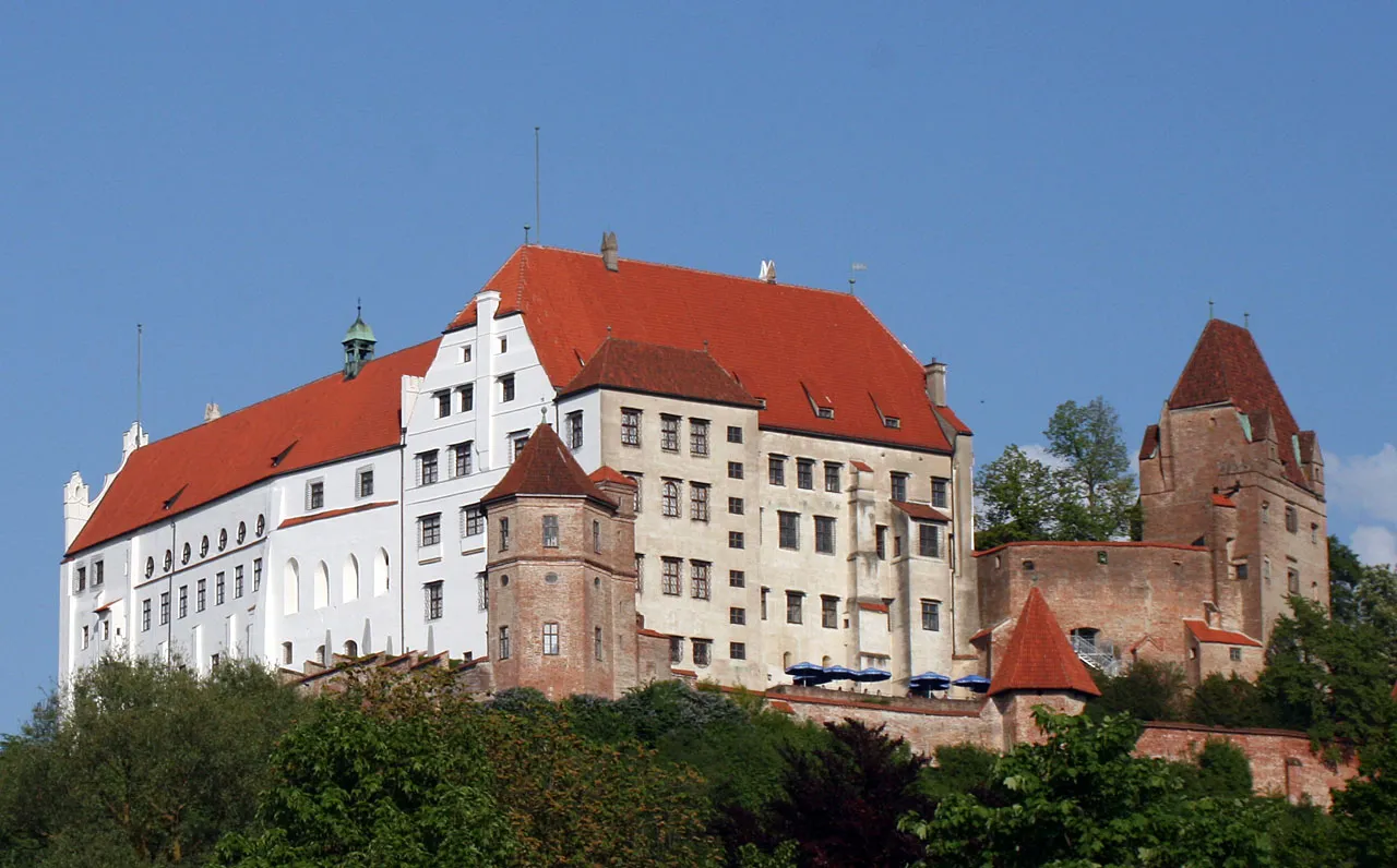 Trausnitz Castle Historic site, Landshut14 km NW
-
Lernerbach River, Bavaria6.8 km S
-
St. Salvator Attraction, Bodenkirchen11 km E
-
Jenkhofen, Kath. Kirche Mariä Himmelfahrt Attraction, Adlkofen11 km N
-
Landshut Concentration Camp Historic site, Landshut16 km NW
Sources & licences
Data last updated: