St. Georg
Located in Mitterfels, Markt, Landkreis Straubing-Bogen Coordinates: 48°58′10″ N 12°40′47″ E
- Local time
- UTC+01:00
- Europe/Berlin · UTC+01:00
- Elevation
- 407 m
- above sea level
- Airports
- MUC Munich Airport95 km
- JCL České Budějovice South Bohemian Airport128 km
About St. Georg
St. Georg is a tourist attraction. Location: Mitterfels, Markt, Landkreis Straubing-Bogen. The best months to visit are June–August. The nearest airport is Munich Airport (95 km). Nearby sights include Burg Mitterfels and Neues Schloss Steinach.
Photos of St. Georg
-
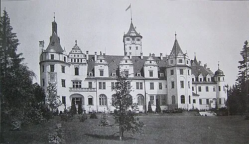
Neues Schloss Steinach WagnerMünster · CC BY-SA 4.0

Climate of St. Georg
Best months for sightseeingBest months for sightseeing: June–August.
This month · November
A cold month
Day 5° · Night 0° · Rain 66 mm
- Hottest month
- July (day 23°)
- Coldest month
- January (night -5°)
- Wettest month
- July (100 mm)
- Driest month
- April (53 mm)
Bars: average monthly low and high temperature. Below: precipitation. Monthly averages for 1970–2000 at about 18 km resolution, adjusted for elevation. Highlighted months are mild and relatively dry. Source: WorldClim 2.1 (CC BY 4.0).
Show values as a table
| Month | Jan | Feb | Mar | Apr | May | Jun | Jul | Aug | Sep | Oct | Nov | Dec |
|---|---|---|---|---|---|---|---|---|---|---|---|---|
| Average high (°C) | 1° | 3° | 8° | 13° | 19° | 21° | 23° | 23° | 18° | 12° | 5° | 2° |
| Average low (°C) | -5° | -4° | -1° | 2° | 7° | 10° | 12° | 12° | 8° | 4° | 0° | -3° |
| Precipitation (mm) | 62 | 55 | 61 | 53 | 76 | 94 | 100 | 88 | 71 | 65 | 66 | 77 |
How to get to St. Georg
The nearest airport is Munich Airport (MUC), 95 km to the southwest as the crow flies. The nearest large city is Regensburg, 43 km to the west.
Airports
- Munich Airport (MUC) Munich 95 kmsouthwest
- České Budějovice South Bohemian Airport (JCL) České Budějovice 128 kmeast
- Nuremberg Airport (NUE) Nuremberg 131 kmnorthwest
Nearby large cities
- Regensburg Population: 151.4K 43 kmwest
- Ingolstadt Population: 120.7K 95 kmwest
- Munich Population: 1.5M 123 kmsouthwest
- Nuremberg Population: 515.5K 129 kmnorthwest
- Salzburg Population: 157.2K 133 kmsouth
Straight-line distances; road distances are longer. Airport data: OurAirports.
Day trips from St. Georg
Within 100 km: 277 historic and cultural sites, 1,444 natural sites, 413 lakes, rivers and coasts.
0–25 km137 places
- Bohemian Forest Mountain 24 kmE
- Großer Hammerweiher Lake 15 kmNW
- Alte Donau Lake 22 kmW
- Hackerweiher Lake 22 kmSE
25–60 km641 places
- Biber-Revier River 34 kmNE
- Isar River 29 kmSE
- Unterer Markweiher Lake 51 kmNW
- Thundorfer Weiher Lake 57 kmNW
60–100 km1,356 places
- Rannasee Lake 94 kmSE
- Teufelsschüssel Mountain 88 kmE
- Zwiesel Berg Mountain 91 kmE
- Stelzer Berg Mountain 100 kmSE
Straight-line distances.
Nearby attractions & nature
Everything nearby-
Burg Mitterfels Historic site, Mitterfels, Markt0.1 km SE
-
Neues Schloss Steinach Historic site, Steinach7.1 km W
-
Bogenberg, Kath. Kirche St. Salvator Attraction, Bogen7.8 km S
-
Kronawittbuckl Mountain, Steinach7.1 km W
-
Bogenberg Mountain, Bogen7.6 km S
-
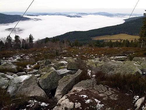 Käsplatte Mountain, Sankt Englmar12 km NE
-
Hadriwa Mountain, Haibach9.6 km NE
-
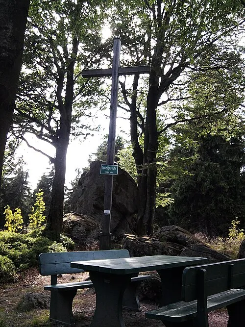 Predigtstuhl Mountain, Sankt Englmar13 km E
Nearest towns and villages
-
Mitterfels Village, Mitterfels, Markt0.8 km N
-
Scheibelsgrub Village, Mitterfels, Markt0.6 km SW
-
Hinterbuchberg Village, Mitterfels, Markt0.8 km E
-
 Weingarten Village, Mitterfels, Markt1.6 km SW
Sources & licences
Data last updated: