Fellen
Located in Landkreis Main-Spessart, Lower Franconia Coordinates: 50°09′00″ N 9°35′00″ E
- Population
- 834
- 834
- Elevation
- 244 m
- above sea level
- Local time
- UTC+01:00
- Europe/Berlin · UTC+01:00
- Places inside
- 11
- listed under Fellen
- Airports
- FRA Frankfurt Main Airport75 km
- MHG Mannheim-City Airport108 km
About Fellen
Fellen is a village. Location: Landkreis Main-Spessart, Lower Franconia. Population: 834. Elevation: 244 m. The best months to visit are June–August. The nearest airport is Frankfurt Main Airport (75 km). Nearby sights include Fella and Aß Grund.
Photos of Fellen
-
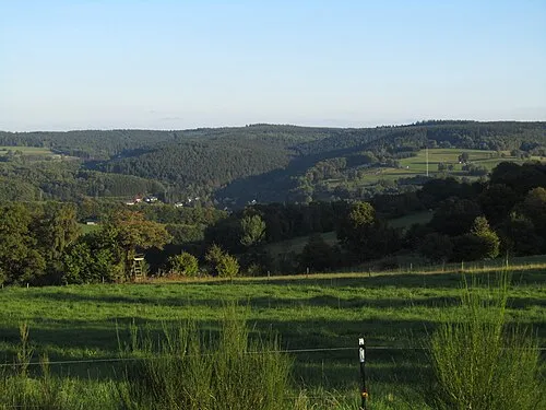
Hermannskoppe Jörg Braukmann · CC BY-SA 3.0

Climate of Fellen
Best months for sightseeingBest months for sightseeing: June–August.
This month · November
A cold month
Day 7° · Night 2° · Rain 84 mm
- Hottest month
- July (day 23°)
- Coldest month
- January (night -2°)
- Wettest month
- December (101 mm)
- Driest month
- April (59 mm)
Bars: average monthly low and high temperature. Below: precipitation. Monthly averages for 1970–2000 at about 18 km resolution, adjusted for elevation. Highlighted months are mild and relatively dry. Source: WorldClim 2.1 (CC BY 4.0).
Show values as a table
| Month | Jan | Feb | Mar | Apr | May | Jun | Jul | Aug | Sep | Oct | Nov | Dec |
|---|---|---|---|---|---|---|---|---|---|---|---|---|
| Average high (°C) | 3° | 4° | 8° | 13° | 18° | 21° | 23° | 23° | 18° | 13° | 7° | 4° |
| Average low (°C) | -2° | -2° | 1° | 4° | 8° | 11° | 13° | 13° | 9° | 6° | 2° | 0° |
| Precipitation (mm) | 86 | 74 | 75 | 59 | 65 | 75 | 84 | 63 | 70 | 81 | 84 | 101 |
How to get to Fellen
The nearest airport is Frankfurt Main Airport (FRA), 75 km to the west as the crow flies. The nearest large city is Würzburg, 48 km to the southeast.
Airports
- Frankfurt Main Airport (FRA) Frankfurt am Main 75 kmwest
- Mannheim-City Airport (MHG) Mannheim 108 kmsouthwest
- Nuremberg Airport (NUE) Nuremberg 130 kmsoutheast
Nearby large cities
- Würzburg Population: 133.7K 48 kmsoutheast
- Offenbach Population: 119.2K 59 kmwest
- Frankfurt am Main Population: 650K 64 kmwest
- Darmstadt Population: 167K 74 kmsouthwest
- Mainz Population: 222.9K 95 kmwest
Straight-line distances; road distances are longer. Airport data: OurAirports.
Day trips from Fellen
Within 100 km: 1,123 historic and cultural sites, 4,592 natural sites, 804 lakes, rivers and coasts.
0–25 km418 places
- Kinzigtalsperre Lake 20 kmNW
- Steigkoppe Mountain 23 kmSW
- Zöllersberg Mountain 8 kmNW
- Zimmerberg Mountain 25 kmE
25–60 km1,834 places
- Unterer Metzenweiher Lake 48 kmN
- Sennfelder See Lake 49 kmE
- Schwanensee Lake 56 kmSE
- Oberer Metzenweiher Lake 49 kmN
60–100 km4,267 places
- Umpfer River 68 kmS
- Uzbach River 80 kmSE
- Ohe River 95 kmNW
- Modau River 89 kmSW
Straight-line distances.
Places in Fellen
11 placesBar: population relative to the most populous place in this list.
Cities & villages3
- Neuhof · Village
- Rengersbrunn · Village
- Wohnrod · Village
Mountains & nature7
- Hintere Wart · Mountain
- Koppe · Mountain
- Lohrer Höhe · Mountain
- Richtberg · Mountain
- Sinneberg · Mountain
- Vordere Wart · Mountain
- Wartküppel · Mountain
Nearby attractions & nature
Everything nearby-
Fella River, Bavaria1.2 km NE
-
Aß Grund Natural site, Bavaria2.5 km NW
-
Petzchen Mountain, Aura i.Sinngrund3 km NW
-
Gresselwald Natural site, Bavaria2.8 km NE
-
Sägberg Mountain, Bavaria4.9 km NW
-
Rienecker Koppe Mountain, Rieneck5 km SE
Sources & licences
Data last updated: