Landkreis Neustadt an der Aisch-Bad Windsheim
Located in Middle Franconia, Bavaria Coordinates: 49°34′09″ N 10°28′38″ E
- Population
- 101,043
- 101K
- Elevation
- 384 m
- above sea level
- Local time
- UTC+01:00
- Europe/Berlin · UTC+01:00
- Places inside
- 38
- listed under Landkreis Neustadt an der Aisch-Bad Windsheim
- Airports
- NUE Nuremberg Airport44 km
- STR Stuttgart Airport134 km
About Landkreis Neustadt an der Aisch-Bad Windsheim
Landkreis Neustadt an der Aisch-Bad Windsheim is a municipality. Location: Middle Franconia, Bavaria. Population: 101,043. Elevation: 384 m. The best months to visit are June–August. The nearest airport is Nuremberg Airport (44 km). Nearby sights include Güterwald and Kreutgraben.
Photos of Landkreis Neustadt an der Aisch-Bad Windsheim
-
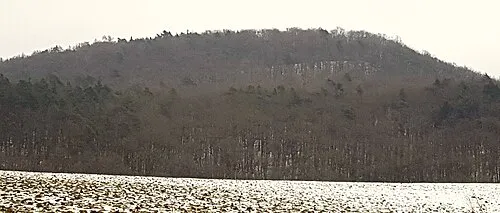
Rotes Hörnle Nico1995fcb · CC0 -
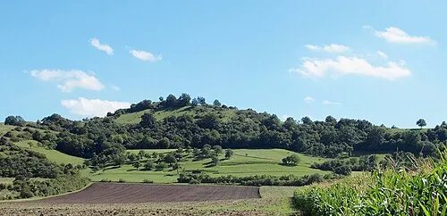
Petersberg Kreuzschnabel · CC BY-SA 3.0 -
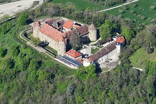
Schloss Frankenberg Carsten Steger · CC BY-SA 4.0


Climate of Landkreis Neustadt an der Aisch-Bad Windsheim
Best months for sightseeingBest months for sightseeing: June–August.
This month · November
A cold month
Day 6° · Night 0° · Rain 53 mm
- Hottest month
- August (day 23°)
- Coldest month
- January (night -3°)
- Wettest month
- June (78 mm)
- Driest month
- February (46 mm)
Bars: average monthly low and high temperature. Below: precipitation. Monthly averages for 1970–2000 at about 18 km resolution, adjusted for elevation. Highlighted months are mild and relatively dry. Source: WorldClim 2.1 (CC BY 4.0).
Show values as a table
| Month | Jan | Feb | Mar | Apr | May | Jun | Jul | Aug | Sep | Oct | Nov | Dec |
|---|---|---|---|---|---|---|---|---|---|---|---|---|
| Average high (°C) | 2° | 4° | 9° | 13° | 19° | 21° | 23° | 23° | 19° | 13° | 6° | 3° |
| Average low (°C) | -3° | -3° | 0° | 2° | 7° | 10° | 12° | 11° | 8° | 4° | 0° | -2° |
| Precipitation (mm) | 50 | 46 | 50 | 50 | 64 | 78 | 72 | 57 | 52 | 56 | 53 | 59 |
How to get to Landkreis Neustadt an der Aisch-Bad Windsheim
The nearest airport is Nuremberg Airport (NUE), 44 km to the east as the crow flies. The nearest large city is Erlangen, 38 km to the east.
Airports
- Nuremberg Airport (NUE) Nuremberg 44 kmeast
- Stuttgart Airport (STR) Stuttgart 134 kmsouthwest
- Mannheim-City Airport (MHG) Mannheim 143 kmwest
Nearby large cities
- Erlangen Population: 102.7K 38 kmeast
- Fürth Population: 132K 38 kmeast
- Nuremberg Population: 515.5K 45 kmeast
- Würzburg Population: 133.7K 45 kmnorthwest
- Heilbronn Population: 120.7K 103 kmsouthwest
Straight-line distances; road distances are longer. Airport data: OurAirports.
Day trips from Landkreis Neustadt an der Aisch-Bad Windsheim
Within 100 km: 1,425 historic and cultural sites, 3,538 natural sites, 773 lakes, rivers and coasts.
0–25 km457 places
- Uzbach River 22 kmW
- Wolfsee Lake 9 kmNW
- Tränksee Lake 20 kmNW
- Sperbersee Lake 13 kmNW
25–60 km1,945 places
- Umpfer River 54 kmW
- Badsee Lake 39 kmN
- Welles Weiher Lake 34 kmE
- Unterer Herrnsee Lake 38 kmNE
60–100 km3,334 places
- Waldstadion Weismain Landmark 80 kmNE
- Hessental Concentration Camp Historic site 73 kmSW
- Spitzelberg Mountain 70 kmE
- Stollenberg Mountain 68 kmE
Straight-line distances.
Landkreis Neustadt an der Aisch-Bad Windsheim and similar cities
Side by side with cities of similar size in the same country: population, elevation and climate.
| Measure | Landkreis Neustadt an der Aisch-Bad Windsheim | Trier | Erlangen | Moers |
|---|---|---|---|---|
| Population | 101K | 100.1K | 102.7K | 103.5K |
| Elevation | 384 m | 141 m | 290 m | 29 m |
| Summer day (hottest month) | 23° | 24° | 24° | 24° |
| Winter night (coldest month) | -3° | 0° | -3° | 1° |
| Annual rainfall | 687 mm | 817 mm | 745 mm | 770 mm |
| Best months | Jun–Aug | Jun–Sep | May–Sep | Jun–Sep |
| Distance | — | 278 km | 38 km | 344 km |
Climate values are 1970–2000 monthly averages; straight-line distance.
Places in Landkreis Neustadt an der Aisch-Bad Windsheim
38 places- 1 Neustadt a.d.Aisch 13.3K
- 2 Bad Windsheim 12.4K
- 3 Uffenheim 6.4K
- 4 Emskirchen, Markt 5.9K
- 5 Markt Erlbach, Markt 5.6K
- 6 Scheinfeld 4.6K
- 7 Diespeck 3.7K
- 8 Burgbernheim 3.5K
- 9 Uehlfeld, Markt 3.1K
- 10 Burghaslach, Markt 2.7K
- 11 Gerhardshofen 2.5K
- 12 Obernzenn, Markt 2.5K
- 13 Sugenheim, Markt 2.3K
- 14 Neuhof a.d.Zenn, Markt 2.2K
- 15 Ipsheim, Markt 2.2K
- 16 Dietersheim 2.1K
- 17 Dachsbach, Markt 1.8K
- 18 Markt Bibart, Markt 1.8K
- 19 Hagenbüchach 1.7K
- 20 Marktbergel, Markt 1.6K
- 21 Münchsteinach 1.4K
- 22 Wilhelmsdorf 1.4K
- 23 Gutenstetten 1.3K
- 24 Trautskirchen 1.3K
- 25 Baudenbach, Markt 1.3K
- 26 Markt Nordheim, Markt 1.1K
- 27 Langenfeld 1.1K
- 28 Ippesheim, Markt 1.1K
- 29 Ergersheim 1.1K
- 30 Oberscheinfeld, Markt 1K
- 31 Markt Taschendorf, Markt 1K
- 32 Weigenheim 984
- 33 Simmershofen 952
- 34 Illesheim 945
- 35 Gollhofen 883
- 36 Gallmersgarten 751
- 37 Oberickelsheim 715
- 38 Hemmersheim 664
Bar: population relative to the most populous place in this list.
Nearby attractions & nature
Everything nearby-
Güterwald Natural site, Bavaria1.3 km W
-
Kreutgraben River, Bavaria1.7 km NE
-
Güterholz Natural site, Bavaria3 km N
-
Buchwald Natural site, Bavaria3.5 km N
-
Tiefenbach River, Bavaria5.5 km N
-
Nesselbach River, Bavaria5.8 km E
-
Beerbach River, Bavaria6.1 km E
-
Fuchsau Natural site, Bavaria7.4 km N
Sources & licences
Data last updated: