Pfofeld
Located in Landkreis Weißenburg-Gunzenhausen, Middle Franconia Coordinates: 49°07′00″ N 10°50′00″ E
- Population
- 1,470
- 1.5K
- Elevation
- 487 m
- above sea level
- Local time
- UTC+01:00
- Europe/Berlin · UTC+01:00
- Places inside
- 6
- listed under Pfofeld
- Airports
- NUE Nuremberg Airport46 km
- MUC Munich Airport110 km
About Pfofeld
Pfofeld is a village. Location: Landkreis Weißenburg-Gunzenhausen, Middle Franconia. Population: 1,470. Elevation: 487 m. The best months to visit are June–August. The nearest airport is Nuremberg Airport (46 km). Nearby sights include Kleinkastell Gunzenhausen Hinterer Schlossberg and Erdkastell Theilenhofen.
Photos of Pfofeld
-
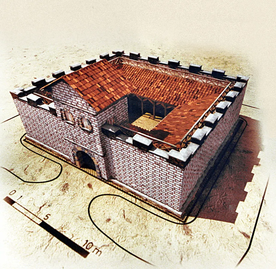
Kleinkastell Gunzenhausen Hinterer Schlossberg unbekannt. Photographiert mit einer Minolta X 700. Objektiv: Tokina 28-70 mm. Film: 24-DIN-Film · Public domain

Climate of Pfofeld
Best months for sightseeingBest months for sightseeing: June–August.
This month · November
A cold month
Day 6° · Night 0° · Rain 56 mm
- Hottest month
- August (day 23°)
- Coldest month
- January (night -4°)
- Wettest month
- June (84 mm)
- Driest month
- February (47 mm)
Bars: average monthly low and high temperature. Below: precipitation. Monthly averages for 1970–2000 at about 18 km resolution, adjusted for elevation. Highlighted months are mild and relatively dry. Source: WorldClim 2.1 (CC BY 4.0).
Show values as a table
| Month | Jan | Feb | Mar | Apr | May | Jun | Jul | Aug | Sep | Oct | Nov | Dec |
|---|---|---|---|---|---|---|---|---|---|---|---|---|
| Average high (°C) | 2° | 4° | 9° | 13° | 18° | 21° | 23° | 23° | 19° | 13° | 6° | 3° |
| Average low (°C) | -4° | -3° | 0° | 3° | 7° | 10° | 12° | 12° | 8° | 4° | 0° | -2° |
| Precipitation (mm) | 49 | 47 | 49 | 52 | 72 | 84 | 82 | 67 | 56 | 59 | 56 | 60 |
How to get to Pfofeld
The nearest airport is Nuremberg Airport (NUE), 46 km to the northeast as the crow flies. The nearest large city is Nuremberg, 42 km to the northeast.
Airports
- Nuremberg Airport (NUE) Nuremberg 46 kmnortheast
- Munich Airport (MUC) Munich 110 kmsoutheast
- Stuttgart Airport (STR) Stuttgart 127 kmwest
Nearby large cities
- Nuremberg Population: 515.5K 42 kmnortheast
- Fürth Population: 132K 42 kmnorth
- Erlangen Population: 102.7K 54 kmnorth
- Ingolstadt Population: 120.7K 58 kmsoutheast
- Augsburg Population: 301.1K 83 kmsouth
Straight-line distances; road distances are longer. Airport data: OurAirports.
Day trips from Pfofeld
Within 100 km: 1,251 historic and cultural sites, 2,836 natural sites, 636 lakes, rivers and coasts.
0–25 km244 places
- Kreutweiher Lake 19 kmW
- Klarweiher Lake 18 kmW
- Igelsbachsee Lake 6 kmNE
- Altmühlsee Lake 8 kmW
25–60 km1,164 places
- Zusam River 47 kmS
- Welles Weiher Lake 55 kmN
- Stephansweiher Lake 49 kmN
- Rosenweiher Lake 46 kmN
60–100 km3,315 places
- Hessental Concentration Camp Historic site 77 kmW
- Spitzelberg Mountain 67 kmNE
- Stollenberg Mountain 64 kmNE
- Deckersberg Mountain 61 kmNE
Straight-line distances.
Places in Pfofeld
6 placesPfofeld
Population: 1.4K

Langlau
Population: 655

Rehenbühl
Population: 195

Gundelshalm
Population: 86
Nearby attractions & nature
Everything nearby-
Kleinkastell Gunzenhausen Hinterer Schlossberg Historic site, Gunzenhausen3.8 km W
-
Erdkastell Theilenhofen Historic site, Theilenhofen3.2 km S
-
Kastell Theilenhofen Historic site, Theilenhofen3.2 km S
-
Burgstall Natural site, Bavaria3.6 km W
-
Kleiner Brombachsee Lake, Bavaria4.2 km NE
-
Pfaffenberg Mountain, Ellingen5.8 km SE
Other cities and towns in Landkreis Weißenburg-Gunzenhausen
-
 Unterasbach Village, Gunzenhausen4.4 km SW
-
 Igelsbach Village, Absberg, Markt5.1 km N
-
 Wachstein Village, Theilenhofen4.6 km S
-
 Stopfenheim Village, Ellingen6.5 km SE
-
Brand Village, Haundorf5 km NW
-
 Veitserlbach Village, Pleinfeld, Markt5.7 km E
Sources & licences
Data last updated: