
- Population
- 35
- 35
- Elevation
- 456 m
- above sea level
- Local time
- UTC+01:00
- Europe/Berlin · UTC+01:00
- Airports
- NUE Nuremberg Airport19 km
- MUC Munich Airport128 km
About Weihersberg
Weihersberg is a village. Location: Leinburg, Nürnberger Land. Population: 35. Elevation: 456 m. The best months to visit are June–August. The nearest airport is Nuremberg Airport (19 km). Nearby sights include Reuther Berg and Moritzberg.
Photos of Weihersberg
-
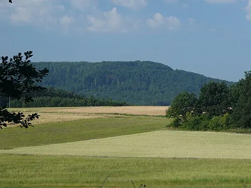
Nonnenberg Mikmaq · CC BY 3.0 -
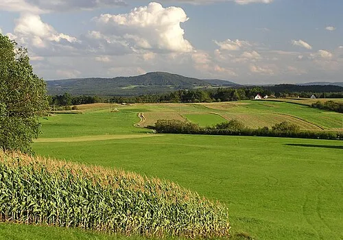
Moritzberg Klaus M · CC BY-SA 3.0


Population of Weihersberg over time
| 1875 | 35 | |
|---|---|---|
| 1925 | 22 | |
| 1950 | 32 | |
| 1970 | 12 | |
| 1987 | 26 |
Censuses and official estimates; source: Wikidata.
Climate of Weihersberg
Best months for sightseeingBest months for sightseeing: June–August.
This month · November
A cold month
Day 6° · Night 0° · Rain 62 mm
- Hottest month
- July (day 23°)
- Coldest month
- January (night -4°)
- Wettest month
- June (89 mm)
- Driest month
- February (50 mm)
Bars: average monthly low and high temperature. Below: precipitation. Monthly averages for 1970–2000 at about 18 km resolution, adjusted for elevation. Highlighted months are mild and relatively dry. Source: WorldClim 2.1 (CC BY 4.0).
Show values as a table
| Month | Jan | Feb | Mar | Apr | May | Jun | Jul | Aug | Sep | Oct | Nov | Dec |
|---|---|---|---|---|---|---|---|---|---|---|---|---|
| Average high (°C) | 2° | 3° | 8° | 12° | 18° | 21° | 23° | 23° | 18° | 12° | 6° | 3° |
| Average low (°C) | -4° | -4° | -1° | 2° | 7° | 10° | 12° | 11° | 8° | 4° | 0° | -2° |
| Precipitation (mm) | 60 | 50 | 57 | 56 | 73 | 89 | 86 | 72 | 61 | 62 | 62 | 71 |
How to get to Weihersberg
The nearest airport is Nuremberg Airport (NUE), 19 km to the west as the crow flies. The nearest large city is Nuremberg, 18 km to the west.
Airports
- Nuremberg Airport (NUE) Nuremberg 19 kmwest
- Munich Airport (MUC) Munich 128 kmsouth
- Karlovy Vary Airport (KLV) Karlovy Vary 141 kmnortheast
Nearby large cities
- Nuremberg Population: 515.5K 18 kmwest
- Fürth Population: 132K 25 kmwest
- Erlangen Population: 102.7K 27 kmnorthwest
- Regensburg Population: 151.4K 75 kmsoutheast
- Ingolstadt Population: 120.7K 78 kmsouth
Straight-line distances; road distances are longer. Airport data: OurAirports.
Day trips from Weihersberg
Within 100 km: 1,276 historic and cultural sites, 3,249 natural sites, 726 lakes, rivers and coasts.
0–25 km403 places
- Spitzelberg Mountain 14 kmNE
- Stollenberg Mountain 12 kmNE
- Deckersberg Mountain 10 kmE
- Kreuzweiher Lake 19 kmNW
25–60 km1,535 places
- Welles Weiher Lake 32 kmNW
- Unterer Herrnsee Lake 44 kmNW
- Stephansweiher Lake 30 kmW
- Schleifweiher Lake 50 kmE
60–100 km3,313 places
- Waldstadion Weismain Landmark 70 kmN
- Český Les Mountain 88 kmE
- Zusam River 94 kmSW
- Uzbach River 84 kmW
Straight-line distances.
Nearby attractions & nature
Everything nearby-
Reuther Berg Mountain, Leinburg0.6 km N
-
Moritzberg Mountain, Röthenbach a.d.Pegnitz1.3 km NW
-
Aussichtsturm Moritzberg Landmark, Röthenbach a.d.Pegnitz1.4 km NW
-
Nonnenberg Mountain, Bavaria2.5 km E
-
Grünberg Mountain, Lauf a.d.Pegnitz2.3 km N
-
Buchenberg Mountain, Leinburg4.1 km E
Other cities and towns in Leinburg
-
 Weißenbrunn Village, Leinburg4.3 km SE
-
 Scheerau Village, Leinburg2.9 km W
-
 Entenberg Village, Leinburg3.1 km E
-
 Ernhofen Village, Leinburg5.2 km SE
-
Gersberg Village, Leinburg2.6 km NE
-
Diepersdorf Village, Leinburg2.7 km W
Sources & licences
Data last updated: · 2 independent sources