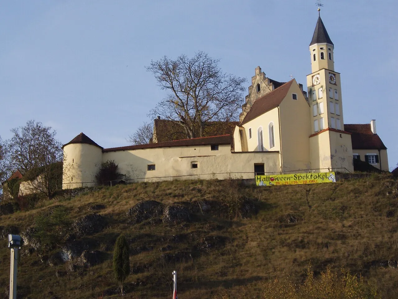
Schloss Hexenagger
Located in Altmannstein, Markt, Landkreis Eichstätt Coordinates: 48°55′18″ N 11°40′55″ E
- Local time
- UTC+01:00
- Europe/Berlin · UTC+01:00
- Elevation
- 409 m
- above sea level
- Airports
- MUC Munich Airport64 km
- NUE Nuremberg Airport78 km
About Schloss Hexenagger
Schloss Hexenagger is a historic site. Location: Altmannstein, Markt, Landkreis Eichstätt.
Schloss Hexenagger is a Bavarian castle located in the district of Hexenagger located near the town of Altmannstein in the Altmühl Valley Nature Park (Naturpark Altmühltal). The castle probably was first built in the tenth century, as it is first mentioned in a record from the Monastery of St. Emmeram of Regensburg in 982. Originally, the Bavarian noble family of Muggenthaler resided in the castle. The castle was destroyed during the Thirty Years' War and rebuilt in the Baroque style.
Source: Wikipedia · CC BY-SA 4.0
At a glance
- Heritage designation
- architectural heritage monument in Bavaria
Source: Wikidata
Climate of Schloss Hexenagger
Best months for sightseeingBest months for sightseeing: June–August.
This month · November
A cold month
Day 6° · Night 1° · Rain 58 mm
- Hottest month
- July (day 23°)
- Coldest month
- January (night -4°)
- Wettest month
- July (87 mm)
- Driest month
- February (46 mm)
Bars: average monthly low and high temperature. Below: precipitation. Monthly averages for 1970–2000 at about 18 km resolution, adjusted for elevation. Highlighted months are mild and relatively dry. Source: WorldClim 2.1 (CC BY 4.0).
Show values as a table
| Month | Jan | Feb | Mar | Apr | May | Jun | Jul | Aug | Sep | Oct | Nov | Dec |
|---|---|---|---|---|---|---|---|---|---|---|---|---|
| Average high (°C) | 1° | 3° | 8° | 13° | 19° | 21° | 23° | 23° | 19° | 12° | 6° | 3° |
| Average low (°C) | -4° | -3° | 0° | 3° | 8° | 11° | 13° | 12° | 9° | 5° | 1° | -2° |
| Precipitation (mm) | 54 | 46 | 53 | 48 | 71 | 86 | 87 | 73 | 59 | 58 | 58 | 61 |
How to get to Schloss Hexenagger
The nearest airport is Munich Airport (MUC), 64 km to the south as the crow flies. The nearest large city is Ingolstadt, 26 km to the southwest.
Airports
- Munich Airport (MUC) Munich 64 kmsouth
- Nuremberg Airport (NUE) Nuremberg 78 kmnorthwest
- Memmingen Allgau Airport (FMM) Memmingen 149 kmsouthwest
Nearby large cities
- Ingolstadt Population: 120.7K 26 kmsouthwest
- Regensburg Population: 151.4K 32 kmeast
- Nuremberg Population: 515.5K 74 kmnorthwest
- Fürth Population: 132K 80 kmnorthwest
- Augsburg Population: 301.1K 84 kmsouthwest
Straight-line distances; road distances are longer. Airport data: OurAirports.
Nearby attractions & nature
Everything nearby-
Burgruine Altmannstein Historic site, Altmannstein, Markt3.5 km SW
-
Schloss Rosenburg Historic site, Riedenburg4.3 km N
-
Burg Prunn Historic site, Riedenburg5.3 km NE
-
Burgruine Tachenstein Historic site, Riedenburg4.6 km N
-
Sandbuckel Mountain, Bavaria3.8 km E
-
Pflegholz Natural site, Bavaria3.1 km NW
-
Prunn Castle Historic site, Riedenburg5.3 km NE
-
Schloss Sandersdorf Historic site, Altmannstein, Markt5.8 km SW
Nearest towns and villages
-
Ottersdorf Village, Altmannstein, Markt0.1 km W
-
Hexenagger Village, Altmannstein, Markt0.3 km E
-
Riedenburg Village, Landkreis Kelheim5 km N
-
Althexenagger Village, Altmannstein, Markt2.1 km S
Sources & licences
Data last updated: · 2 independent sources