- Elevation
- 487 m
- above sea level
- Local time
- UTC+01:00
- Europe/Berlin · UTC+01:00
- Airports
- MUC Munich Airport28 km
- NUE Nuremberg Airport110 km
About Traich
Traich is a village. Location: Rudelzhausen, Landkreis Freising. Elevation: 487 m. The best months to visit are June–August. The nearest airport is Munich Airport (28 km). Nearby sights include Schindlberg and NDB-Funkfeuer MIQ.
Climate of Traich
Best months for sightseeingBest months for sightseeing: June–August.
This month · November
A cold month
Day 6° · Night 0° · Rain 61 mm
- Hottest month
- July (day 23°)
- Coldest month
- January (night -4°)
- Wettest month
- June (98 mm)
- Driest month
- February (44 mm)
Bars: average monthly low and high temperature. Below: precipitation. Monthly averages for 1970–2000 at about 18 km resolution, adjusted for elevation. Highlighted months are mild and relatively dry. Source: WorldClim 2.1 (CC BY 4.0).
Show values as a table
| Month | Jan | Feb | Mar | Apr | May | Jun | Jul | Aug | Sep | Oct | Nov | Dec |
|---|---|---|---|---|---|---|---|---|---|---|---|---|
| Average high (°C) | 1° | 3° | 8° | 12° | 18° | 21° | 23° | 23° | 18° | 12° | 6° | 3° |
| Average low (°C) | -4° | -4° | 0° | 2° | 7° | 10° | 12° | 12° | 8° | 4° | 0° | -3° |
| Precipitation (mm) | 49 | 44 | 54 | 56 | 80 | 98 | 97 | 87 | 68 | 59 | 61 | 56 |
How to get to Traich
The nearest airport is Munich Airport (MUC), 28 km to the south as the crow flies. The nearest large city is Ingolstadt, 28 km to the northwest.
Airports
- Munich Airport (MUC) Munich 28 kmsouth
- Nuremberg Airport (NUE) Nuremberg 110 kmnorthwest
- Memmingen Allgau Airport (FMM) Memmingen 129 kmsouthwest
Nearby large cities
- Ingolstadt Population: 120.7K 28 kmnorthwest
- Munich Population: 1.5M 53 kmsouth
- Regensburg Population: 151.4K 54 kmnortheast
- Augsburg Population: 301.1K 65 kmsouthwest
- Nuremberg Population: 515.5K 106 kmnorthwest
Straight-line distances; road distances are longer. Airport data: OurAirports.
Day trips from Traich
Within 100 km: 674 historic and cultural sites, 1,668 natural sites, 518 lakes, rivers and coasts.
0–25 km54 places
- Unterweiher Lake 14 kmN
- Oberweiher Lake 13 kmN
- Ausgleichweiher Lake 24 kmSE
- Reigersberg Mountain 23 kmSW
25–60 km701 places
- elf-pavlik's tent Historic site 47 kmS
- Stauweiher Lake 27 kmSE
- Speichersee Lake 43 kmS
- Gretlmühle Lake 38 kmE
60–100 km2,105 places
- Frauenchiemsee Island 97 kmSE
- Schloss Hirschberg am Haarsee Historic site 95 kmSW
- Herreninsel Island 97 kmSE
- Isar River 96 kmE
Straight-line distances.
Nearby attractions & nature
Everything nearby-
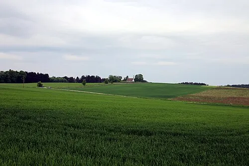 Schindlberg Mountain, Wolfersdorf14 km S
-
NDB-Funkfeuer MIQ Landmark, Wolnzach, Markt9.2 km SW
-
Eschelbach Concentration Camp Historic site, Wolnzach, Markt10 km W
-
Jägerberg Mountain, Bavaria13 km N
-
Pötzmes, Pfarrkirche St. Georg Attraction, Attenhofen9.3 km NE
-
Lustholz Natural site, Bavaria12 km SW
Sources & licences
Data last updated: