Schliersberg
Located in Schliersee, Markt, Landkreis Miesbach Coordinates: 47°44′35″ N 11°53′21″ E
- Elevation
- 1,265 m
- above sea level
- Local time
- UTC+01:00
- Europe/Berlin · UTC+01:00
- Airports
- INN Innsbruck Airport68 km
- MUC Munich Airport68 km
About Schliersberg
Schliersberg is a mountain. Location: Schliersee, Markt, Landkreis Miesbach. Elevation: 1,265 m.
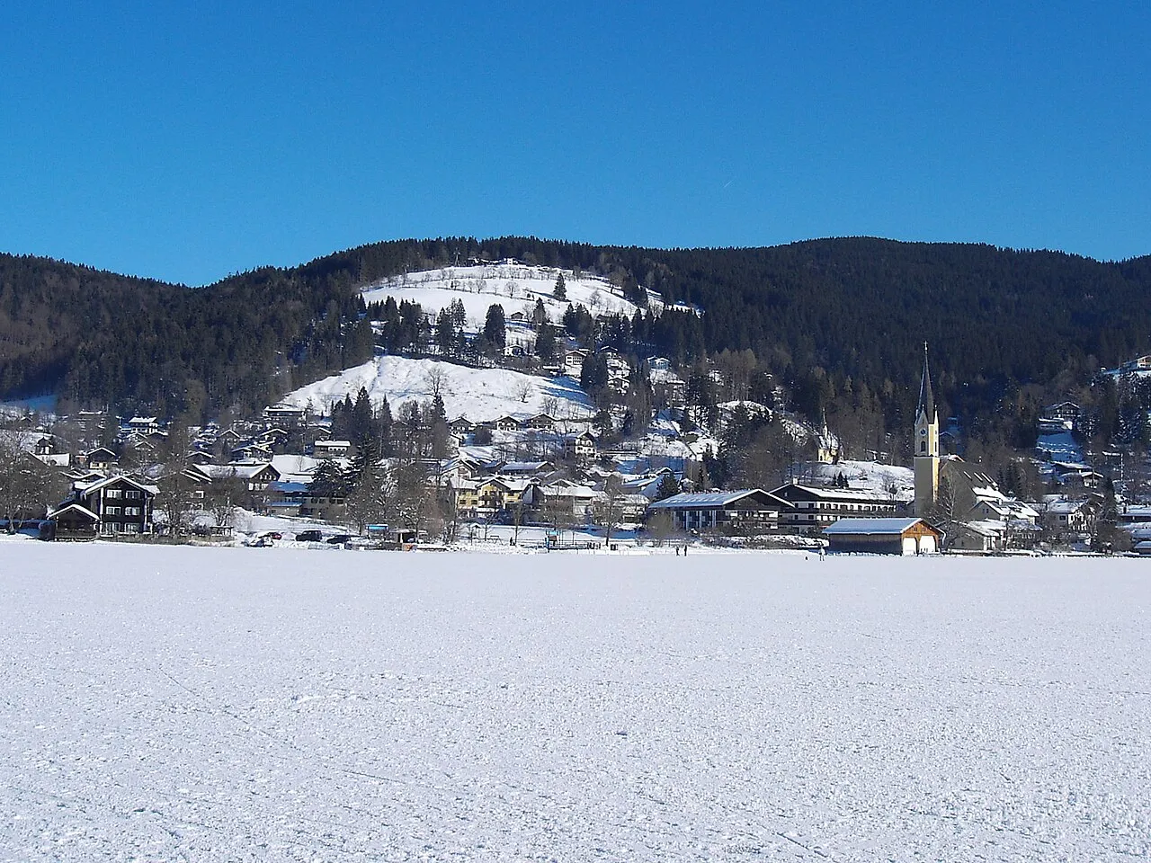
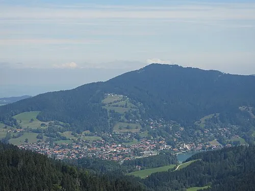
The Schliersberg (also known as Rhonberg or Rohnberg) is a 1,265-metre-high (4,150 ft) mountain in the Bavarian Prealps above the village Schliersee (Miesbach district, Upper Bavaria) and Lake Schliersee. The wooded summit can be reached within a 1.5 hour hike and passes the hut Schliersbergalm, located 1,055 m above sea level, which can also be reached by a cable car since 1952.
Source: Wikipedia · CC BY-SA 4.0
Photos of Schliersberg
-

Strubbl · CC BY-SA 4.0 -

Strubbl · CC BY-SA 4.0 -
Sterneck Wasquewhat · CC BY-SA 4.0 -
Schwarzenberg Wasquewhat · CC BY-SA 4.0 -
Rainerberg Wasquewhat · CC BY-SA 3.0


Climate of Schliersberg
Best months for sightseeingBest months for sightseeing: July–August.
This month · November
A cold month
Day 4° · Night -3° · Rain 94 mm
- Hottest month
- July (day 19°)
- Coldest month
- January (night -7°)
- Wettest month
- July (170 mm)
- Driest month
- January (72 mm)
Bars: average monthly low and high temperature. Below: precipitation. Monthly averages for 1970–2000 at about 18 km resolution, adjusted for elevation. Highlighted months are mild and relatively dry. Source: WorldClim 2.1 (CC BY 4.0).
Show values as a table
| Month | Jan | Feb | Mar | Apr | May | Jun | Jul | Aug | Sep | Oct | Nov | Dec |
|---|---|---|---|---|---|---|---|---|---|---|---|---|
| Average high (°C) | 0° | 1° | 5° | 8° | 14° | 16° | 19° | 18° | 15° | 10° | 4° | 0° |
| Average low (°C) | -7° | -7° | -4° | -1° | 4° | 7° | 9° | 9° | 6° | 2° | -3° | -6° |
| Precipitation (mm) | 72 | 72 | 89 | 97 | 118 | 160 | 170 | 158 | 108 | 80 | 94 | 86 |
How to get to Schliersberg
The nearest airport is Innsbruck Airport (INN), 68 km to the southwest as the crow flies. The nearest large city is Munich, 50 km to the northwest.
Airports
- Innsbruck Airport (INN) Innsbruck 68 kmsouthwest
- Munich Airport (MUC) Munich 68 kmnorth
- Salzburg Airport (SZG) Salzburg 84 kmeast
Nearby large cities
- Munich Population: 1.5M 50 kmnorthwest
- Innsbruck Population: 132.5K 65 kmsouthwest
- Salzburg Population: 157.2K 87 kmeast
- Augsburg Population: 301.1K 102 kmnorthwest
- Ingolstadt Population: 120.7K 119 kmnorth
Straight-line distances; road distances are longer. Airport data: OurAirports.
Day trips from Schliersberg
Within 100 km: 468 historic and cultural sites, 3,862 natural sites, 1,166 lakes, rivers and coasts.
0–25 km464 places
- Veitsberg Mountain 20 kmS
- Trainsjoch Mountain 19 kmSE
- Schneidjoch Mountain 21 kmS
- Schinder Mountain 16 kmS
25–60 km1,453 places
- Bayerisches Oberland Mountain 40 kmW
- Frauenchiemsee Island 43 kmE
- Schloss Hirschberg am Haarsee Historic site 51 kmW
- Herreninsel Island 40 kmE
60–100 km3,579 places
- Fürlegsee Lake 87 kmSE
- Wildsee Lake 71 kmSW
- Eissee Lake 84 kmSE
- Brandlsee Lake 87 kmSE
Straight-line distances.
Nearest towns and villages
-
 Schliersee Town, Schliersee, Markt2.4 km W
-
Hausham Town, Hausham3.7 km W
-
Oberleiten Village, Schliersee, Markt2.2 km SW
-
Kalkgraben Village, Schliersee, Markt2.6 km W
-
Grandau Village, Fischbachau2 km N
-
Westenhofen Neighbourhood, Schliersee, Markt2.8 km W
Nearby attractions & nature
Everything nearby-
Breitenberg Mountain, Schliersee, Markt2.3 km SE
-
Gern Mountain, Miesbach3.1 km NW
-
Brentenspitz Mountain, Hausham2.9 km NW
-
Kellnerberg Mountain, Schliersee, Markt3.6 km S
-
Stadlberg Mountain, Miesbach3.8 km NW
-
Leitner Graben River, Bavaria2.3 km SW
-
Schlierach River, Schliersee, Markt2.8 km SW
-
Hirschgröhrkopf Mountain, Schliersee, Markt3.3 km S
More nature in Germany
-
Rainerberg Mountain, Schliersee, Markt4.9 km W
-
Huberspitz Mountain, Schliersee, Markt4 km W
-
 Jägerkamp Mountain, Schliersee, Markt7.8 km S
-
Brunstkogel Mountain, Schliersee, Markt5 km SW
-
Rainerkopf Mountain, Schliersee, Markt7.2 km SW
-
 Bodenschneid Mountain, Schliersee, Markt8.8 km SW
Sources & licences
Data last updated: · 2 independent sources