Eiberg
Located in Aschau im Chiemgau, Landkreis Rosenheim Coordinates: 47°46′29″ N 12°21′53″ E
- Elevation
- 1,002 m
- above sea level
- Local time
- UTC+01:00
- Europe/Berlin · UTC+01:00
- Airports
- SZG Salzburg Airport48 km
- MUC Munich Airport78 km
About Eiberg
Eiberg is a mountain. Location: Aschau im Chiemgau, Landkreis Rosenheim. Elevation: 1,002 m. The best months to visit are June–August. The nearest airport is Salzburg Airport (48 km). Nearby sights include Erlberg-Kopf and Sulten.
Photos of Eiberg
-
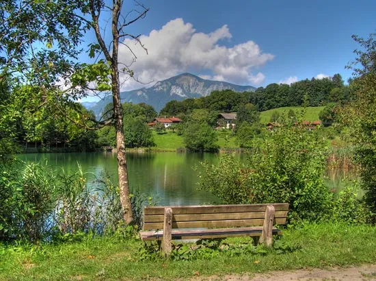
Hochplatte Ludwig Flug · CC BY-SA 3.0 -
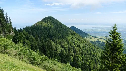
Friedenrath 2015 Michael 2015 · CC BY-SA 4.0 -
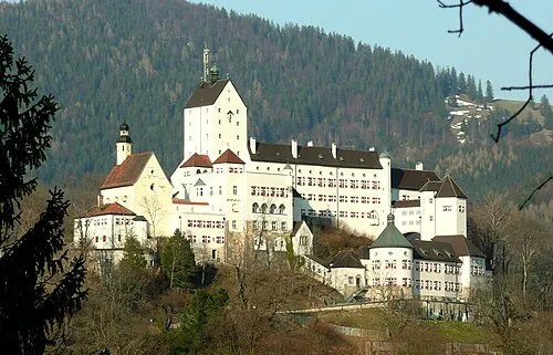
Schloss Hohenaschau WerWil · CC BY-SA 3.0


Climate of Eiberg
Best months for sightseeingBest months for sightseeing: June–August.
This month · November
A cold month
Day 5° · Night -2° · Rain 91 mm
- Hottest month
- July (day 20°)
- Coldest month
- January (night -6°)
- Wettest month
- July (167 mm)
- Driest month
- February (71 mm)
Bars: average monthly low and high temperature. Below: precipitation. Monthly averages for 1970–2000 at about 18 km resolution, adjusted for elevation. Highlighted months are mild and relatively dry. Source: WorldClim 2.1 (CC BY 4.0).
Show values as a table
| Month | Jan | Feb | Mar | Apr | May | Jun | Jul | Aug | Sep | Oct | Nov | Dec |
|---|---|---|---|---|---|---|---|---|---|---|---|---|
| Average high (°C) | 1° | 2° | 6° | 10° | 15° | 18° | 20° | 20° | 16° | 11° | 5° | 1° |
| Average low (°C) | -6° | -6° | -3° | 1° | 5° | 8° | 10° | 10° | 7° | 3° | -2° | -5° |
| Precipitation (mm) | 75 | 71 | 88 | 92 | 112 | 159 | 167 | 150 | 104 | 78 | 91 | 89 |
How to get to Eiberg
The nearest airport is Salzburg Airport (SZG), 48 km to the east as the crow flies. The nearest large city is Salzburg, 51 km to the east.
Airports
- Salzburg Airport (SZG) Salzburg 48 kmeast
- Munich Airport (MUC) Munich 78 kmnorthwest
- Innsbruck Airport (INN) Innsbruck 96 kmsouthwest
Nearby large cities
- Salzburg Population: 157.2K 51 kmeast
- Munich Population: 1.5M 71 kmnorthwest
- Innsbruck Population: 132.5K 93 kmsouthwest
- Augsburg Population: 301.1K 128 kmnorthwest
- Ingolstadt Population: 120.7K 130 kmnorthwest
Straight-line distances; road distances are longer. Airport data: OurAirports.
Day trips from Eiberg
Within 100 km: 410 historic and cultural sites, 3,522 natural sites, 1,125 lakes, rivers and coasts.
0–25 km314 places
- Frauenchiemsee Island 12 kmNE
- Herreninsel Island 10 kmN
- Hecht See Lake 24 kmSW
- Taubensee Lake 10 kmSE
25–60 km1,388 places
- Zireiner See Lake 54 kmSW
- Wildsee Lake 40 kmS
- Wiesensee Lake 36 kmSE
- Schwarzsee Lake 35 kmS
60–100 km3,355 places
- Hoher Dachstein Mountain 99 kmE
- Bayerisches Oberland Mountain 76 kmW
- Schloss Hirschberg am Haarsee Historic site 86 kmW
- elf-pavlik's tent Historic site 71 kmNW
Straight-line distances.
Nearest towns and villages
-
Aschau im Chiemgau Town, Aschau im Chiemgau3.1 km W
-
Bernau am Chiemsee Village, Landkreis Rosenheim4.2 km N
-
Bernau am Chiemsee Town, Bernau am Chiemsee4.2 km N
-
 Rottau Village, Grassau, Markt4.4 km NE
-
Frasdorf Village, Landkreis Rosenheim4.7 km NW
-
Grassau, Markt Village, Landkreis Traunstein5.3 km E
Nearby attractions & nature
Everything nearby-
Erlberg-Kopf Mountain, Aschau im Chiemgau0.9 km NE
-
Sulten Mountain, Aschau im Chiemgau1.3 km S
-
Haindorfer Berg Mountain, Aschau im Chiemgau1.1 km NW
-
Kampenwand Mountain, Aschau im Chiemgau2.1 km S
-
Brunnenstein Kopf Mountain, Aschau im Chiemgau2.8 km SW
-
Friedenrath Mountain, Marquartstein3.5 km SE
-
Kleinstaffen Mountain, Marquartstein3.2 km E
-
Hammerstein Mountain, Schleching3.3 km S
Sources & licences
Data last updated: · 2 independent sources