Goldberg
Located in Eslarn, Markt, Neustadt an der Waldnaab Coordinates: 49°35′05″ N 12°33′25″ E
- Elevation
- 607 m
- above sea level
- Local time
- UTC+01:00
- Europe/Berlin · UTC+01:00
- Airports
- KLV Karlovy Vary Airport73 km
- NUE Nuremberg Airport107 km
About Goldberg
Goldberg is a mountain. Location: Eslarn, Markt, Neustadt an der Waldnaab. Elevation: 607 m. The best months to visit are June–August. The nearest airport is Karlovy Vary Airport (73 km). Nearby sights include Verhau and Teufelstein.
Photos of Goldberg
-
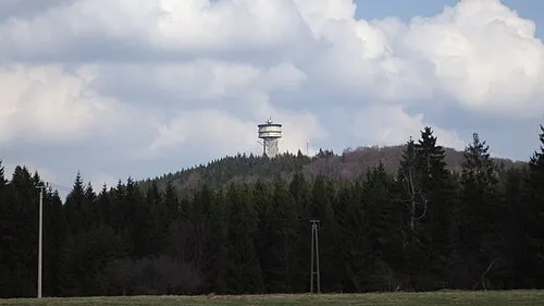
Velký zvon Allexkoch · CC BY-SA 4.0

Climate of Goldberg
Best months for sightseeingBest months for sightseeing: June–August.
This month · November
A cold month
Day 4° · Night -1° · Rain 54 mm
- Hottest month
- July (day 21°)
- Coldest month
- January (night -5°)
- Wettest month
- July (94 mm)
- Driest month
- April (47 mm)
Bars: average monthly low and high temperature. Below: precipitation. Monthly averages for 1970–2000 at about 18 km resolution, adjusted for elevation. Highlighted months are mild and relatively dry. Source: WorldClim 2.1 (CC BY 4.0).
Show values as a table
| Month | Jan | Feb | Mar | Apr | May | Jun | Jul | Aug | Sep | Oct | Nov | Dec |
|---|---|---|---|---|---|---|---|---|---|---|---|---|
| Average high (°C) | 1° | 2° | 6° | 11° | 17° | 19° | 21° | 21° | 16° | 11° | 4° | 1° |
| Average low (°C) | -5° | -5° | -2° | 1° | 6° | 9° | 11° | 11° | 7° | 3° | -1° | -3° |
| Precipitation (mm) | 59 | 49 | 54 | 47 | 64 | 85 | 94 | 76 | 61 | 60 | 54 | 69 |
How to get to Goldberg
The nearest airport is Karlovy Vary Airport (KLV), 73 km to the north as the crow flies. The nearest large city is Regensburg, 71 km to the southwest.
Airports
- Karlovy Vary Airport (KLV) Karlovy Vary 73 kmnorth
- Nuremberg Airport (NUE) Nuremberg 107 kmwest
- Václav Havel Airport Prague (PRG) Prague 135 kmnortheast
Nearby large cities
- Regensburg Population: 151.4K 71 kmsouthwest
- Nuremberg Population: 515.5K 108 kmwest
- Erlangen Population: 102.7K 112 kmwest
- Fürth Population: 132K 114 kmwest
- Ingolstadt Population: 120.7K 123 kmsouthwest
Straight-line distances; road distances are longer. Airport data: OurAirports.
Day trips from Goldberg
Within 100 km: 313 historic and cultural sites, 1,990 natural sites, 388 lakes, rivers and coasts.
0–25 km182 places
- Český Les Mountain 10 kmNW
- Kleiner Gaisweiher Lake 24 kmNW
- Großer Gaisweiher Lake 24 kmNW
- Zenkenberg Mountain 15 kmNW
25–60 km803 places
- Biber-Revier River 53 kmSE
- Unterer Markweiher Lake 46 kmSW
- Thundorfer Weiher Lake 36 kmSW
- Süßenloher Weiher Lake 34 kmNW
60–100 km1,706 places
- Spitzelberg Mountain 80 kmW
- Stollenberg Mountain 82 kmW
- Deckersberg Mountain 80 kmW
- Stoličná Mountain 93 kmNE
Straight-line distances.
Nearest towns and villages
-
Eslarn Village, Eslarn, Markt2.6 km W
-
 Tillyschanz Village, Eslarn, Markt1.3 km E
-
 Kreuth Village, Eslarn, Markt2.6 km S
-
Bühl Village, Eslarn, Markt2.9 km W
-
 Železná Village, Bělá nad Radbuzou2.2 km E
-
 Gmeinsrieth Village, Eslarn, Markt4.3 km SW
Nearby attractions & nature
Everything nearby-
Verhau Natural site, Bavaria0.7 km E
-
Teufelstein Natural site, Bavaria2.1 km S
-
Kalvarienberg Mountain, Eslarn, Markt2.9 km W
-
Geißbühl Mountain, Eslarn, Markt3.4 km NW
-
Ruberlschlag Natural site, Bavaria4.2 km SW
-
Mühlberg Mountain, Eslarn, Markt5.3 km W
-
Stückstein Mountain, Eslarn, Markt5.4 km SW
-
Gradelhöhe Mountain, Schönsee5.8 km S
Sources & licences
Data last updated: · 2 independent sources