Naturschutzgebiet Schönower Heide
Located in Bernau bei Berlin, Landkreis Barnim Coordinates: 52°41′27″ N 13°30′41″ E
- Elevation
- 69 m
- above sea level
- Airports
- BER Berlin Brandenburg Airport37 km
- SZZ Solidarity Szczecin–Goleniów Airport136 km
About Naturschutzgebiet Schönower Heide
Naturschutzgebiet Schönower Heide is a natural site. Location: Bernau bei Berlin, Landkreis Barnim. The best months to visit are June–August. The nearest airport is Berlin Brandenburg Airport (37 km). Nearby sights include Probstheide and Bernauer Stadtforst.
Photos of Naturschutzgebiet Schönower Heide
-
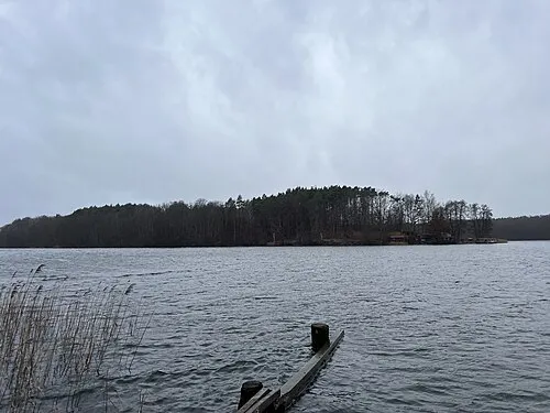
Großer Werder Lukas Beck · CC BY 4.0

Climate of Naturschutzgebiet Schönower Heide
Best months for sightseeingBest months for sightseeing: June–August.
This month · November
A cold month
Day 7° · Night 2° · Rain 45 mm
- Hottest month
- July (day 23°)
- Coldest month
- January (night -3°)
- Wettest month
- July (78 mm)
- Driest month
- April (32 mm)
Bars: average monthly low and high temperature. Below: precipitation. Monthly averages for 1970–2000 at about 18 km resolution, adjusted for elevation. Highlighted months are mild and relatively dry. Source: WorldClim 2.1 (CC BY 4.0).
Show values as a table
| Month | Jan | Feb | Mar | Apr | May | Jun | Jul | Aug | Sep | Oct | Nov | Dec |
|---|---|---|---|---|---|---|---|---|---|---|---|---|
| Average high (°C) | 2° | 3° | 7° | 12° | 18° | 21° | 23° | 23° | 18° | 13° | 7° | 4° |
| Average low (°C) | -3° | -2° | 0° | 3° | 8° | 11° | 13° | 13° | 10° | 6° | 2° | -1° |
| Precipitation (mm) | 49 | 36 | 43 | 32 | 59 | 60 | 78 | 64 | 50 | 42 | 45 | 53 |
How to get to Naturschutzgebiet Schönower Heide
The nearest airport is Berlin Brandenburg Airport (BER), 37 km to the south as the crow flies. The nearest large city is Berlin, 20 km to the south.
Airports
- Berlin Brandenburg Airport (BER) Berlin 37 kmsouth
- Solidarity Szczecin–Goleniów Airport (SZZ) Szczecin(Glewice) 136 kmnortheast
- Heringsdorf Airport (HDF) Zirchow 139 kmnorth
Nearby large cities
- Berlin Population: 3.4M 20 kmsouth
- Potsdam Population: 184.8K 44 kmsouthwest
- Magdeburg Population: 244.3K 142 kmsouthwest
- Leipzig Population: 505K 169 kmsouthwest
- Halle Population: 237.9K 171 kmsouthwest
Straight-line distances; road distances are longer. Airport data: OurAirports.
Day trips from Naturschutzgebiet Schönower Heide
Within 100 km: 499 historic and cultural sites, 1,958 natural sites, 1,737 lakes, rivers and coasts.
0–25 km428 places
- Valentinswerder Island 23 kmSW
- Scharfenberg Island 22 kmSW
- Freibad Tegelsee Beach 22 kmSW
- Museum Island Island 20 kmSW
25–60 km1,553 places
- Schlachtensee Lake 34 kmSW
- Dahme River River 27 kmS
- Strandbad Beach 47 kmNE
- Strandbad Wannsee Beach 36 kmSW
60–100 km2,213 places
- Mittelbruch Island 70 kmSW
- Buhnenwerder Island 78 kmSW
- Großer Horst Island 74 kmNW
- Unterseeinsel Island 77 kmW
Straight-line distances.
Nearest towns and villages
-
 Panketal Village, Landkreis Barnim5.8 km S
-
Bernau bei Berlin Town, Bernau bei Berlin5.3 km E
-
 Schönow Village, Bernau bei Berlin2.3 km SE
-
 Basdorf Village, Wandlitz5.5 km NW
-
 Buch Neighbourhood, Berlin6.3 km S
-
Waldfrieden Village, Bernau bei Berlin2.4 km E
Nearby attractions & nature
Everything nearby-
Probstheide Natural site, Brandenburg2.5 km N
-
Bernauer Stadtforst Natural site, Brandenburg2.9 km N
-
Lause Berg Mountain, Bernau bei Berlin3.1 km SE
-
Gorinsee Lake, Brandenburg2.8 km W
-
Basdorfer Heide Natural site, Brandenburg4.7 km NW
-
Im Woltersdorf Natural site, Brandenburg4.7 km NE
-
Hinterheide Natural site, Brandenburg4.8 km NW
-
Bucher Forst Natural site, Berlin4.8 km SW
Sources & licences
Data last updated: