Birkenwerder Nord
Located in Birkenwerder, Landkreis Oberhavel Coordinates: 52°42′10″ N 13°16′33″ E
- Elevation
- 40 m
- above sea level
- Local time
- UTC+01:00
- Europe/Berlin · UTC+01:00
- Airports
- BER Berlin Brandenburg Airport41 km
- HDF Heringsdorf Airport143 km
About Birkenwerder Nord
Birkenwerder Nord is a neighbourhood. Location: Birkenwerder, Landkreis Oberhavel. The best months to visit are June–August. The nearest airport is Berlin Brandenburg Airport (41 km). Nearby sights include Bogenluchgraben and Karmelitenkloster.
Photos of Birkenwerder Nord
-
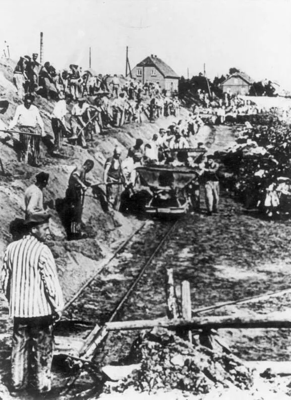
Oranienburg Concentration Camp (Klinkerwerk) Unknown author Unknown author · CC BY-SA 3.0 de -
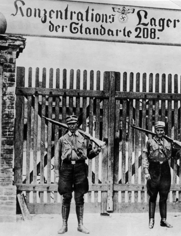
Early Camp Oranienburg Unknown author Unknown author · CC BY-SA 3.0 de -
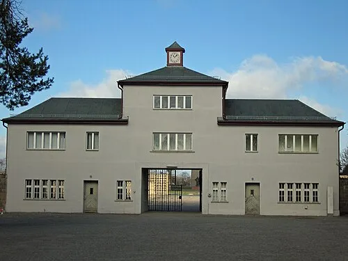
Sachsenhausen Concentration Camp Greg Schechter from San Francisco, USA · CC BY 2.0


Climate of Birkenwerder Nord
Best months for sightseeingBest months for sightseeing: June–August.
This month · November
A cold month
Day 7° · Night 2° · Rain 44 mm
- Hottest month
- July (day 23°)
- Coldest month
- January (night -3°)
- Wettest month
- June (63 mm)
- Driest month
- February (32 mm)
Bars: average monthly low and high temperature. Below: precipitation. Monthly averages for 1970–2000 at about 18 km resolution, adjusted for elevation. Highlighted months are mild and relatively dry. Source: WorldClim 2.1 (CC BY 4.0).
Show values as a table
| Month | Jan | Feb | Mar | Apr | May | Jun | Jul | Aug | Sep | Oct | Nov | Dec |
|---|---|---|---|---|---|---|---|---|---|---|---|---|
| Average high (°C) | 2° | 4° | 8° | 13° | 19° | 21° | 23° | 23° | 18° | 13° | 7° | 4° |
| Average low (°C) | -3° | -2° | 0° | 3° | 8° | 12° | 13° | 13° | 9° | 6° | 2° | -1° |
| Precipitation (mm) | 42 | 32 | 40 | 36 | 53 | 63 | 57 | 55 | 44 | 38 | 44 | 53 |
How to get to Birkenwerder Nord
The nearest airport is Berlin Brandenburg Airport (BER), 41 km to the south as the crow flies. The nearest large city is Berlin, 22 km to the southeast.
Airports
- Berlin Brandenburg Airport (BER) Berlin 41 kmsouth
- Heringsdorf Airport (HDF) Zirchow 143 kmnortheast
- Solidarity Szczecin–Goleniów Airport (SZZ) Szczecin(Glewice) 147 kmnortheast
Nearby large cities
- Berlin Population: 3.4M 22 kmsoutheast
- Potsdam Population: 184.8K 37 kmsouthwest
- Magdeburg Population: 244.3K 129 kmsouthwest
- Halle Population: 237.9K 162 kmsouthwest
- Leipzig Population: 505K 164 kmsouthwest
Straight-line distances; road distances are longer. Airport data: OurAirports.
Day trips from Birkenwerder Nord
Within 100 km: 532 historic and cultural sites, 2,123 natural sites, 1,725 lakes, rivers and coasts.
0–25 km454 places
- Valentinswerder Island 16 kmS
- Scharfenberg Island 15 kmS
- Freibad Tegelsee Beach 14 kmS
- Museum Island Island 22 kmS
25–60 km1,670 places
- Schlachtensee Lake 29 kmS
- Dahme River River 35 kmSE
- Strandbad Beach 58 kmNE
- Strandbad Wannsee Beach 30 kmS
60–100 km2,256 places
- Buhnenwerder Island 65 kmSW
- Großer Horst Island 63 kmNW
- Burgwallinsel Island 66 kmNE
- Kohlwerder Island 61 kmNE
Straight-line distances.
Nearby attractions & nature
Everything nearby-
Bogenluchgraben River, Birkenwerder1 km E
-
Karmelitenkloster Attraction, Birkenwerder2.3 km SE
-
Briese River, Brandenburg2.2 km SW
-
Sand See Lake, Brandenburg2.2 km S
-
Pinnower See Lake, Brandenburg2.9 km NW
-
Langer Berg Mountain, Oranienburg4 km N
Sources & licences
Data last updated: