- Elevation
- 41 m
- above sea level
- Local time
- UTC+01:00
- Europe/Berlin · UTC+01:00
- Airports
- BER Berlin Brandenburg Airport58 km
- RLG Rostock-Laage Airport137 km
About Gehrenberg
Gehrenberg is a mountain. Location: Kremmen, Landkreis Oberhavel. Elevation: 41 m. The best months to visit are June–August. The nearest airport is Berlin Brandenburg Airport (58 km). Nearby sights include Räuberberg and Flatower Kienheide.
Photos of Gehrenberg
-
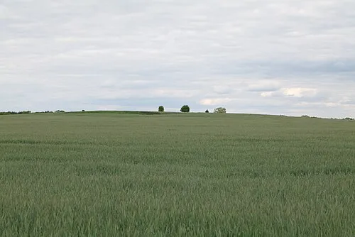
Silberberg Leonhard Lenz · CC0

Climate of Gehrenberg
Best months for sightseeingBest months for sightseeing: June–August.
This month · November
A cold month
Day 7° · Night 2° · Rain 40 mm
- Hottest month
- July (day 23°)
- Coldest month
- January (night -3°)
- Wettest month
- June (63 mm)
- Driest month
- February (30 mm)
Bars: average monthly low and high temperature. Below: precipitation. Monthly averages for 1970–2000 at about 18 km resolution, adjusted for elevation. Highlighted months are mild and relatively dry. Source: WorldClim 2.1 (CC BY 4.0).
Show values as a table
| Month | Jan | Feb | Mar | Apr | May | Jun | Jul | Aug | Sep | Oct | Nov | Dec |
|---|---|---|---|---|---|---|---|---|---|---|---|---|
| Average high (°C) | 3° | 4° | 8° | 13° | 19° | 21° | 23° | 23° | 18° | 13° | 7° | 4° |
| Average low (°C) | -3° | -2° | 0° | 3° | 8° | 11° | 13° | 12° | 9° | 5° | 2° | -1° |
| Precipitation (mm) | 40 | 30 | 38 | 36 | 49 | 63 | 49 | 51 | 43 | 36 | 40 | 51 |
How to get to Gehrenberg
The nearest airport is Berlin Brandenburg Airport (BER), 58 km to the southeast as the crow flies. The nearest large city is Potsdam, 40 km to the south.
Airports
- Berlin Brandenburg Airport (BER) Berlin 58 kmsoutheast
- Rostock-Laage Airport (RLG) Laage 137 kmnorth
- Heringsdorf Airport (HDF) Zirchow 150 kmnortheast
Nearby large cities
- Potsdam Population: 184.8K 40 kmsouth
- Berlin Population: 3.4M 41 kmsoutheast
- Magdeburg Population: 244.3K 112 kmsouthwest
- Wolfsburg Population: 123.1K 150 kmwest
- Halle Population: 237.9K 155 kmsouthwest
Straight-line distances; road distances are longer. Airport data: OurAirports.
Day trips from Gehrenberg
Within 100 km: 556 historic and cultural sites, 2,359 natural sites, 1,732 lakes, rivers and coasts.
0–25 km214 places
- Insel im Bützsee Island 10 kmN
- Werbellinsee Lake 20 kmN
- Wangenpfuhl Lake 22 kmN
- Vielitzsee Lake 22 kmN
25–60 km1,828 places
- Schlachtensee Lake 39 kmSE
- Valentinswerder Island 29 kmSE
- Scharfenberg Island 29 kmSE
- Dahme River River 55 kmSE
60–100 km2,605 places
- Strandbad Beach 75 kmNE
- Burgwallinsel Island 79 kmNE
- Wolletzseeinseln Island 72 kmNE
- Kohlwerder Island 70 kmNE
Straight-line distances.
Nearest towns and villages
-
Flatow Village, Kremmen2.8 km SE
-
Linumhorst Village, Kremmen4.1 km N
-
Kuhsiedlung Village, Kremmen4.2 km E
-
 Staffelde Village, Kremmen4.7 km SE
-
Kremmen Town, Kremmen6.8 km E
-
 Linum Village, Fehrbellin3.8 km W
Nearby attractions & nature
Everything nearby-
Räuberberg Mountain, Fehrbellin0.6 km NW
-
Flatower Kienheide Natural site, Kremmen1.7 km S
-
Dülberg Mountain, Fehrbellin3 km W
-
Feuerberg Mountain, Kremmen4.1 km SE
-
Silberberg Mountain, Fehrbellin5.4 km W
-
Naturschutzgebiet Oberes Rhinluch Natural site, Fehrbellin4.1 km NW
-
Vorderster Steinberg Mountain, Kremmen5.4 km SE
-
Quermathenberg Mountain, Fehrbellin5.7 km W
Sources & licences
Data last updated: