- Elevation
- 40 m
- above sea level
- Airports
- BER Berlin Brandenburg Airport49 km
- HDF Heringsdorf Airport135 km
About Bäke
Bäke is a river. Location: Oranienburg, Landkreis Oberhavel. The best months to visit are June–August. The nearest airport is Berlin Brandenburg Airport (49 km). Nearby sights include Grabowsee and Oranienburg Concentration Camp (Klinkerwerk).
Photos of Bäke
-
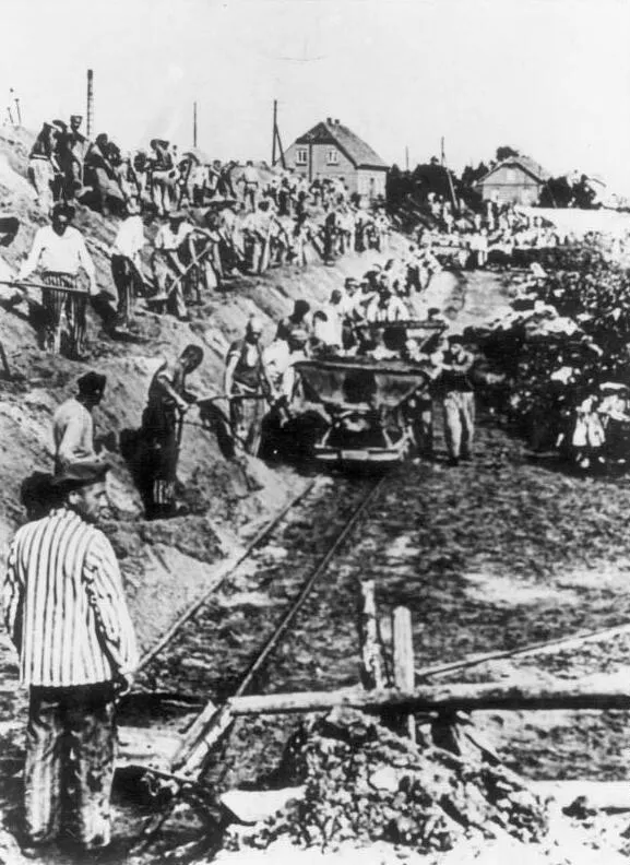
Oranienburg Concentration Camp (Klinkerwerk) Unknown author Unknown author · CC BY-SA 3.0 de -
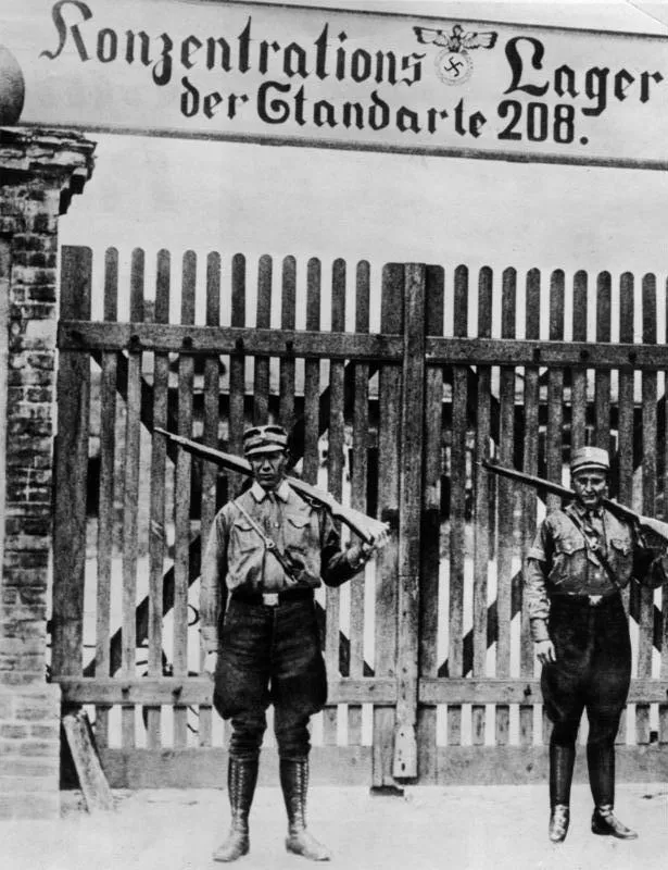
Early Camp Oranienburg Unknown author Unknown author · CC BY-SA 3.0 de -
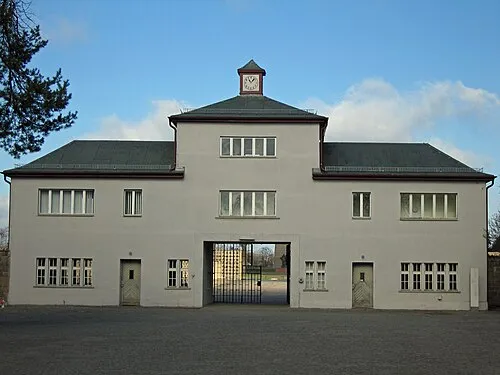
Sachsenhausen Concentration Camp Greg Schechter from San Francisco, USA · CC BY 2.0


Climate of Bäke
Best months for sightseeingBest months for sightseeing: June–August.
This month · November
A cold month
Day 7° · Night 2° · Rain 44 mm
- Hottest month
- July (day 23°)
- Coldest month
- January (night -3°)
- Wettest month
- June (63 mm)
- Driest month
- February (32 mm)
Bars: average monthly low and high temperature. Below: precipitation. Monthly averages for 1970–2000 at about 18 km resolution, adjusted for elevation. Highlighted months are mild and relatively dry. Source: WorldClim 2.1 (CC BY 4.0).
Show values as a table
| Month | Jan | Feb | Mar | Apr | May | Jun | Jul | Aug | Sep | Oct | Nov | Dec |
|---|---|---|---|---|---|---|---|---|---|---|---|---|
| Average high (°C) | 2° | 4° | 8° | 13° | 19° | 21° | 23° | 23° | 18° | 13° | 7° | 4° |
| Average low (°C) | -3° | -2° | 0° | 3° | 8° | 12° | 13° | 13° | 9° | 6° | 2° | -1° |
| Precipitation (mm) | 42 | 32 | 40 | 36 | 53 | 63 | 57 | 55 | 44 | 38 | 44 | 53 |
How to get to Bäke
The nearest airport is Berlin Brandenburg Airport (BER), 49 km to the south as the crow flies. The nearest large city is Berlin, 29 km to the south.
Airports
- Berlin Brandenburg Airport (BER) Berlin 49 kmsouth
- Heringsdorf Airport (HDF) Zirchow 135 kmnortheast
- Solidarity Szczecin–Goleniów Airport (SZZ) Szczecin(Glewice) 140 kmnortheast
Nearby large cities
- Berlin Population: 3.4M 29 kmsouth
- Potsdam Population: 184.8K 45 kmsouth
- Magdeburg Population: 244.3K 134 kmsouthwest
- Rostock Population: 198.3K 165 kmnorthwest
- Halle Population: 237.9K 170 kmsouthwest
Straight-line distances; road distances are longer. Airport data: OurAirports.
Day trips from Bäke
Within 100 km: 538 historic and cultural sites, 2,184 natural sites, 1,756 lakes, rivers and coasts.
0–25 km333 places
- Valentinswerder Island 24 kmS
- Scharfenberg Island 23 kmS
- Freibad Tegelsee Beach 23 kmS
- Streesee Lake 24 kmE
25–60 km1,903 places
- Schlachtensee Lake 38 kmS
- Dahme River River 42 kmSE
- Strandbad Beach 52 kmNE
- Strandbad Wannsee Beach 39 kmS
60–100 km2,242 places
- Mittelbruch Island 63 kmSW
- Buhnenwerder Island 70 kmSW
- Herrenwerder Island 84 kmNE
- Wulfswerder Island 73 kmW
Straight-line distances.
Nearest towns and villages
-
Oranienburg Town, Oranienburg4.3 km SW
-
Schmachtenhagen-West Neighbourhood, Oranienburg1.7 km SE
-
Friedrichsthal Village, Oranienburg2 km N
-
 Schmachtenhagen Village, Oranienburg3.1 km SE
-
Fichtengrund Village, Oranienburg2.4 km NW
-
Upstall Village, Oranienburg2.5 km E
Nearby attractions & nature
Everything nearby-
Grabowsee Lake, Brandenburg0.8 km N
-
Oranienburg Concentration Camp (Klinkerwerk) Historic site, Oranienburg0.8 km SW
-
Kirchenruine Historic site, Oranienburg0.9 km N
-
Sachsenhausen concentration camp Historic site, Oranienburg2.3 km SW
-
Schnelle Havel River, Oranienburg2.8 km NW
-
Lehnitzsee Lake, Brandenburg3 km SW
-
Sachsenhausen Concentration Camp Historic site, Oranienburg2.3 km SW
-
Forst Sachsenhausen Natural site, Brandenburg3.7 km NW
Sources & licences
Data last updated: